
Bent at Burnt Coat, part 2
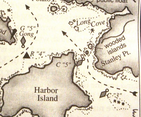
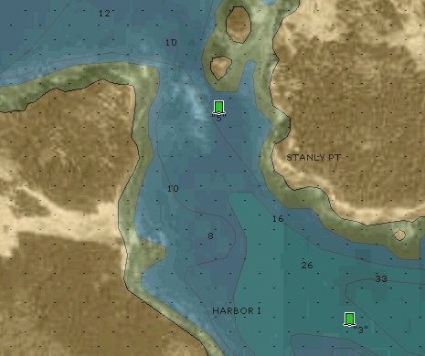
Why haven’t more people who use Navionics charts experienced a C “5” ledge misfortune? Certainly one reason is the Taft/Rindlaub Cruising Guide to the Maine Coast, which contains the sketch chart excerpted above and is consulted in biblical fashion by many cruisers. Notice how useful those dashed arrows are, especially as the overall bouyage—if you happen to be passing right through Burnt Coat, as many do—changes from red right to red left (or vice-versa, because both passages are returning from the sea to a harbor). Heck, my 1979 Duncan and Ware Cruising Guide to the New England Coast talks about how an “able vessel can beat through” this passage “leaving the two cans to starboard”. And that was before chart plotters even existed (and sailors were gnarly navigators, especially Roger Duncan!) Going to the other end of the spectrum, look below how Navionics’ own Platinum grade chart shows the ledge, if you have the top-down photos turned on, including the “land & sea” option (full screen here). There are many ways to get by that Can without da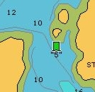 mage.
mage.
But before anyone starts judging yesterday’s ledge leaper a fool, they should take another look at the plain Navionics chart image, excerpted at right. It’s a clean-looking, easily-read chart, just what we’ve been asking for. But not only did Navionics leave out the ledge, the very vector gods (who actually ‘draw’ these charts) conspired to worsen the error. Look how the extra big Can symbol (which I like) hides the fact that there’s any water at all between it and the little island (though, mysteriously, not below). My point? Vector charts are “smart”, they really are, but sometimes not as smart as a cartographer placing a Can just so on a paper chart, or someone who’s been there simply sketching some guidance.


The Taft/Rindlaub cruising guide is, in our opinion, the very best cruising guide available. This is somewhat a religious debate, but every time we referenced the guide for planning or navigation we felt lucky to have it. When we ventured toward the Caribbean, my wife and I frequently sighed “I wish Rindlaub did a guide here.” The guide is not overdone, is generally concise and the nav info is always just what the doctor ordered.
dave
Every time I go in to Burnt Coat by this passage I have the Taft/Rindlaub AND the Duncan up in the cockpit, along with paper chart 13313 as well as well as whatever is on the MFD chart screen. That may seem overdone, but long ago I found a very expensive rock on the way into The Mud Hole and have been extra careful ever since. You have to read and then think it through, ahead of time, each time. If there is doubt, I usually try to follow the guide book chartlets and their written explanation. Besides, I have a reputation to maintain…