Navionics Platinum Plus cards, 8 gigs!

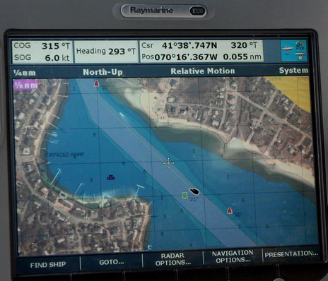
Navionics just announced its new Platinum+ chart cards, which I got a peek at along the coast of Cape Cod last month. As the name implies Plus, or “+”, takes Platinum’s numerous features up a notch, or two. The top down photo maps and panoramic port photos are higher res, the bathy data underlying the 3D screens is more detailed, and the coastal pilots are more tightly integrated. I was particularly struck by the photo maps.
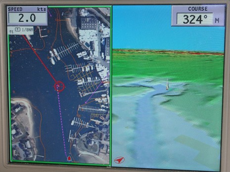
I used to find them a useful reference but the ones we navigated on around Hyannis, MA, as seen above (bigger here) were so detailed that you might well navigate on them. Of course they need to be properly mixed with soundings and nav aid data, which I think the Raymarine E-Series does pretty well with its combination of overlay and variable blending. But I also liked how a GeoNav Multy (a interesting plotter that runs under Linux, but unfortunately is only available in Europe) overlays most all critical data over unblended photos. Thus in the screen below, bigger here, you can clearly see how off the charted docks are (one of the reasons you might want to navigate on the photo map). Let’s note though that Navionics says these photo maps are “up to {a vague term} four times higher resolution (25cm per pixel)”, and told me that resolution varies from place to place, the highest being around harbors. How good the coverage is for your areas of interest remains to be seen. On the other hand the $499 cards—which cover XL3 areas just like Platinum, which will continue to be available—have a whopping 8 gigs of memory, which is 4 times what the original Platinum cards can hold. That’s a lot more data.


These look awfully similar to what Furuno is promoting at it’s Navnet 3D promo web site.