Garmin 5xxx, more thoughts

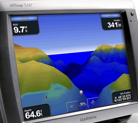
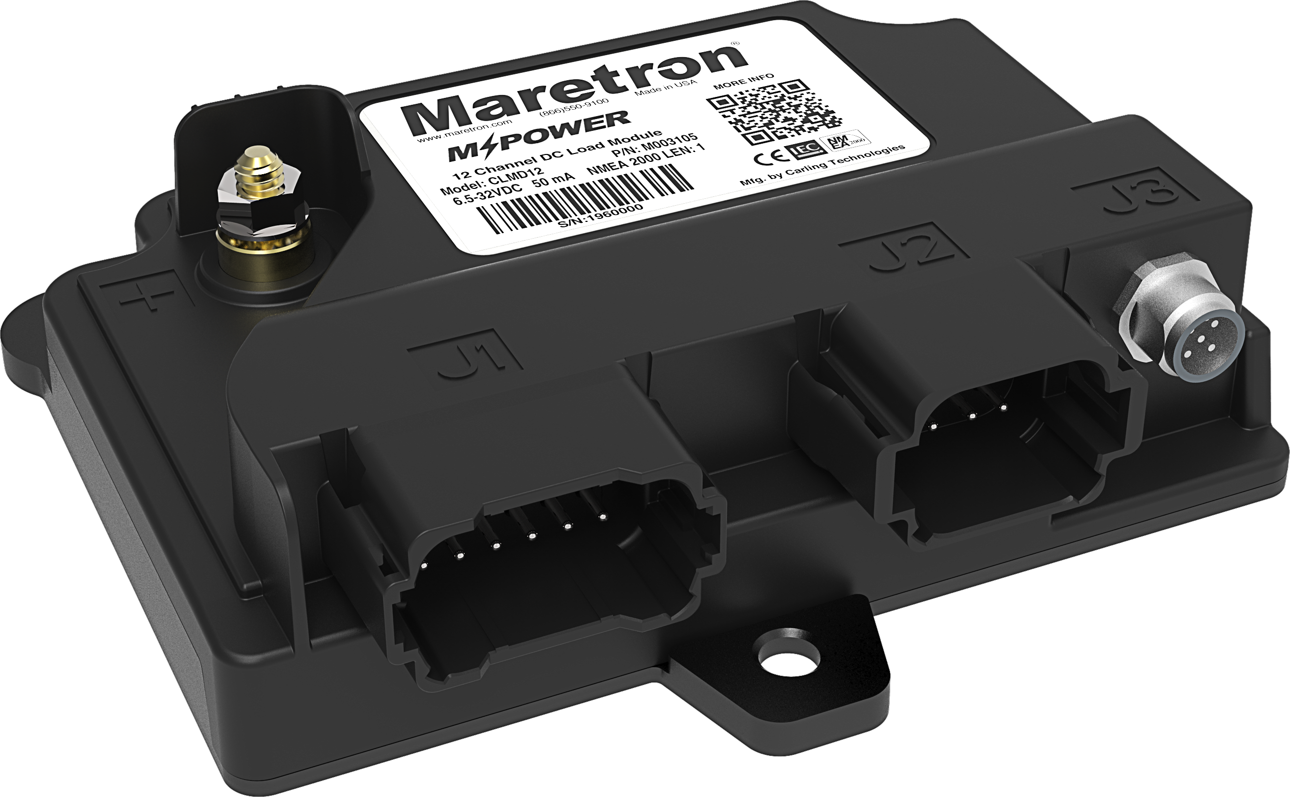
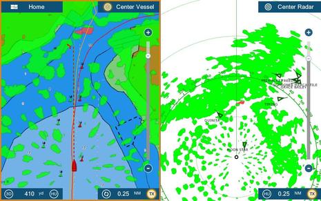
Garmin has put up more press images of the 5xxx series, and this one shows some of the neat 3D abilities I saw demoed in Miami. These machines, and I’d guess at least the 4xxx series too, can overlay radar imagery onto this “mariner’s eye” topside view, and fishfinder imagery onto the separate “fish eye” 3D view. And I don’t mean ARPA targets and fish icons, though they can be useful too. There’s a handsome engine screen too (if you have a NMEA 2000 talking engine, or can use Maretron’s conversion box). The demo units were very much prototypes so I have no idea how fast and smooth they’ll be in real life (actually I’m not even positive which 3D view that is), but they certainly seemed bright, especially for touch screen. I’ve also learned that these 5000 series machines can support a wireless mouse and remote control (4000 series too), which may mollify those folks worried that the touch screen will be hard to work in bouncy conditions. (And I tried faking the Harmony remote into “learning” one of these remotes, which I’m pretty sure it can do). But all this is really just glimpses of Garmin’s new high end; time, and some testing I look forward to, will tell.


That is pretty cool! I have one small complaint with the engine instruments, I hope that Garmin is listening. I think they should put the common engine instruments next to each other. For example port oil pressure and starboard oil pressure should be next to each other. Port volt and starboard volt should be next to each other. etc, etc. Some people prefer my way, some people prefer how it is on that screen shot. Garmin should make it configurable to both ways. One more thing, they have an opportunity here to make a fundamental change with way they display engine intruments. As we see aviation move from steam gauges to glass cockpit primary flight displays, the designers present the information in a completely new way. The designers could have simply shown steam gauges on the PFD LCD, but someone, somewhere figured out there is a better way to display the information. So that the pilot has a significant increase in situational awareness. I hope that Garmin and the rest of the manufacturers are also considering other ways to display the information. Other then simply showing a conventional gauge on an LCD. Don’t get me wrong, it does look REALLY cool the way it is, but there is an opportunity here to re-define how to display the information. This is a very small gripe about what appears to be a really great product!!
Anyone know that the dimensions will be for this unit? I have seen specs that show it as the same size as the 4212 but that can’t be right since it looks like the case (with the deletion of the buttons) looks smaller. Also, if anyone knows about the real depth (behind the mounting surface) I would appreciate it. The one leg up the Northstar 8000i may have is that it is real thin compared to the E120 and possibly this Garmin. This means you too Garmin if you are listening.
“The 5000 series has all of the same networking capabilities of other multifunction displays within the proprietary Garmin Marine Network�, a system that combines GPS, radar, sonar, XM WX Satellite Weather, and other data for unparalleled situational awareness.”
Sure, it’s whizzy. A $4,000 plotter ought to be whizzy! And using 17 year old graphics standards (XGA was introduced in 1990) and proprietary interfaces will help keep Garmin’s net profit margin at a whopping 29%. That’s NET, not gross. How many of us work for a company with 29% net margins? Even Microsoft, with a bona fide monopoly only has 25% net margins.
Keyword = “proprietary”
The computer industry hung onto this idea for a long time also. Remember the early “proprietary” versions of MS-DOS? Remember Novell and IBM’s “proprietary” networking systems? We (consumers) didn’t really begin to realize the full benefits of the PC and networks until we all started using the same version of the OS and open networking (TCP/IP – Ethernet).
What’s in our interest is interoperability between manufacturers so that we can buy the “best of breed” for each function (or a fully integrated device if that’s your preference) and know they’ll play nice with each other.
You’ll know that’s happening when Garmin touts a new product’s interoperability rather than it’s “proprietary” network.
Bob, Check out Simrad’s engine display here:
https://panbo.com/yae/archives/001281.html
Russ, Why so cranky? These units do seem to support NMEA 2000 more clearly than other major brand, right? And every other brand’s Ethernet system is proprietary, right?
Hmmm? I have a brochure from Miami which lists both the 5212 and 4212 as having dimensions of 14.8″W x 9.5″H x 4.75″D, but the 4212 certainly looks wider. I know that some Garmin engineers read Panbo; maybe one can straighten this out?
Ben, I think the whizzy new products should be seen in the broader context of the available technology and the industry’s economics.
Customers should see that Garmin is not promoting N2K interoperability, they are spending their money (they wrote the ad copy) to promote a proprietary system.
Their promotion of proprietary networks is in their economic interest, not ours. There is not a reader of this blog (other than Garmin employees) who works for a company with 29% net margins.
Caveat emptor.
Well, at least Garmin calls it NNMEA 2000, not SimNet, LowranceNet, SeaTalk2, etc., and they used the standard plug, right? Plus they told me that they are outputing all the data they can on the network. I’m all for interoperability, and my tech purchases lean in that direction, but I don’t see Garmin as a particular offender amongst the ME crowd.
As for the profit margins I just don’t get where that’s a consumer concern, as long as a monopolistic company isn’t holding us up. Marine electronics certainly seems competitive. If Garmin, or Raymarine, or whoever figure out how to make a better product at an attractive price, what do I care how much money they make? (And in most cases, I’ll never know).
By the way, when Garmin stormed the market with the 2010 way back when some competitors claimed they were losing money on each one sold. If so, was that wrong? Better or worse than making lots of $ on each one sold?
The real question, if I understand my investor friends right, is how can Garmin sustain profit margins like that. By definition, can’t someone sell similar products cheaper and still make good money?
I’m not trying to single out Garmin, the original post just happened to be on a new Garmin product. The others you mention are equally guilty of trying to lock us into their product lines.
The ancient nature of the technology being sold to us has annoyed me for awhile. Furuno’s current recreational products still have 640×480 resolution, even on 15″ displays! Most of the computing, memory and graphics processing technology included in these products is off the shelf and dirt cheap at this point. A laptop computer for less than $1,500 has more computer power, graphics processing speed, memory and networking capability (1GB e-net + 802.11g) than the products we’re seeing for 2x that price. This is 2007, pushing 780×1024 pixels around the screen is not a challenge. The recreational marine market is paying a premium price for old technology and the proof is in the net margins.
The copy that I included in my original post came directly from Garmin’s web site, they call it “the proprietary Garmin Marine Network”, no mention of NMEA 2000.
See: http://www.garmin.com/products/gpsmap5212/
I see you saying NMEA 2000 and standard connectors, but I don’t hear Garmin saying it. Why?
Yes, market forces should eventually bring their margins more in line with the 10% – 15% net margins of other excellent companies (GE, Apple, etc.). At the same time, we are part of those market forces and our awareness of what’s possible for our dollars factors into our buying decision.
Interoperability, unlike price pressure, takes more than one company to achieve.
OK – end of RANT. Thanks for the forum!
Ben, thanks for the link. that Simrad looks nice. Exactly what I had in mind. I didn’t want to say it in my original comment, but I really like bar graphs. They are kinda ugly, but very ergonomic. If you calibrate the instruments so that the top of all the bar graphs line up when things are in their normal operating range, it makes it VERY obvious when something is outside that normal operating range. A quick glance is all you need, and your eyes are back out on the water, where they should be. I just wish the bar graph had some more glitz, and looked prettier. I hate to say it but “pretty” does sell units. Those Garmin round gauges sure are pretty!
Russ: If you think your laptop would be better suited as a navigation system just use that instead. I have not seen an affordable laptop that can take a dunking of salt water and that I can see the screen in direct sunlight. Both are realities on my open helm. Yes garmin has a propietary network, but it also supports n2k. You just can’t argue it is a closed system. Companies NEED to make a margin to survive. Margin does NOT equal profit. R&D expenses usually come from the margin, along with marketing expenses. No margin and no profit means the company won’t be around very long. Garmin is in business to make GPS’s and a make profit for the stockholders. They are not around to just make GPS’s to sell to you at cost. If you think that Garmin is too expensive, then simply purchase one from a competitor.
Bob:
While I do have both a PC and integrated equipment on my boat (Northstar and Furuno), the point was not that the PC is better for navigation. The point is that most of the silicon that goes into the integrated devices is very inexpensive because it was developed for the computer industry years ago. For example, it’s no accident that the screen resolutions of the integrated devices are PC standards (i.e., 640 x 480, 768 x 1024, etc.), it’s because low cost graphics processors with lots of power are available at those resolutions. Same thing for memory, microprocessors, I/O controllers, ethernet controllers, etc.
Regarding Garmin’s margin, perhaps I wasn’t clear that 29% is their NET margin. Also known as net income, income available to common, etc. It’s the bottom line, after ALL of Garmin’s expenses.
I believe you are thinking of gross margin, sometimes called gross profit, from which of course Garmin must pay for R&D, SG&A, taxes, etc. Just for reference, here are a few of the relevant numbers from Garmin’s 2006 annual report.
Gross margin = 49.7%
R&D = 6.4%
SG&A = 12%
By comparison, here are the NET margins at a few other very successful companies:
GE = 11.2%
Apple = 10.3%
HP = 6.8%
Microsoft = 28.5%
And while the British report their financials a little differently, using “statutory operating profit” as their net income (i.e., after taxes), Raymarine’s NET margin for 2006 was 11.8%.