Monthly Archive: April 2012

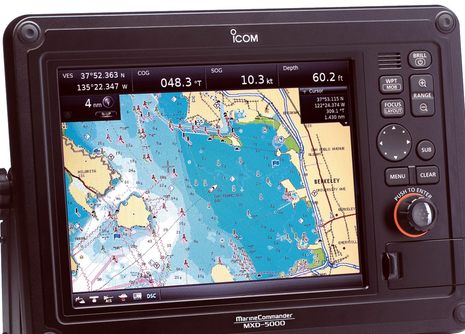
When I wrote about Icom’s “New Look” VHF radios after Miami I also mentioned a new and “affordable” black box navigation system that impressed me for its rugged-looking build. Well, let’s say hello to Icom MarineCommander. While I think that there are still many details to learn about — online manuals and spec sheets will help — a lot about MarineCommander is becoming clear, and, besides, I obtained some high res images that nicely compliment what’s on that Icom site…

That’s New Zealand’s fascinating Fiordland coast and while I’m not positive the photo was taken from a helicopter, I do know that the solar-powered navigation light in the foreground is serviced by one. Which is how the technicians who recently added an AIS transponder to the site got there too. But you won’t see the nav light on an AIS plotting screen because the transponder is programmed to mark a dangerous submerged rock at the mouth of Doubtful Sound 3.4 miles in the distance. Now the visiting cruise ships report that they can now plot Tarapunga Rock from 10 miles offshore or from two miles inside the Sound. The concept is called a Virtual Aid to Navigation, or VAtoN, and while it’s the first I know detail of, I’m sure it won’t be the last…


