
David Burch wants to educate us about Electronic Navigation Charts (ENC)
I’m hard put to name anyone more knowledgeable and passionate about marine navigation than David Burch, long-time director of the Starpath School of Navigation in Seattle. These days, David is especially concerned about the Electronic Navigation Charts rapidly replacing the official paper and RNC charts in the USA and elsewhere. So he recently followed up his comprehensive Introduction to Electronic Chart Navigation with a booklet titled ENC Essentials, whose preface and first chapter are excerpted below. I boldfaced some important points and look forward to discussing the state of ENC in the comments section. ~ Ben E
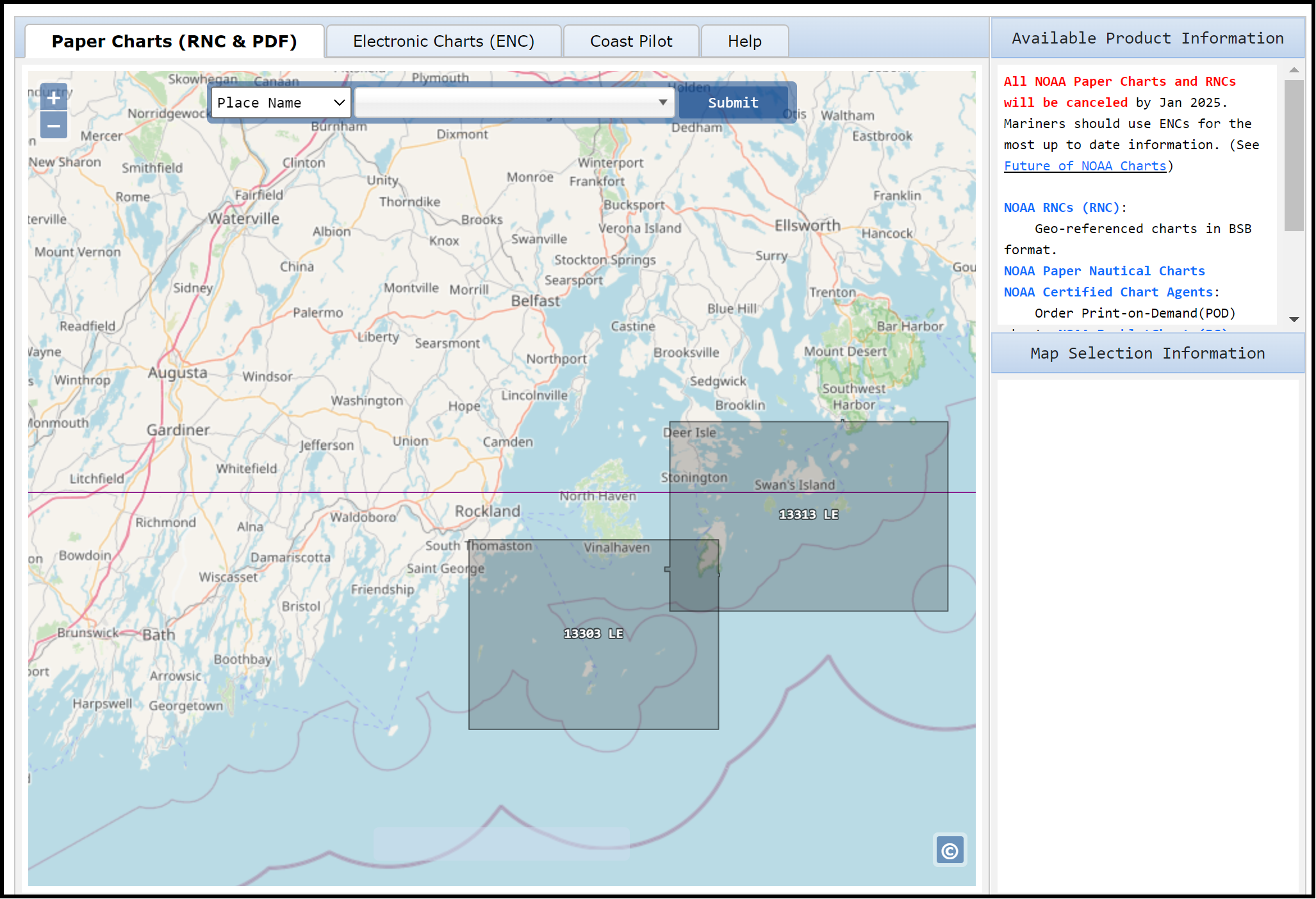
By the end of 2024, Electronic Navigational Charts (ENC) are projected to be the only official NOAA charts. As of August, 2023, over 60% of all traditional NOAA paper charts have been discontinued, and hundreds of new ENC have replaced them. ENC are already common on commercial vessels using ECDIS (electronic chart display and information systems), having been available for over twenty years, but for recreational mariners, ENC are still rarely used.
This booklet is intended to provide the information needed for all mariners to get started using these powerful electronic charts successfully, as they will soon be what we mean when we say “nautical chart.”
Although they have been in use for many years, ENC are dynamic products, undergoing significant improvements as we speak—transitioning from legacy ENC to reschemed ENC. As such, many commercial mariners will be continuing to learn about the format and full functionality of ENC alongside recreational mariners being introduced to them for the first time. Our hope is both groups can benefit from ENC status and procedures included in this booklet.
Chapter 1: What is an ENC?
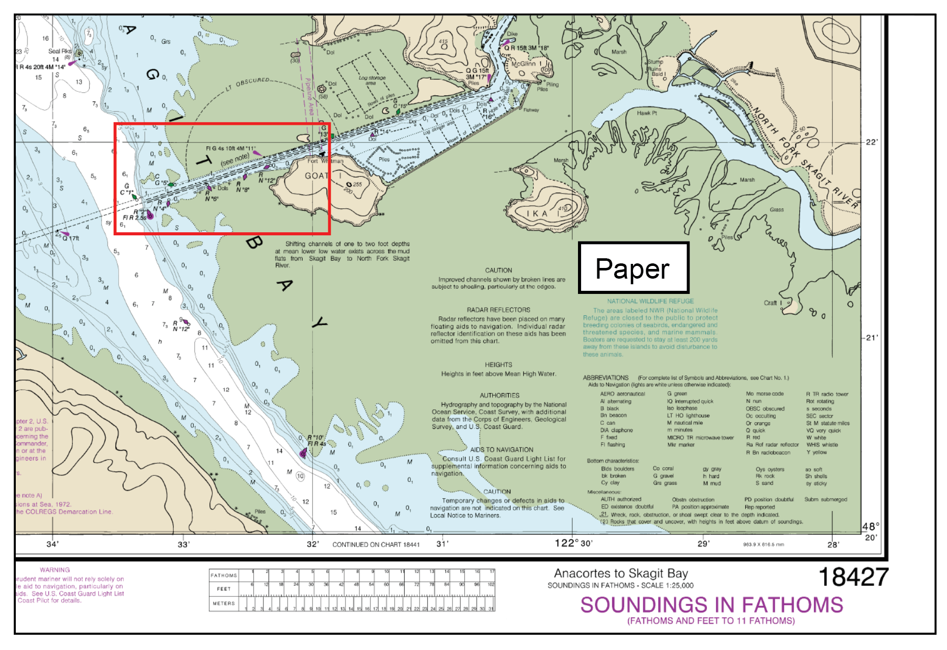
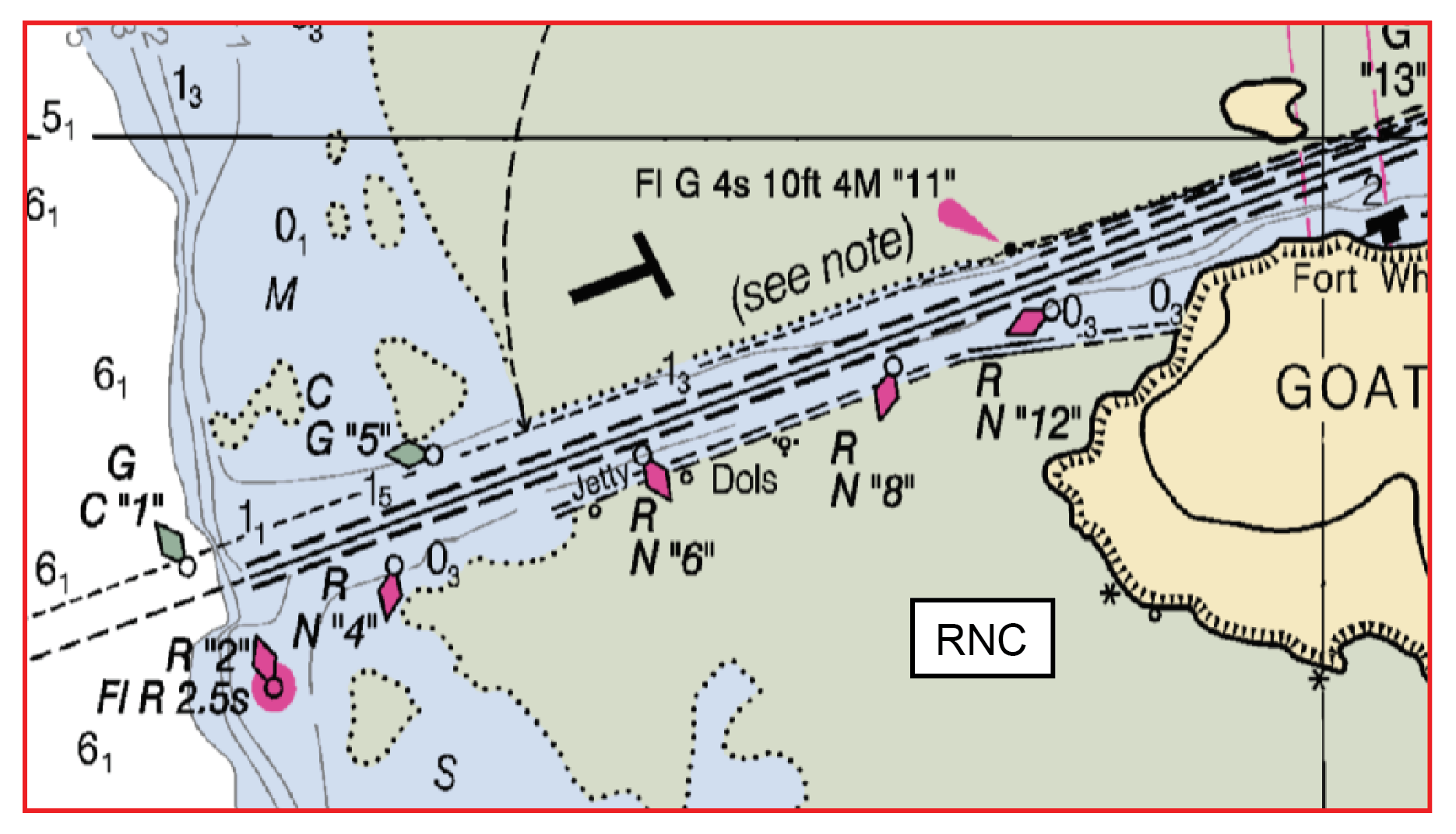
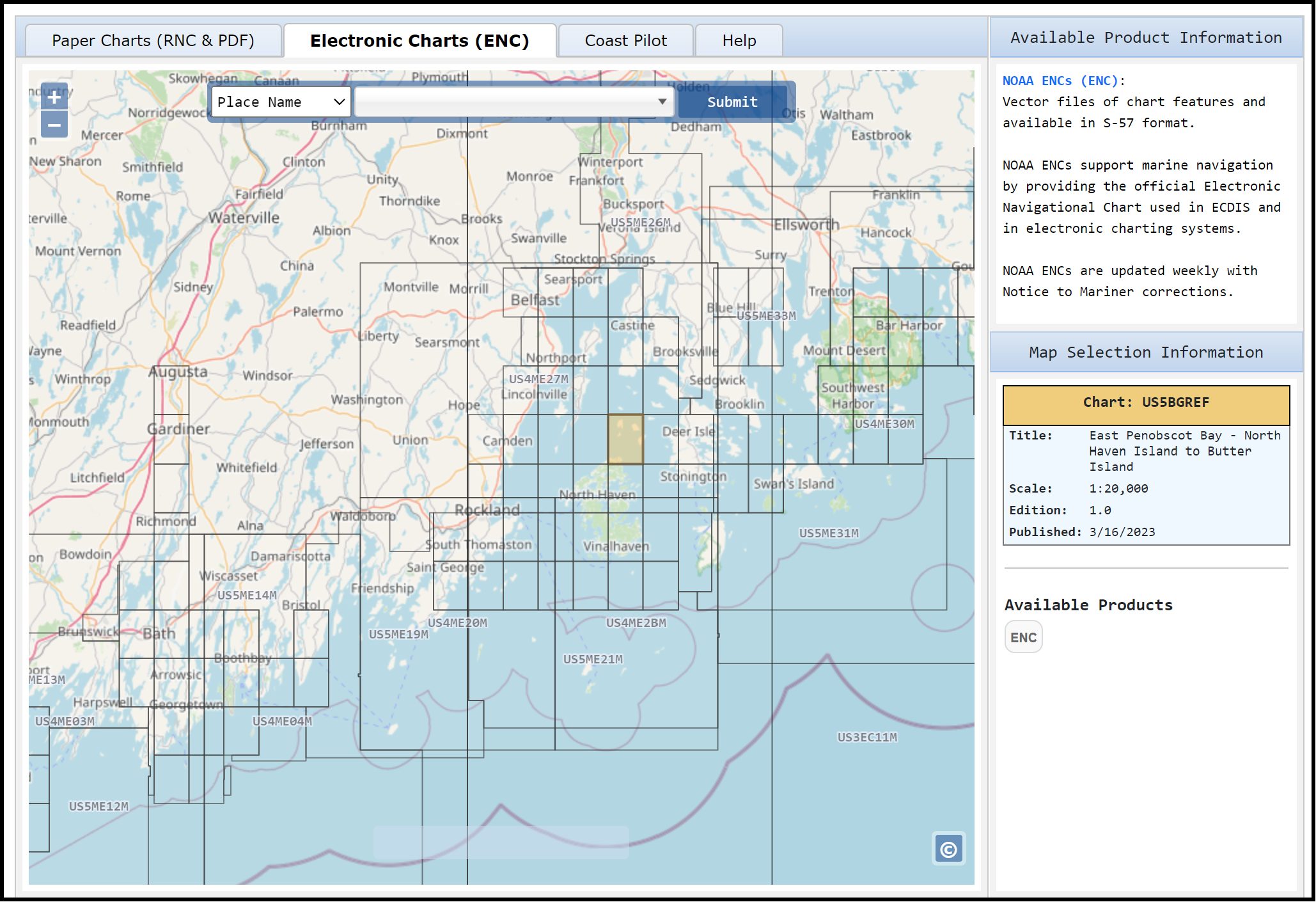
ENC are vector charts that differ notably from raster navigational charts (RNC), which are static graphic images of the corresponding paper charts. Vector charts are basically a mathematical set of drawing instructions that tell the display software how to create the chart drawing based on user selected options, such as zoom scale, contour choices, symbol styles, level of detail, among others that we explain in this booklet. The ENC in view is created on the wing every time we load it or change its perspective by zooming or panning. Usually this is accomplished very quickly, so this creation process is not discernible.
Since ENC are effectively digital layers of information, they can contain many more specific details about individual charted objects than a paper chart can. Their appearance and display behavior, however, differ notably from what we are accustomed to with traditional paper charts, so their acceptance among recreational mariners has been slow. The symbols are different and their size on the screen does not change with zoom level. There are prominent new symbols that appear in some cases and not others. Also, the charting of land areas on ENC is notably more sparse than on paper charts, which is rightfully distracting to many, even knowing that NOAA is in the process of improving that coverage.
The reluctance to adopt ENC has likely been a matter of training in many cases; once we learn how to use them, most mariners recognize the efficiency, thoroughness, and convenience of the presentation. After all, many mariners are already accustomed to using third party vector charts in their GPS chart plotter displays. The only difference is the ENC are official charts, updated weekly, with much more information, standardized display formats, and fewer errors. Plus, essentially all available navigation programs that can display ENC, even those that are free, include much enhanced functionality compared to typical chart plotters.
It is important to stress that the name electronic navigational chart (ENC) is a legally defined term that refers only to charts that meet the International Hydrographic Organization (IHO) chart standard S-57. This specifies what objects are to be included in the chart, and what attributes that describe these objects are to be included, along with the standardized names of each. It also establishes the categories of the objects.
Third party vector charts are not ENC, and apps that use them require an end user license agreement (EULA) wherein the user acknowledges, in one form or another, that they know the charts being used are not official charts, and that official charts are required for safe navigation. There are countless examples that show the importance of that EULA.
Since ENC will soon be the only official charts, it is crucial to have a system at hand that will display ENC. Beyond the safety factor, ENC will be the only way to meet chart carriage requirements that might apply to your operations. Some insurance companies, for example, require official charts on board for some waters, and third-party charts do not suffice.
There is even a proposed new USCG Ruling that will require all operators of commercial vessels, regardless of size, to have some means of displaying ENC. It is not clear yet how this will end up, but as it reads now, if your activity, such as teaching sailing on the water or running chartered fishing trips, requires a USCG license, then this ruling applies to you. Section 3 shows easy ways to meet these requirements.
I’ll add that even if you never directly use ENC, they are the fundamental building block of electronic charts available from companies like Navionics, C-Map, and TimeZero. So understanding how the latest ENC format works is a lesson in what should be possible with third-party charts. Note that David Burch’s ENC Essentials is also available on Amazon, and that Starpath maintains an excellent list of online charting resources (including the tools used for the Panbo screenshots).


Another good ENC resource is NOAA itself — https://nauticalcharts.noaa.gov/charts/noaa-enc.html — and for some valuable detail on “rescheming” and where official vector charting is headed after that, check out:
https://nauticalcharts.noaa.gov/publications/docs/nautical-charting-plan.pdf
It’s not clear to me what the difference in definition is between an ENC and a vector chart such as Navionics. I think many recreational sailors are very familiar with vector charts thanks to the Navionics App on their smartphones and tablets.
Hi Martin. As Burch points out “ENC is a legally defined term that refers only to charts that meet the International Hydrographic Organization (IHO) chart standard S-57”. So, yes, Navionics are vector charts — and much of the underlying data comes from ENC produced by NOAA and other hydrographic offices — but they are not ENC and they can not serve as official charts. Some mariners are required to use official charts, others like me (at age 77) learned to navigate on paper charts and still like to have the RNC equivalent on display as a familiar and official reference.
That said, I’ve also happily used Navionics and other vector chart formats. Without the constraints of international standards and government agency bureaucracy, the non-official chart manufacturers can add valuable features, like Navionics Sonar Charts, for instance. But then again, it’s hard to know what Navionics and others are leaving out unless you get familiar with the detail of ENC.
One good example is Zones of Confidence (ZoC), an IHO initiative to clarify degrees of depth sounding accuracy that I wrote about in 2016:
https://panbo.com/noaa-introduces-zones-of-confidence-mind-your-zoc/
Using the Navionics app to query depth soundings on their chart, I see no mention of ZoC. But using NOAA’s ENC Viewer for the same area (where I cruise in Maine), I can see that in some sections the ZoC grade is “D” for quite poor, probably because the bottom hasn’t been surveyed since 1909, and that means much less accurate tools were used. The viewer can even overlay ZoC grade symbols over the chart so you can get a quick view of presumed accuracy.
https://nauticalcharts.noaa.gov/enconline/enconline.html
Navionics or any other vector chart manufacturer, along with the plotter manufacturer who supports their charts, could offer us the same ENC feature, but I’m not sure that any has?
PS Here’s how a ZoC area is shown for a spot on a current ENC, as seen in NOAA’s viewer.
https://panbo.com/wp-content/uploads/2024/01/Barred-Islands-area-on-NOAA-ENC-Viewer-January-2024.png
Interestingly that popular anchorage in the middle has never been officially sounded, but I may have been the first to add it to Navionics SonarCharts (though I did not survey the anchorage as well as Navionics shows, and like many Navionics attributes no data source or date is given).
https://panbo.com/navionics-sonarcharts-now-via-sonarphone-or-gpx-file-plus-the-lowrance-autopilot/
I hope mariners realize that ENC from NOAA and IENC from USACE are free to download and update. Use a system that accepts S57 and be wary of off the shelf systems that “sell” electronic charts.
Hi Ben, thanks for this announcement. I am standing by to answer any questions i can about these charts… and the new reschemed versions.
I have both of David Burch’s books you mention. The newer, skinnier, ENC Essentials book strikes me as too limited for anyone actually interested in the topic.
His older/larger book “Introduction to Electronic Chart Navigation” on the other hand is an excellent book, and perfect to reading while you have navigation software running on a tablet or laptop right in front of you.
Hi David, I am interested in your opinion on the implementation of S-100 charting system, whether we’re going to get S101 ENC’s in early in 2025 as the IHO currently predict, and what effect that might have on recreational users of ENC
Hi Robert, I do not think we will see S-100 data this year in typical nav programs used by recreational mariners. In part because they are abandoning the grib format and switching to all HD5, which to my knowledge none of the programs support nor are even working toward conversions. The anticipated data, however, are very promising. See https://marinenavigation.noaa.gov/s100.html . The proposed “new” weather data is actually not quite up to par with what we already have in grib format, although it will in principle be included in the S-100 ENC making it very easy to access, rather than be a separate overlay as we do now using grib files. Bur frankly, recreational mariners already have essentially state of the art weather options. Also we do now have digital tides and currents that we can use in optimum sailboat routing. These are from the NOAA Operational Forecast (OFS) model. To my knowledge the only grib source of the data is from the LuckGrib app (iOS or Mac), which lets us export the data to other nav apps. What is exciting to look forward to is the digital bathymetry which then, using digital tides, gives us real water depths at all locations. Note that programs like qtVlm allow us to now load shape files of the digital elevation and depth contours onto to ENC, so we are definitely moving toward more GIS oriented navigational charting, which is what the S-100 system represents.
Sorry, to more specifically answer your question, I meant not this year nor early next year.
I’ve seen conflicting sources that state that Navionics indeed uses official and up-to-date ENCs and meet the carriage requirements while other sources (as mentioned in this thread) state that Navionics does not meet the carriage requirements of ENCs. What is the truth? It has been suggested that programs such as qtVlm do indeed meet the requirements; however, holy cow, this program is extremely difficult to use and not intuitive at all. I gave up on it after a couple of hours of trying to interpret the user’s guide and get the program to work on my laptop. Perhaps I just need some more patience and training.
I’ve asked Navionics reps about how and when charts are updated and on what cycle. Spefically, how soon after NOAA issues updated chart data is that reflected in the Navionics charts.
The only answer I have ever succeeded in getting is the stock answer “We update thousands of datapoints worldwide every day” or something like that. If you are a pest, and keep asking the question a different way, they will eventually say – you can look at our heatmap that will explain it all. The heatmap merely shows dots on a map, and says those are datapoints that were recently updated. What datapoints? No way to tell.
If anyone has gotten specific answers from the Navionics folks, I’ll be very impressed and definitely want to hear the answers
I’ve also asked about LNM and light list. I got the same sort of answers as about the charts. They clearly do not update quickly. I’ve been following some buoys in Galveston bay that were destroyed and replaced by the USCG about 5 months ago. One temporary buoy went into a different location, not hugely far away – but in a different spot. The other how have different light characteristics.
Navionics has the old buoy data, not the data that has been publicly available from USCG for about 5 months.