
ReVA, who’s the geek now?
Yup, it’s funny to imagine paying $3,500 to wear this gizmo around your megayacht, but if it works as advertised I’ll bet there’s a small market for it. The idea of ReVA—Remote Video Assistance...
The Marine Electronics Hub
Yup, it’s funny to imagine paying $3,500 to wear this gizmo around your megayacht, but if it works as advertised I’ll bet there’s a small market for it. The idea of ReVA—Remote Video Assistance...
We interrupt the normal new electronics programming for a brief rant. I just read this in the November issue of Boat.U.S., reportedly the largest circulation boating magazine on the planet (and generally quite good):...
I would have posted earlier today, except that fooling with this Garmin 376C vividly reminded me (above, and bigger here) that the spell of dry, sunny weather was about to end. So I spent some hours...
The deer hunters now stalking the woods where I live rate a trophy kill by the “points” in its antler “rack”. I’m guessing that the owner of Janie was thinking along the same lines when he ordered...
The above snip from a Nobeltec VNS screen (full size here) shows how some of the megayachts tied stern-to at the Ft. Lauderdale show looked AIS-wise. There are obviously a few errors either in the vessel dimensions or...
Whoa, things are happening even faster than enthusiastic yours truly thought possible. For $500, Maptech’s new Chart Navigator Pro (CNP) give’s you 13 (13!) DVDs containing NOAA’s entire portfolio of U.S. RNCs and ENCs, plus all of Maptech’s accessory...
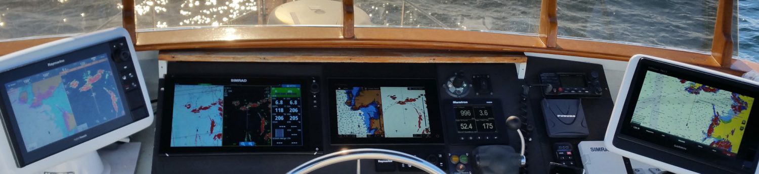
I got a peek at this display during NMEA , and I’m looking forward to going deeper in Lauderdale. What’s the docking display? How much control does the user get over engine alarms? Are...
Late on Friday I learned that PMY is sending a crew of editors to the delayed Fort Lauderdale show. I sympathize with all the exhibitors and locals who don’t think the show should be...
Rose Point Navigation just announced that Coastal Explorer is “the first program to include the entire NOAA chart collection covering all US waters.” What they mean is a sort of mulligan stew of cartography—500 ENC vector charts,...
What’s wrong with this AIS target, seen off Naples, Florida, a couple of weeks ago (with the Si-Tex receiver)? How about a bogus MMSI # (only 4 digits), no name, and destination as “HOME”...


