Monthly Archive: July 2016
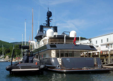 Have we reached the era when “special ops” makes sense as a superyacht style? I joke, but RH3 would be pretty imposing even if it weren’t cruising Maine in company with the all-black, dual jet drive, 40-foot-plus RH4. Given the two other substantial black tenders on the boat deck — and lord knows what’s in the hidden arms lockers (ok, I’m fantasizing, but armament is a seriously untold big yacht story) — this team seems ready to fend off a serious bad guy attack or invade a small island nation…
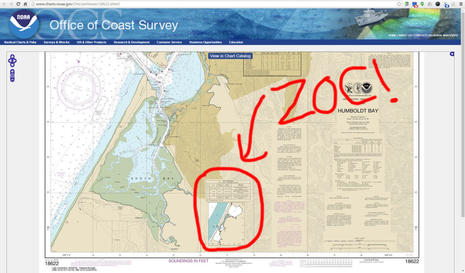
Yikes! Did you know that some areas of the U.S. coastal chart you’re using may only show land and bottom features accurate in position to +/- 1,600 feet, and you shouldn’t be confident about the depth soundings either? NOAA has a new way to show boaters how old and inaccurate much of its survey data is, and it will surely give pause to those who pay attention. The concept is called Zones of Confidence and it’s slowly rolling out as diagrams on paper-style raster charts like the one above, but the ZOC accuracy info is coming much faster to NOAA’s ENC vector charts, and apparently it could be made easily accessible on the commercial vector charts you’re probably using.
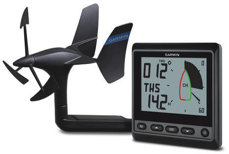
Mount the new Garmin gWind Wireless 2 transducer on your masthead, plug the GNX Wind display into your NMEA 2000 network and — badda bing, badda boom — your sailboat has quality networked wind data that hardly uses any power and retails for $900 bundled. And if you already have a Garmin GPSMAP 7400/7600 or 8400/8600 chartplotter series, you don’t even need the GNX Wind to display and network the data. Meanwhile Raymarine’s updated i70s all-in-one N2K instrument display looks great on several levels…
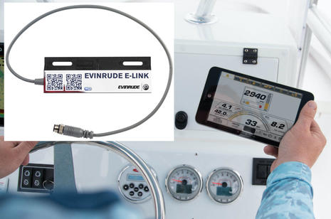 I suspect that a lot of now and future Evinrude E-Tec G2 outboard owners are going to appreciate the new E-Link hardware and app system almost as much as the Fourth of July. The easy-to-install NMEA 2000 WiFi gateway will cost about $360 and will neatly put all G2 gauges, calibrations, and fault codes into otherwise free E-Link Android and iOS (Apple) apps. One E-Link gateway will handle multiple outboards and the system doesn’t require or preclude any other monitoring and control options. In fact, you may soon see a full G2 interface on your favorite multifunction display…


Recent Panbo Comments