Electronic Navigational Charts
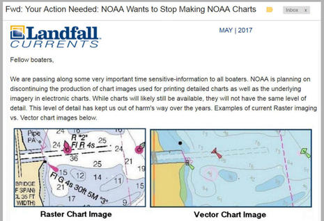
Fairly basic feature story over at the Boating Channel about the advent of electronic navigational charts (ENCs) and how they improve safety. Over a million the ENCs have ben downloaded so far. For a further explanation on how to use these charts, check out this Google Groups discussion. Amongs others, it points you to an ENC viewer from Fugawi and SeeMyDEnc from SevenCs.
 “Often called ‘smart charts’, ENCs provide the nautical data that mariners need, plus vector map features and hydrographic data. They also include electronic compatibility features that paper charts lack. For instance, a mariner can integrate global positioning system (GPS) data, which tells a mariner his or her precise latitude and longitude, with ENC data. The mariner can also integrate data from geographic information systems (GIS), real-time tide and current data, and wind data to enhance the capabilities of the ENC. This information is especially important to large commercial vessels that must navigate through narrow areas.”


