
Garmin GPSMap 943xsv hands-on, X3 delivers
Last November Garmin announced new X3 versions of their mid-tier 7, 9, and 12-inch GPSMap multifunction displays (MFDs), claiming higher resolution displays, twice the processing power, and more features compared to the X2 models they replace. I installed the GPSMap 943xsv — the “3” is what’s new, while “xsv” indicates all the sonar processing built-in — and can report that it works well. And I remember how responsive an X2 series 1242xsv was. I expected an X3 to be an improvement on an already highly capable unit, and I wasn’t disappointed.
What’s new?
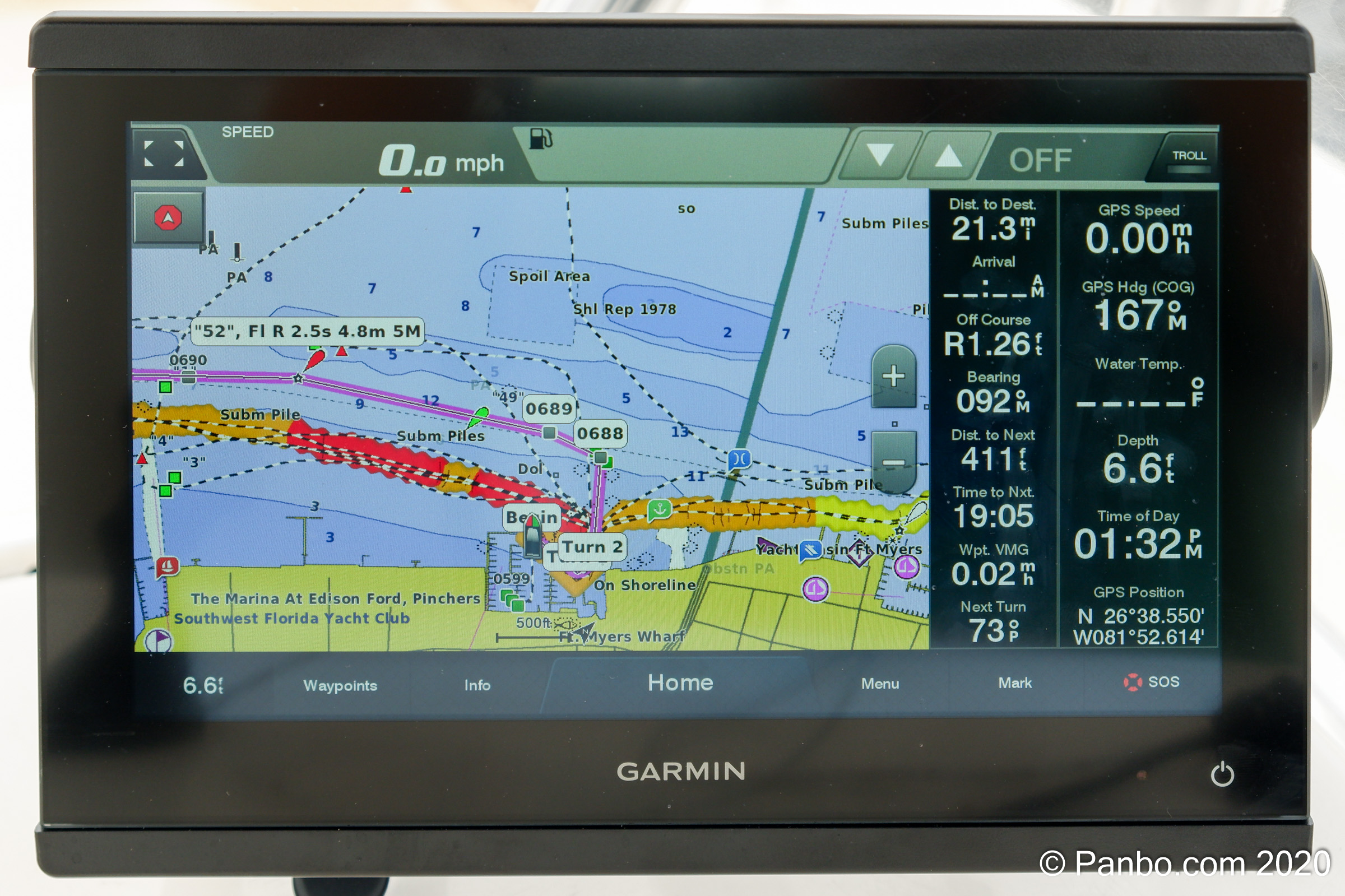
The new Garmin GPSMap 943xsv 
Previous generation Garmin GPSMap 942xs


The major hardware changes for the new 7×3, 9×3, and 12×3 MFDs include increased screen resolution for the seven- and nine-inch models, faster processors, the addition of a J1939 engine data interface, and a new design with slimline display borders and edge-to-edge glass. The design makes the X3 MFDs smaller than the units they replace which means they may be able to replace smaller displays. Plus, in a first for Garmin, there are retrofit kits to go from X2 to X3 displays.
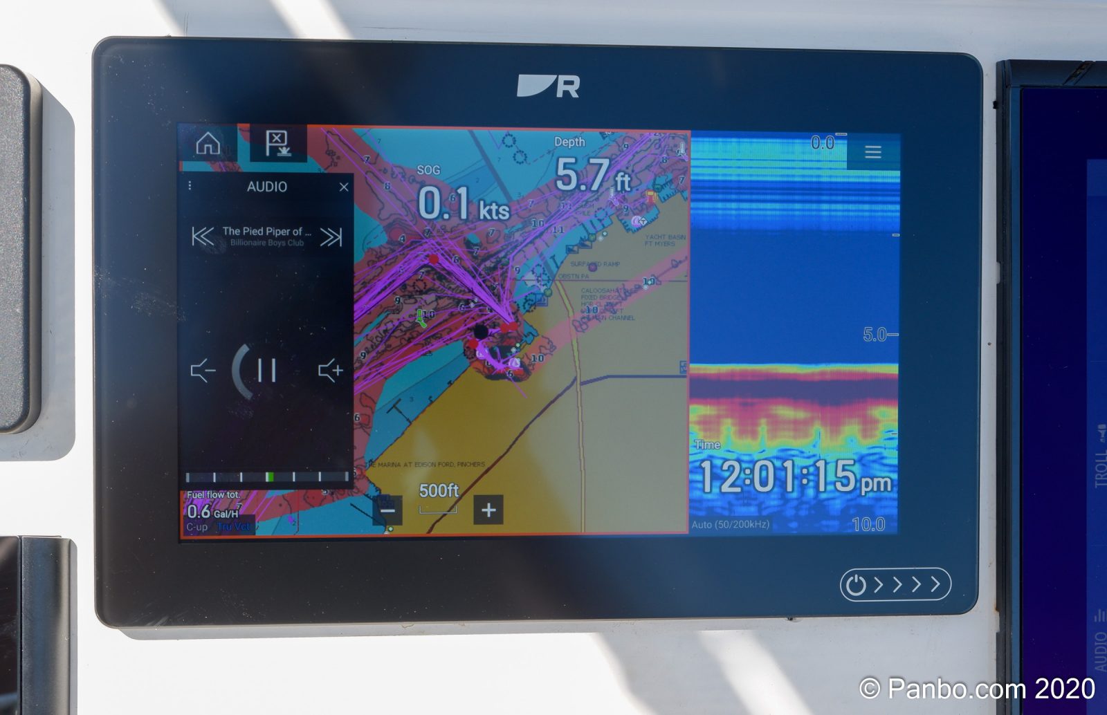
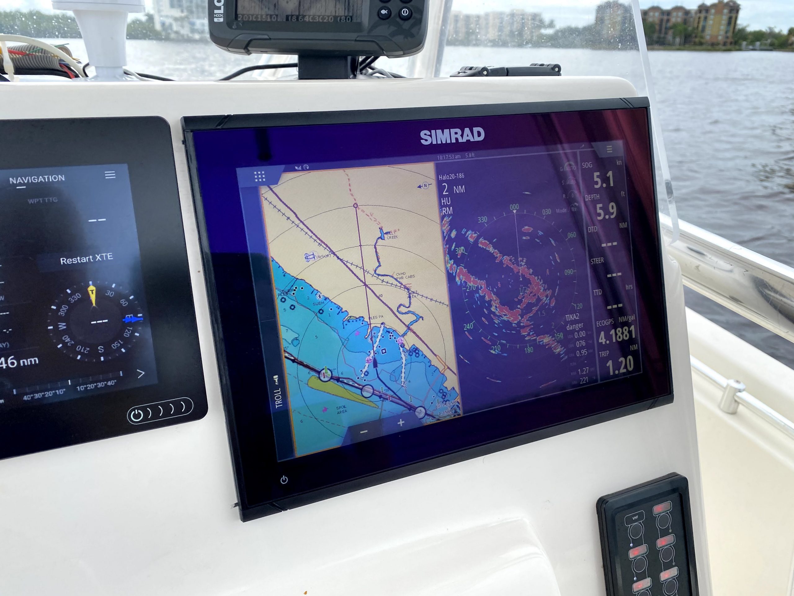
The screen resolution on the seven-inch models has increased from 800×480 pixels for a 742 to 1024×600 for a 743. The nine-inch displays increase from 1024×600 to 1280×720 and the twelve-inch models keep the same 1280×800 resolution. Seven-inch displays utilize twisted nematic or TN displays and the upgrade to a nine or twelve-inch display brings IPS displays and similar to the Axiom to Axiom+ upgrade I recently wrote about. The improved screen resolution is an immediately noticeable and significant upgrade. I have a 12″ GPSMap 8612 aboard Have Another Day with a 1920 x 1080 display and the display on the 943 looks just as sharp and easily viewable as the 8612.
As to Garmin’s claim that the processors in the seven- and nine-inch X3 series are twice as powerful as the previous generation, I haven’t noticed any slowdowns or functions lagging, but then again I never did with the 1242 either. A few years ago I felt that the overall MFD responsiveness was a real issue, with some brands better than others and Garmin MFDs consistently the most responsive. All the plotters I’ve tested recently seem roughly equal in this respect, but this is because others have gotten better, not because Garmin has gotten any worse. In fact, in some subtle and difficult to quantify ways the 943 may still be a little better than other company’s mid-tier MFDs.
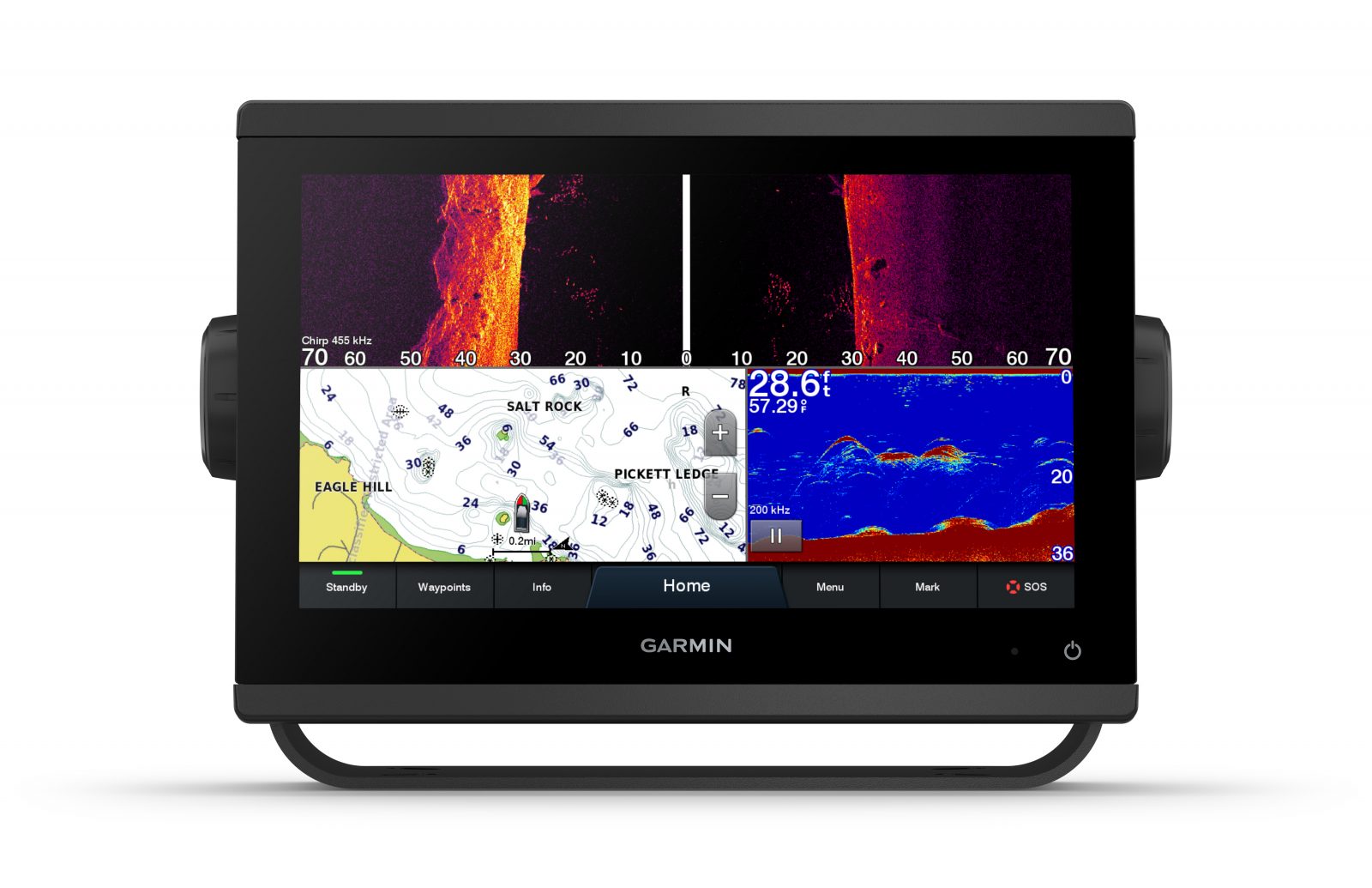
Now discontinued X2 “xs” seven and nine-inch models offered Garmin’s ClearVu and traditional chirp fishfinding and the twelve-inch “xsv” model offered SideVu, ClearVu, and traditional chirp. Now all X3 models with sonar processing are “xsv” with all three sonar technologies displayed in ultra high definition and high-contrast vivid color palettes.
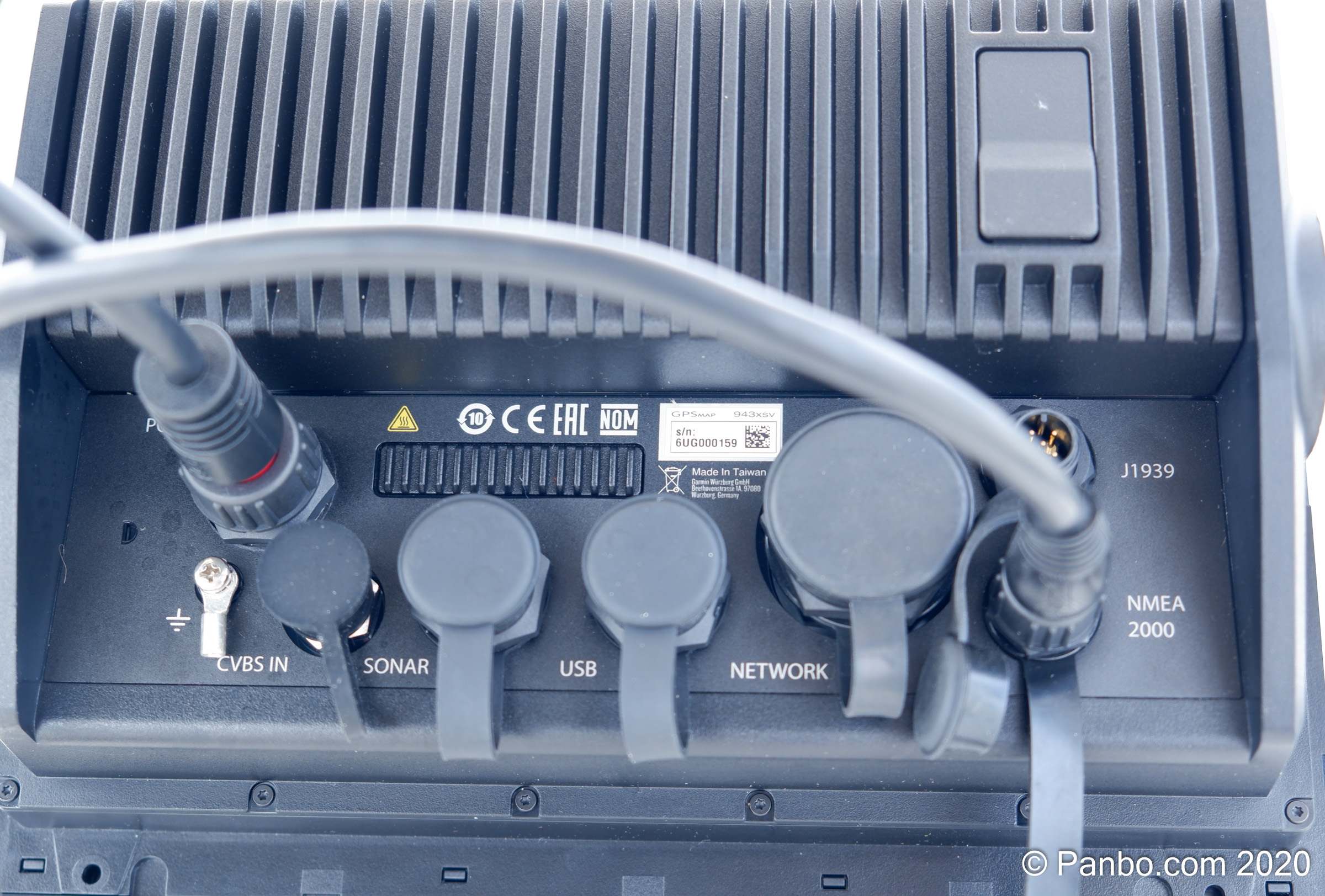
The last major hardware upgrade for the X3 line is the addition of a J1939 interface, which isn’t entirely new. Garmin actually came out with a plus revision to the X2 series which added support for OneHelm and J1939 engines in late 2019. This allows the direct interfacing of engines equipped with a J1939 interface to the MFD.
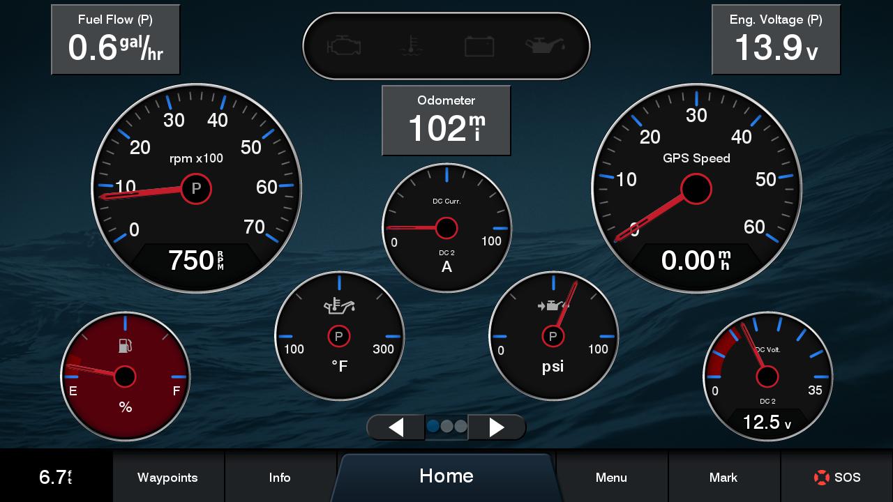
Engine data displayed on Garmin’s gauge screen 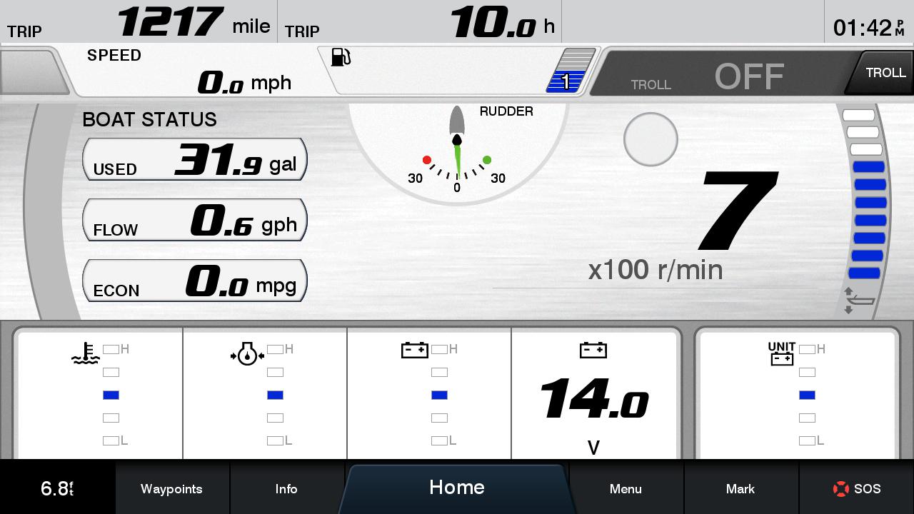
Engine data displayed via the Yamaha view
Currently, I can only find two J1939 cables from Garmin, one for connecting to the Yamaha engine bus, and the other a bare wire cable for making up your own connection. The MFD can display engine information sourced either from the NMEA 2000 network or from the J1939 port. The screenshots captured above came from a Yamaha engine gateway connected via NMEA 2000 but I was also able to successfully feed simulated twin-engine data via the J1939 interface. The X3 MFDs will bridge the J1939 data to the NMEA 2000 network so any other displays on the network will also be able to display engine data.
Garmin has moved the card reader slot from the bottom right of the front panel on the X2 series to the rear of the X3 series. Although I’m aware there are aesthetic and water-resistance reasons for this move, I still lament the much more difficult access it affords — and I’m not alone, as Ben E. and Bob Metcalf dealt with the same issue. You can see the new location for the dual-slot reader — I do appreciate that Garmin includes a dual-slot reader on the X3 plotters — on the top right of the backside photograph.
MFD security
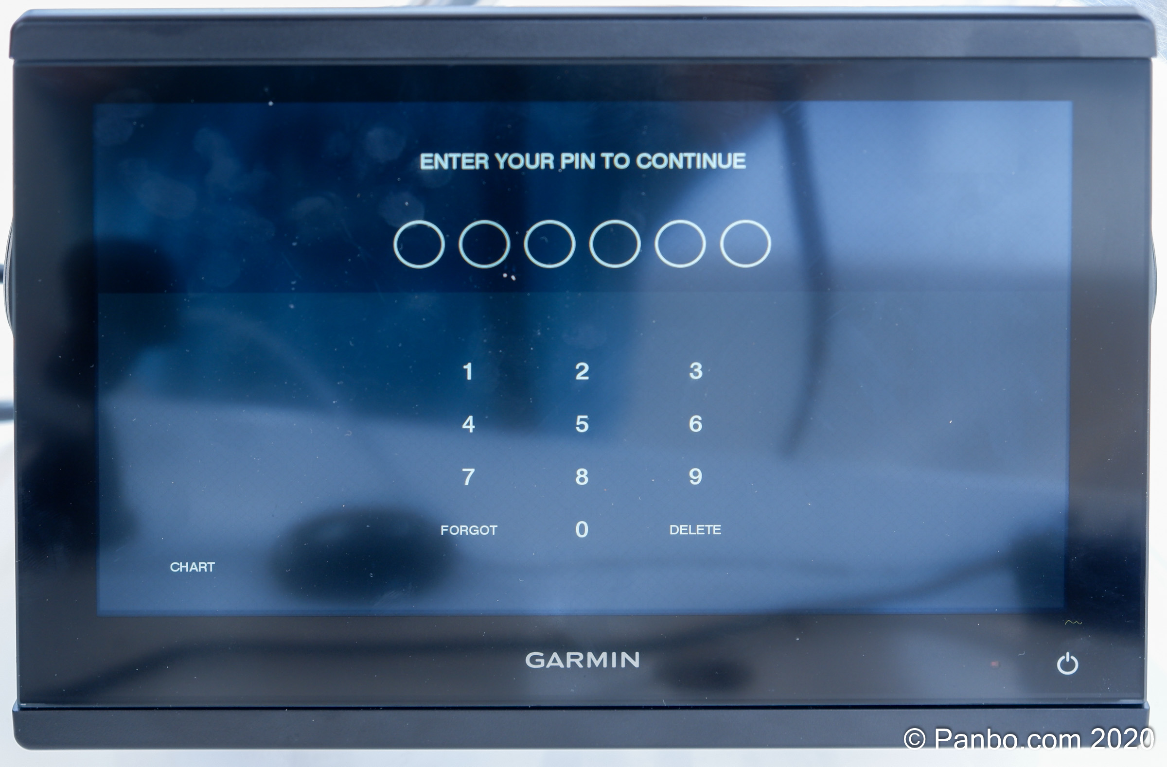
A mid-2020 software release added the ability to set an on-boot security code to help deter MFD theft. There are many stories of high-dollar marine electronics being ripped out of boat consoles, and just such a story caused Bruce Marx, a Miami area lawyer, to start a Facebook group called Stop the GPS Thefts!. Furuno was the first company to add a lock pin to their MFDs with the release of TZT3, and now Garmin has followed suit with a system that appears quite secure.
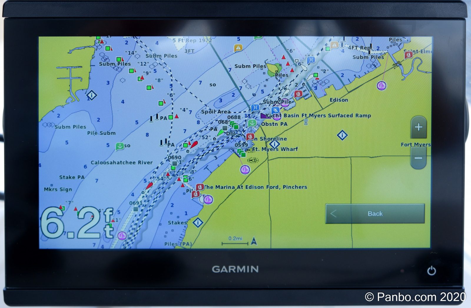
By pressing “chart” on the lower-left of the pin-lock screen you can bring up a limp-home chart view 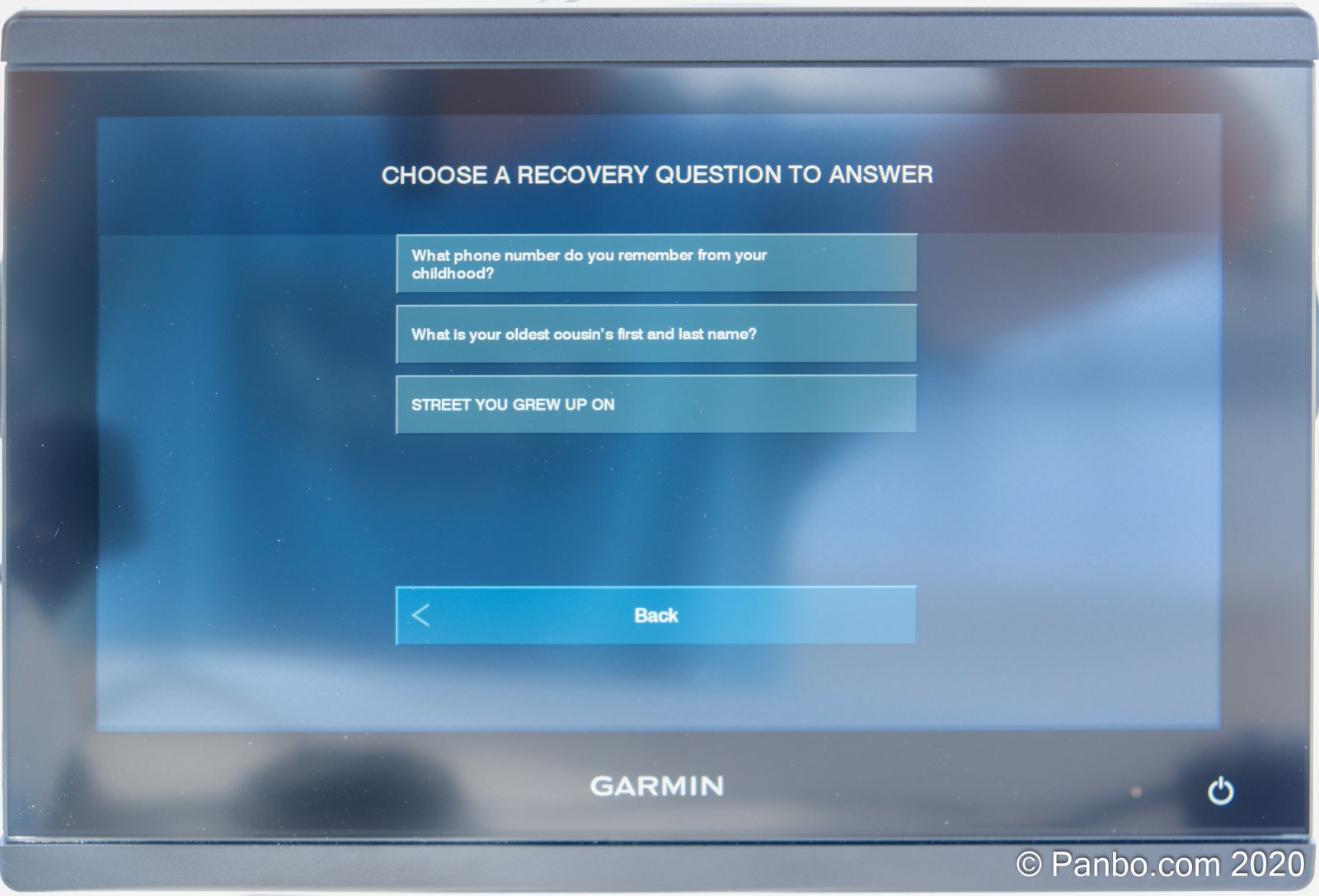
To reset the PIN you need to answer one of the verification questions


Garmin explains that if the PIN is lost and the user can’t answer the reset questions — which are set during the process of entering the pin– the unit is unlockable, even by Garmin. There’s a very basic, chart-only limp-home mode in the event the unit can’t be unlocked. This mode restricts the unit to only displaying the basic chart with none of the normal features available. Garmin also emphasizes that nothing goes across the network, so multiple units on a boat each have their own PIN and there’s no chance of figuring out the code by sniffing the traffic on the network.
So far the electronics industry’s main response to this trouble has been the implementation of security codes. Garmin provides a sticker to place on the helm that shows the unit is protected by a password which might help to convince would-be thieves that it’s not worth their time. There’s also much debate about the wisdom of security screws, through bolting units, and similar measures, the trade-off being that they may increase the damage done to the boat by determined thieves.
Route Planning
On Garmin MFDs, when compared to others I’ve used, you plan your routes backwards. Most MFDs have you start at the boat’s location and work towards your destination adding turns as you go. Garmin has you start at your destination and add turns back to your current location. I’ve never been able to decide which approach I prefer and see the merits of both. The short video above gives a demonstration of the process. The 943’s fast scrolling makes panning around and adding turns a pretty painless experience.
Updates, remote control, and more
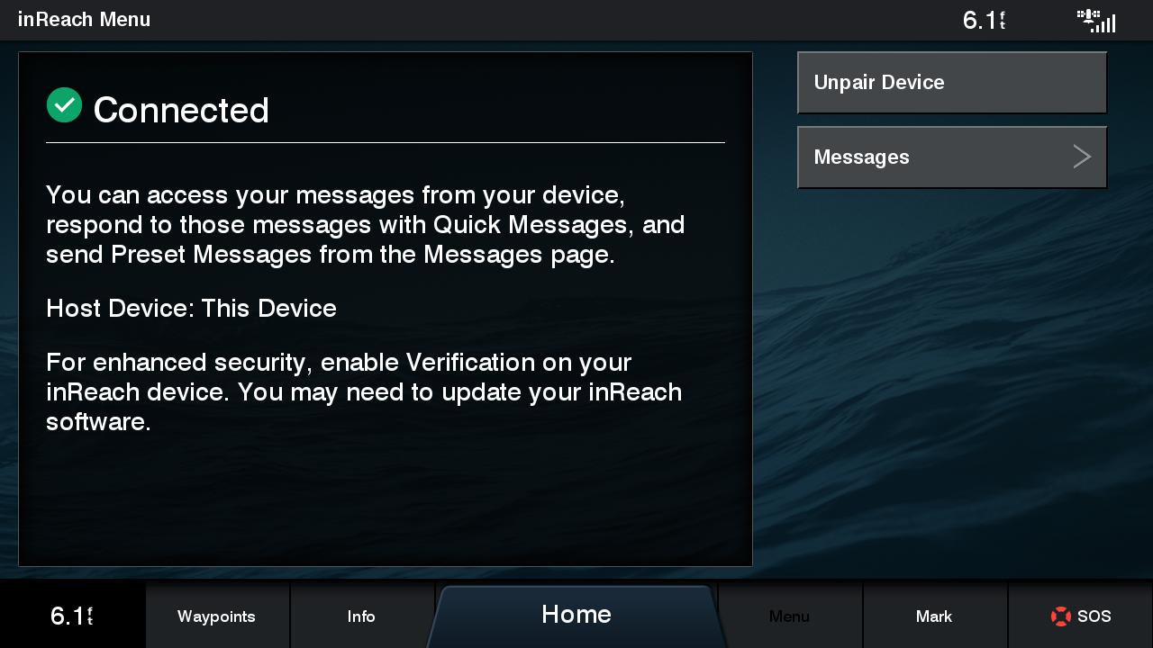
The selection of any particular brand of MFDs comes with a larger ecosystem of components, software, and particular competencies. With Garmin that means you gain access to features like ActiveCaptain Community for crowdsourced cruising data; ANT+ wireless components including Quatix, gWind wireless wind transducer, InReach satellite messengers, and more; and (now discontinued) VIRB action cameras.
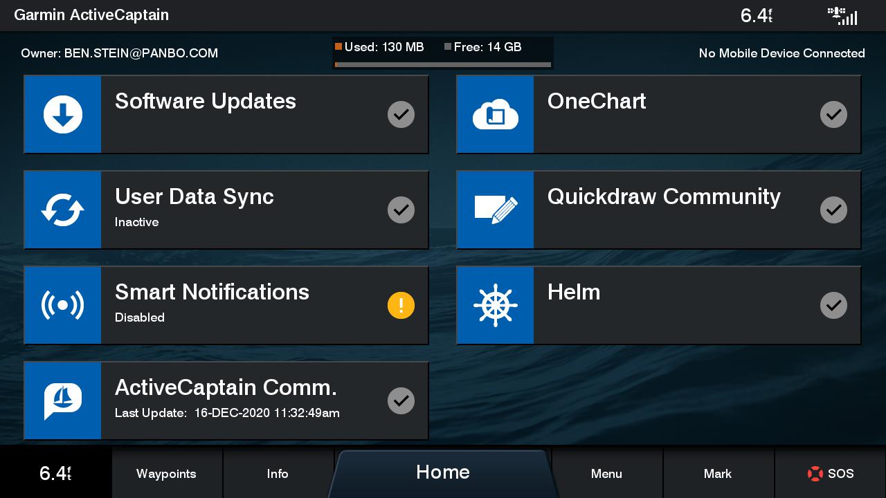
Like all recent Garmin MFDs, updates to the software, charts, QuickDraw Community (crowdsourced bathymetric data), and Active Captain Community data are handled using Garmin’s Active Captain app on your mobile device. The Active Captain app also gives you the ability to view and control your MFD from your mobile device as well as viewing charts, planning routes, and recording tracks directly on your mobile device.
GPSMap naming
You may be confused about where the X3 series fits into Garmin’s MFD offerings, as I have been at times. The GPSMap family is Garmin’s larger boat MFDs with EchoMap products aimed at smaller boats. There are two series of models in the GPSMap family. The X3 (723, 743, 923, 943, 1223, and 1243) is now the more entry-level series followed by the 8000 series (8400, 8600, and 8700) with the 8400 and 8600 being self-contained MFDs and the 8700 a black-box system.
X3 MFDs are available in 7, 9, and 12-inch models and 8000 MFDs are available in 10, 12, 16, 17, 22, and 24-inch models. In the X3 models the first digit is the screen size, so a 7-inch X3 will be a 7×3, a 9-inch a 9×3, and a 12-inch a 12×3. The next digit designates the built-in chart. A 2 indicates a worldwide basemap and a 4 indicates BlueChart G3 and LakeVu G3. The “xsv” after the model number indicates built-in SideVu, ClearVu, and traditional CHIRP sonar processing. So a GPSMAP 1243xsv is a 12-inch MFD with BlueChart and LakeVu cartography and a built-in sonar sounder while a 1223 is the same basic machine with just a basemap preloaded and no sonar built in.
Similar products from other brands
Raymarine Axiom + 9″ 
Simrad Go 12

In terms of price and features, X3 MFDs compare most closely to the Raymarine Axiom+ and Simrad’s Go MFDs that I’ve also tested. Among these three options, the biggest difference is that Simrad GOs don’t allow networking multiple displays together whereas both Raymarine and Garmin support this (as does the Simrad NSS evo3S and Furuno TZT3 series, both of which start at 9-inch display size).
Garmin’s MFDs support BlueCharts cartography — BlueCharts G3 uses Navionics data but not the traditional Navionics presentation — while Raymarine’s MFDs support C-Map, Navionics, and Raymarine’s own LightHouse Charts; and Simrad MFDs support C-Map and Navionics. As I mentioned, Garmin supports ActiveCaptain Community and they’re the only one of the three brands to do so. A seven-inch Simrad Go 7 starts at $500, a 7-inch Axiom+ starts at $750, and a Garmin 723 is $1,000 (though so is the 743 with G3 cartography).
Final thoughts
The GPSMap 943 encompasses several meaningful updates to Garmin’s already highly capable MFDs. If offered the choice between a discounted X2 series MFD or a new X3, I think the increased resolution and extra processing power (even if only for future-proofing) would sway me to spend the extra money for the X3. On the other hand, if you already have X2 series MFDs, I can’t see ripping them out and buying new MFDs for the additional features. Currently, X2 and X3 series MFDs will receive the same software updates and hence have the same capabilities with the exception of features that rely on built-in hardware (like J1939 engine data).


USB socket does not allow you to use Garmin USB Card Reader for maps ?
https://buy.garmin.com/en-US/US/p/pn/010-02251-00#overview
It does work with these MFDs. But, it requires another hole and another $100 outlay. TO be clear, this is not a problem unique to Garmin, all MFDs installed on Panbo(at) have their card readers on the back of the MFD.
-Ben S.
I installed the remote SD Mini size w 2 slots unit on the back of my pedestal NavPod. Works like a charm. Recommended setup is
• SLOT 1 micro on back of unit (Right one) – 32gb Micro SD that you buy install and configure for ActiveCaptain and everything else.
• SLOT 2 micro on back of unit (Left one) – G3 or G3 Vision navigation map card ( I think it’s 8GB)
• SLOT 3 mini on Remote Reader (Left one) – Use for major upgrades with a 2nd 32GB SD
• Slot 4 mini on Remote Reader (Right one) – no idea what to do with this one
If you combined new Garmin unit with the new Garmin GPS antenna and Garmin’s black box AIS… could the Vesper Cortex M-1 add much of anything more?
Peter,
I think you will still get quite a bit from Cortex compared to an MFD and AIS transceiver. First and foremost is the redesign of the basic way you interact with a VHF radio. Brain-dead simple calling of AIS targets by MMSI, powerful collision avoidance, integrated boat monitoring, and more are all major differences from the combination of existing hardware. Additionally, pairing one of these MFDs with a Cortex would give you the best of both worlds in that respect.
-Ben S.
I just found your website and am enjoying it. Our sailboat is used mainly for racing. New race rules will require participants to wear a PLB (Personal Locator Beacon) that has an AIS and in some models an AIS/DSC capability. Could you write an article showing how to use the SOS funcition of the chart plotter to navigate back to a person in the water. Also could you illustrate what the chart plotter will look like when it recieves a PLB AIS signal and how to navigate back to the person. My personal PLB is an Ocean Signal Rescueme MOB1 AIS/DSC. Thanks Craig
Hi Craig.
To be clear, personal AIS MoB beacons are not PLBs. They are two different technologies and two different rescue strategies, so in some cases it makes sense to have both.
At any rate, I tested the ACR sibling of the RescueMe MoB1 and think it’s great. The entry also shows how it and similar AIS MoB devices interact with various VHF radios and chartplotters, but note that the DSC part varies by region:
https://panbo.com/testing-ais-mob-beacons-acr-dsc/
By contrast, here are some entries about PLBs:
https://panbo.com/?s=PLB
I currently use a Globalmap 5200 chartplotter on my boat with limited space for a wider chartplotter which is shared with a Furuno 585 and a Icom m506 radio. Can you make a recommendation for a replacement for my chartplotter?
Hi Nick,
I’d be happy to take a look at what you have, but I’d suggest you post in the Panbo forum so others can chime in as well. Also, if you have a picture of your helm it would be great to upload that so we can understand the space available.
-Ben S.
but still no explorer charts, this makes the chartplotter worthless in the bahamas.
What are the important differences between the 943xsv and the more expensive 8610xsv?
Hi Mitch,
The single largest difference is probably the screen resolution. The 8610 has a 1920 x 1080 display and the 943 has a 1280×720 display. Additionally, the 8610 has three transducer interfaces and deeper sonar capabilities. The 8610 also has HDMI input and output ports.
There used to be more differences between the software, but the X3 series has gained most of those abilities. I also suspect the 8600 series have more capable processers than the X3 series but I don’t know that for sure.
-Ben S.
I just purchased a GPSMAP 743 for a commercial boat. I was told by the store where I bought it that you should be able to add our logo to the start up screen. does anyone know anything about this.
Also what is the USB on the back of the unit for? I plugged it in to my laptop and my laptop did not even recognize it.
It is used for USB Card Reader .
https://buy.garmin.com/en-US/US/p/667679/pn/010-02251-00#devices
I believe there is s setting on the Garmin devices for creating the route starting at the destination or from your current location but can’t remember where they hid it off the top of my head. It is true by default it’s set to start at the destination and then you add turns back wards. This support video shows them going the other way though so clearly it’s possible to change: https://www.youtube.com/watch?v=pW9JWleHEEU&list=PLZQteomUj15P65NTmxujI4FWWuSQ2uP4v
Garmin builds good stuff. My navigation suite is all Garmin however I am needing an upgrade and WILL NOT BUY GARMIN. I also advise any one contemplating going southbound beyond the USA on the west coast to NOT BUY GARMIN until they allow uploading Garmin owned Navionics Charts to their chartplotters. The Garmin charts are beyond garbage. I have submitted some pretty horrendous errors and anchored on many a mountain top to no avail.
I am switching to B&G. Downside is I have to buy new radar. With B&G I don’t need an extra box for the sounder but need an R2K transducer.
Thanks for posting. I recently found this site and I really appreciate all the good content. Just ordered a new Parker 2320 that I will be outfitting with electronics on my own to save some money and choose exactly the gear I want. I decided to go with a 1243 MFD with a Fantom 18x radar. Can’t wait to get on the water!
I have this unit on my sportsman 214 boat with a Yamaha 150. I love it. I was just curious if I buy a Garmin force trolling motor. Will this trolling motor hook to this unit? And if so what wiring will have to be added if any?
Just bought the 943sxv and waiting for it to arrive. The man at west marine said it has a built in antenna. Can’t find anything on line.
Richard, I believe it has a GPS, GLONASS and GALILEO receiver built in with patch antenna, with no connector for an external antenna. This is pretty typical these days and should work fine unless you’re installing it inside a boat with a metal deck and superstructure. In that case you can add a NMEA 2000 external GPS receiver/antenna and select it instead of the 943’s internal one.
Would like to hear from anyone who has seen the 743xsv TN display. I can’t find one on display anywhere nearby. Thinking of pairing a 743xsv as a secondary with the 8610xsv I already have on my console. It’s the only Garmin unit that will fit in the space I have unfortunately. I’m just wondering how it compares to the 8610 IPS display as far as brightness and speed goes. I do understand there’s a big discrepancy in resolution, but the smaller screen should mitigate that somewhat. Neither unit is directly in front of me so I’ll be viewing both just slightly off axis, maybe the 743 would be slightly more so.
Mark, I appreciate your carefulness regarding helm ergonomics and am sorry I can’t deliver a direct answer. However, I tested a lot of Garmin MFDs including 7- and 12-inch models just prior to what you’re dealing with, and I suspect that you’d find the 743xsv quite satisfactory. Hopefully others will weigh in, like maybe Ben Stein, though I think he is still traveling with RV and family.
Does anyone know if you can save a KML file of waypoints on a micro SD card and insert it in one of the slots, will the unit read the locations or is there another way to download all your numbers on to a SD card so that the 943 will show them on the screen?
Frank, I think this can be done if you convert the KML files to GPX format. Or at least I see suggested solutions by searching “import gpx files to Garmin GPSMap 943”