
The next-generation Orca Display 2 is now available for pre-order
Orca, the Norwegian marine tech startup, opened pre-orders for Orca Display 2 on 30 March 2023. The new display delivers chartplotter-level brightness and operating temperature range combined with the portability and performance of a modern tablet. Deliveries will begin in late April 2023 for early pre-orders.
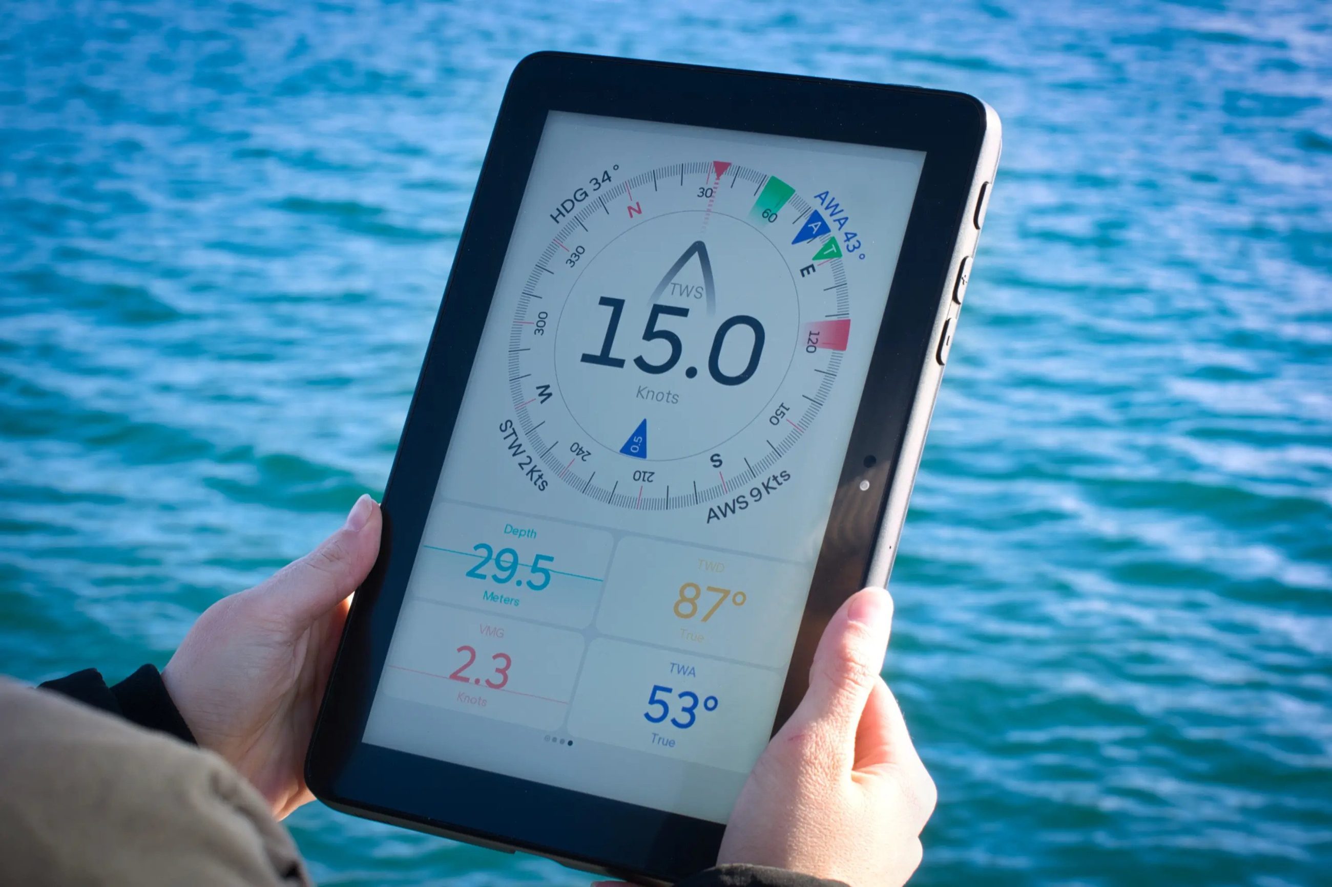
Every aspect of the Orca Display 2 is purpose-built for boating and extreme conditions at sea, and for its second-generation display, Orca developed its Lumen HDX screen.
The Lumen HDX screen delivers 1,000 nits of persistent brightness with a stunning 1200:1 contrast. The screen has an etched glass surface that minimizes screen glare and can be viewed with polarized sunglasses thanks to the Lumen HDX’s TrueShift polariser. The result is an incredibly bright screen that can be easily viewed in direct sunlight.
Orca Display 2 is able to operate in temperatures from -15 to +55 degrees centigrades. The display achieves this with its custom-built 9500 mAh battery that delivers up to eight hours of battery-powered navigation.
Charging the Display 2 is incredibly easy. Orca recently announced the Orca Charging Mount, a wireless charging mount that allows you to use the Orca Display 2 hands-free, just like a traditional chartplotter. The mount charges via a proprietary 25W wireless fast-charging system and can be installed in a variety of ways: With a mounting arm, flush-mounted on a flat surface, or on the mast of a sailboat.
Traditional chartplotters are notoriously slow and unresponsive. The first-generation Orca Display released in 2021 is still the fastest and most powerful marine navigation system on the market with its 8-core processor. Orca Display 2 takes performance even further, delivering up to 60% better CPU performance than its predecessor, and 75% better graphics performance with its dual-core GPU. Orca’s Display 2 responds instantly, from zooming and panning the chart to automatic routing and rich instrument panels.
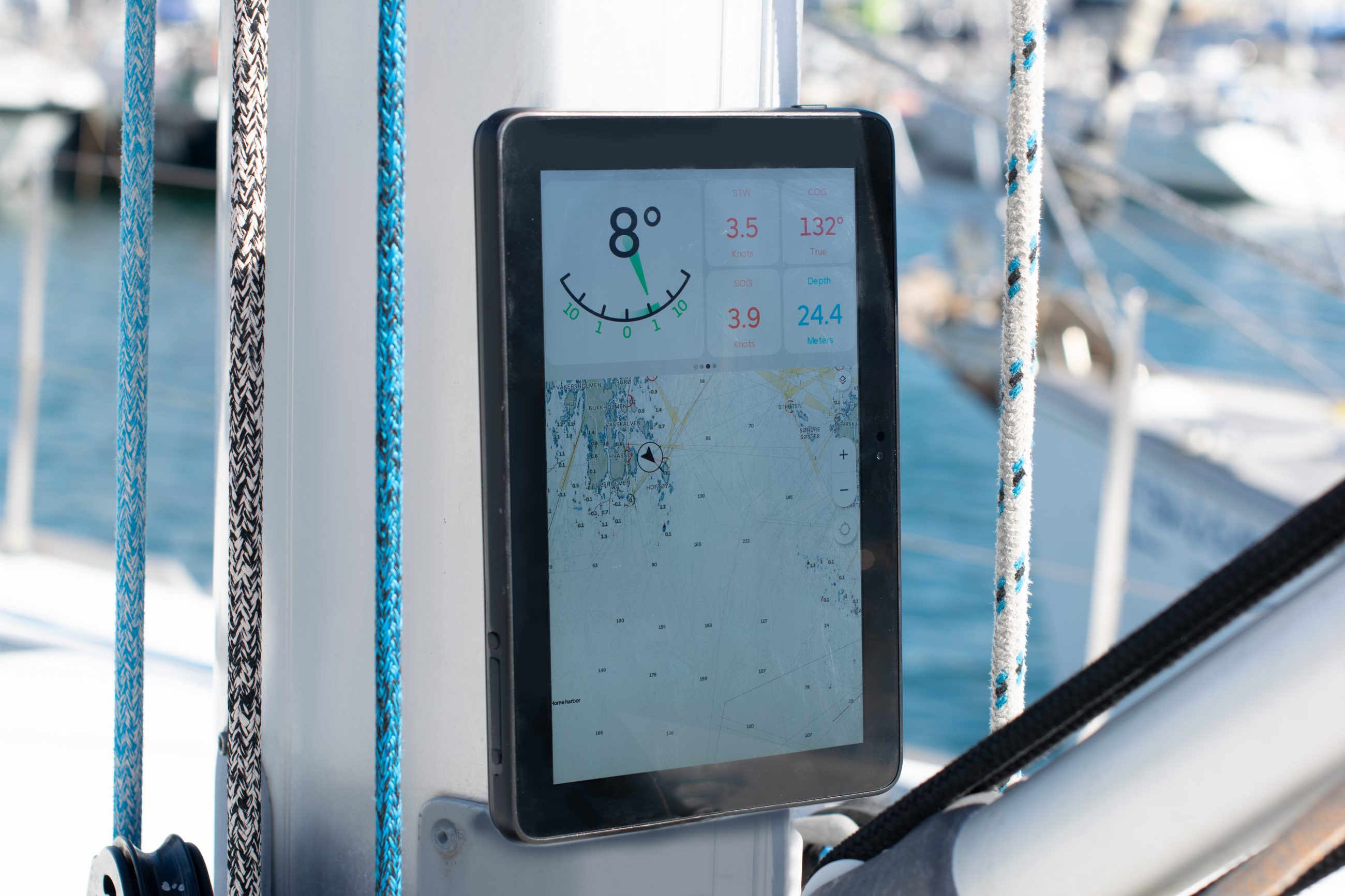
Boaters can view rich sailing instruments, AIS information, engine data and control modern autopilots from the Display 2 wirelessly via the Orca Core. Orca Display 2 is also cellular-enabled, so when used with a SIM card, users can access live AIS, weather forecasts, and advanced tools such as sail routing. Orca Display 2 also synchronises your personal spots and routes directly with the Orca app on your smartphone and tablet, making pre-planning effortless.
Jorge Sevillano, Co-Founder and CEO of Orca, comments on the new product, “Orca Display 2 sets a new standard for marine navigation experiences. It is the first product that delivers chartplotter-level brightness and temperature handling, in combination with great performance and ease-of-use that you get from modern mobile phones and tablets.”
Kristian Fallrø, Co-Founder and CTO of Orca adds, “Orca Display 2 is a fantastic navigation device, but it is also a completely open Google Certified Android tablet. This certification means you can install all your favorite apps via the Play Store, whether it is for boating, entertainment, or productivity.”
Available to pre-order directly from www.getorca.com, the Orca Display 2 is €999 ($999). The optional Orca Core, which delivers wireless boat integration, and optional Orca Charging Mount are sold separately at €449 ($499) and €299 ($299) respectively.
Related Posts:


Panbo publishes select press releases as a service to readers and the marine electronics industry. The release contents do not reflect the opinion of the editors and are not fact checked by the editors


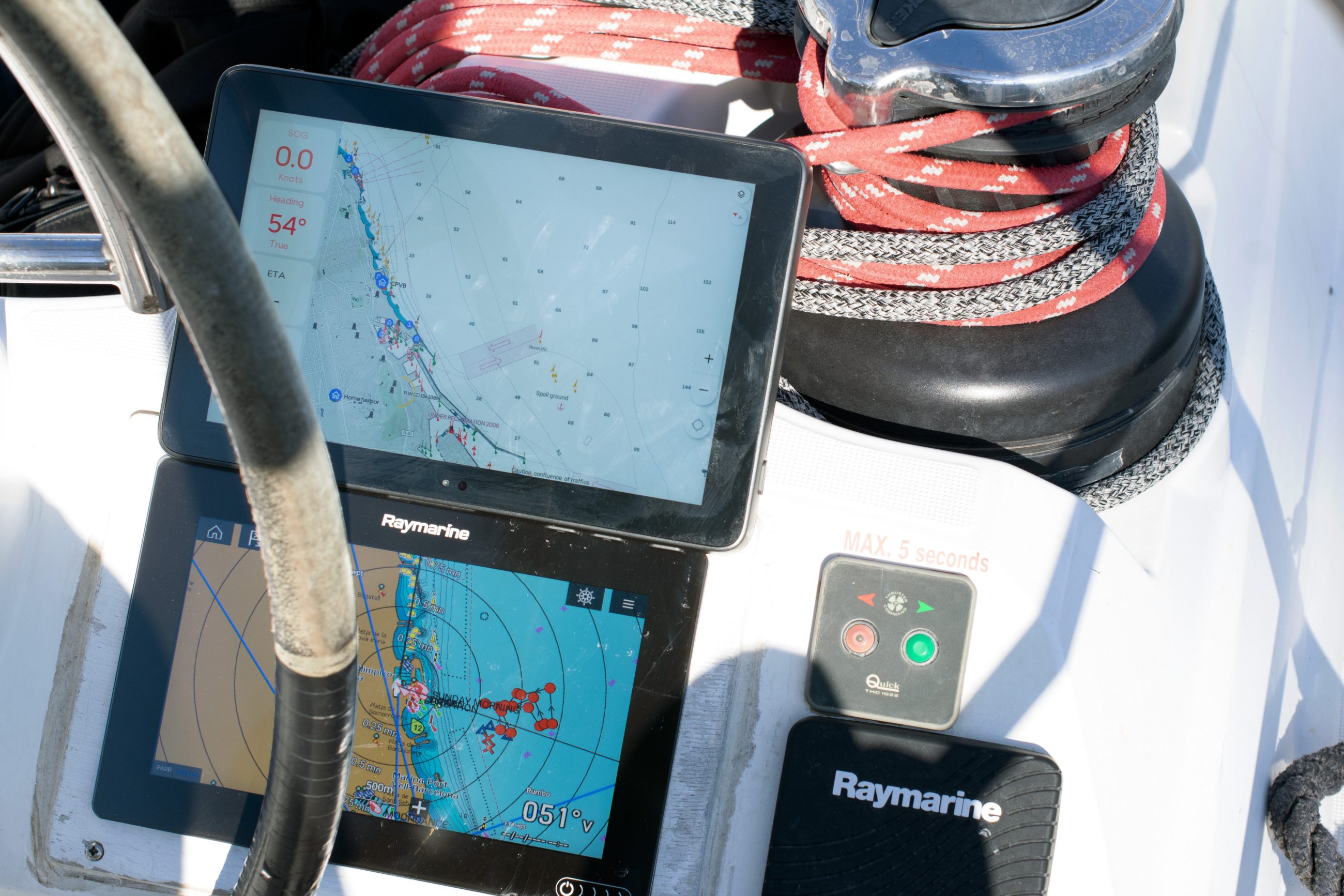
I met the Orca team at METS and appreciated how their previous experience in the marine electronics world has led to their current enthusiasm for creating new options. Now I’m being impressed by their app running on my iPad, while Ben Stein is testing their Core product and may get his hands on a Display 2. We tentatively think that Orca is doing many things well, and you’ll be hearing more about them here.
Interesting stuff, Ben! I downloaded their app onto my iPhone11, and the charting looks pretty good (especially considering the cost!) but missing some fairly essential things (like bridge heights, creek/river names).
I was also impressed that AIS signals were showing up (and I’m 1000 NM from our AIS receiver!) – presumably through Marinetraffic or similar servers. I’m considering the Core as an immediate aid in putting our STNG network “on the air” so we can use it on our fones, etc.
I wonder when charting for the Caribbean and other popular areas of the Americas might appear.
Thanks for the overview. I noted that the iPhone Pro 14 and Pro 14 max has a brighter screen at 2000 NITS (it’s easily readable in full sunlight, I can personally attest to that) vs Orca 2’s 1000 NITS and it’s also dustproof and waterproof to IP68 specs (immersion to 6 meters for 30 minutes). I would doubt that anything beats the iPhone Pro 14 in performance given its 6 cores of CPU, 5 cores of GPU, and 16 cores for the neural engine.
The display has a 2,000,000:1 contrast ratio. compared to Orca 2’s 2000:1. The display of the Orca 2 is 10.1 inches at 1920×1200 vs the iPhone Pro 14 MAX has a higher resolution display at 2796‑by‑1290 at 6.7 inches. I navigated for years using a 5 inch display on a Garmin GPSMAP chartplotter, good enough but not ideal. I like the bigger display of the Orca 2. Personally, I just use the iPad Pro 12.9 but it doesn’t have the display specs of the Orca 2 for waterproof and sunlight viewing, although the display does max out at 1000 NITS in bright areas of the screen, it only has 600 NITS on average. I use it protected inside an enclosure, not in direct sunlight or rain so I don’t care. It has the M1 CPU which is faster than any device on the market.
Reference:
https://www.apple.com/iphone-14-pro/specs/#:~:text=1000%20nits%20max%20brightness%20(typical,multiple%20languages%20and%20characters%20simultaneously
All that’s well and good for the iPhone Pro 14 but the defining feature I need is access to USACE surveys using Aqua Map. Several navigation apps are mentioned but not Aqua Map which is the only app providing USACE survey charts for navigation. Since it’s an Android OS, I would expect the device would support Aqua Map’s Android version – in which case, it makes a great Android device for navigation. However, I don’t see any Android navigation apps listed except their own. Do they support Android navigation apps like Aqua Map, Navionics, etc.? I see weather apps, and apps for finding marinas, etc., but no general navigation apps. I may be missing something there.
I wonder if the 1000 NITS would endure if placed in full sunlight for an extended time like a typical Chartplotter. I know that my iPad Pro 12.9 cannot endure full sunlight without dimming and even shutting down. An extended run in full sunlight would be a good test for the Orca 2 since the device is advertised as the ” ultimate navigation display” in their ads and usable in full sunlight like a Chartplotter. I would expect the Orca 2 to not dim or turn off due to heat from the full sun. It should be an easy test to run if you have a sample device. The ad on their webpage shows a spec of sustained operation in direct sunlight.
“Thermal Coupled Backlight. Lumen HDX’s backlight is embedded in the Orca Display 2’s Thermal Backbone. The backbone dissipates heat from the ultrabright backlight and incoming sunlight, enabling the Orca Display 2 to deliver 1000 nits of sustained brightness in direct sunlight”.
I haven’t tested it but I doubt the iPhone Pro 14 could sustain long exposure to direct sunlight and not dim or shut down. I just haven’t tested something I never do (leave iPhone Pro 14 in direct sunlight).
Thanks for your review, very informative.
Robert,
I first want to note this is a press release from Orca. I haven’t completed a review of the Orca Display 2 yet, but I do have a test device with which I’ve completed some testing. Thus far, I haven’t seen the Orca Display dim or shut down, including in circumstances that took out both a Samsung S5 and an iPad Pro. But, I didn’t capture images of the situation, nor did I have a thermal camera which I think would be useful in comparing the performance.
I will also note that thus far, the display is excellent. It’s been my experience that most current devices are bright enough to be viewed in sunlight when their backlights are at full performance. But, as you note, it’s not uncommon for devices to dim due to thermal issues. Typically, that occurs when conditions are at their brightest, so dimming is most detrimental. I suspect the additional resolution of many tablet displays isn’t critical for the distance at which they are used. I also belive that additional resolution results in greater miniaturization which increases the heat dissipation challenges.
I’ve loaded a few Android apps on the Orca Display without trouble and don’t expect that Aqua Map will be a problem, but I haven’t had the chance to test that just yet.
-Ben S.
Hi Robert & Ben,
My wife has an iPhone 14, and I can tell you for certain that charging it in sunlight will cause it to shut down due to overheat (and it gets HOT!).
I share your liking for AquaMap and the USACE surveys – I’ve found them VERY handy here in the Chesapeake! I put a mount atop our helm console specifically to hold my iPhone 11 with AquaMap for that utility (I sure wish I could get those for my chartplotter!).
I asked the Orca folks about integrating with AquaMap, but they didn’t seem interested. Their charting for Norway is excellent, btw – but not so for the USA. Their Ap uses only NOAA ENC charts -good, but not great, IMHO.
Hartley
I see that the Display 2 has its own GNSS receiver, obviously good for Android nav apps like Aqua Map. But I’m wondering if it allows such apps to use data from the Orca Core, including a boat’s NMEA 2000 stream, like their own app does?
Ben, I just saw your comment. Surely they allow navigation apps to use data from the Orca core?! Are they intent on getting users to navigate only with the charts that come with the Orca 2? Surely not… That would cripple the device. The NOAA charts are flat-out wrong in many places on the ICW – leading the boater into shoal water.
If I understand their plan currently, they plan to use the Core with either their display or any iOS or Android tablet running the Orca app. It’s possible I misunderstand but that’s what I’ve gathered.
As I look more at their app and charts, I’d really appreciate any specific areas you might be able to identify where NOAA’s charts are more likely to lead to trouble.
-Ben S.
Bob, if true, it may well be a technical thing. The way many devices deliver NMEA info over WiFi works OK as we know it, but is actually pretty crude and limited in terms of improvement. So Orca may have used another data protocol in their effort to build a complete WiFi tablet system that can compete well with fixed chart plotters.
Ben, I can supply a list of places where NOAA charts have led to groundings (note the plural) as documented by boaters suffering such fates with analysis by me. It’s Kate at night presently, I’ll put a list together tomorrow.
Note, I’ve met with NOAA in working sessions and several places have been fixed (charts changed, magenta line moved) but there is still work to be done in additional areas. I’ve worked with Kyle Ward and Colleen Roche, both of NOAA, on this over the years which came out of a presentation I made to them two years ago. I can send you a copy if you want.
The errors I’m interested in are not compares between USACE surveys and NOAA charts on depths – since that’s no contest. I’m addressing errors in location such as the example in the link.
https://www.facebook.com/download/1187459592150314/NOAA%20Chart%20Offsets.pdf?
There are many more examples such as this one.
Hi Bob,
I agree with you there – I showed that comparison because I wanted to show why I want more than NOAA ENC charting available to me when we’re in those critical places, like Chesapeake entrances or the ICW. 🙂
Hartley
Ben, it’s good to hear that the Orca 2 accepts navigation apps. I wonder why they didn’t mention that in their release. With that capability, it’s an excellent option for navigation. I agree, resolution is not that important at the dpi level cited, it’s plenty of resolution for the application and places less of a burden on the CPU (and GPU) .
I wonder if it supports split screen. Android advertises it as a native feature of Android but on the Apple iOS at least, even though it’s offered by the iOS, the manufacturer of the app had to specifically program their app to use the feature. Apple’s new feature of “Stage Manager” will provide a split screen or even three apps at a time with resizeable windows without the app manufacturer having to modify their app. That way, I can have Navionics SonarChart and Aqua Map side by side in equal sized windows on the iPad. I wonder if the Android version Orca 2 uses has the same capability?
I think there’s a wider market for a company like Orca. There’s an opportunity to offer a device with apps already loaded for those boaters less computer literate. There could be a list of app groups: Basic, Intermediate, and Advanced. Each group would have apps already loaded suitable to one of the three levels chosen (priced to cover app costs and enrolled if a subscription is required). Apple (and I’m sure Android) has a feature to automatically update apps so once set up, the user can just use the apps and know he always has the latest version. It would fit in with their business plan of providing a complete navigation system with auxiliary apps needed (weather apps, marina reviews, anchorage reviews, etc.) I forget how many times I’m asked for this feature and I keep replying, nobody offers it (yet). Oh well.
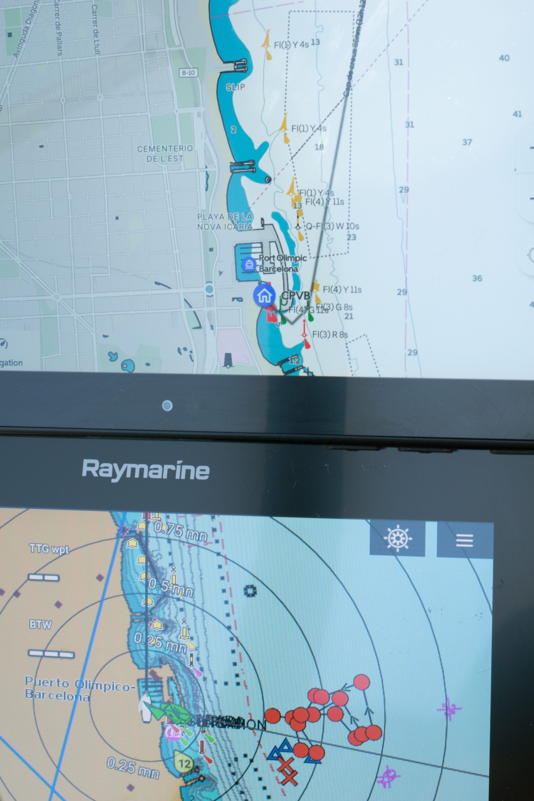
It works! Here’s Aqua Map running on the Display 2:
But, a quick note. The Orca Display 2 is running a customized launcher that results in the Orca App being launched by default.
To get to apps, you hit the menu button in the top left:
Then you select apps from the bottom left of the menu that comes up:
And a list of apps is displayed:
Clicking on an app launches it:
Does it allow AquaMap to see your network data? I’m particularly interested in AIS info, but other things would be interesting, too (wind, depth, etc).
Hartley
Ben, can Aqua Map see NMEA data through Orca2? Aqua Map will attach a depth number to the nearest tenth of a foot to every track point if it receives NMEA data. You can imagine how valuable that is to me in running the ICW and in receiving tracks from other boaters (my Bob423 Surveyors Group, about a dozen boaters with the same setup I have in sending NMEA data to Aqua Map over WiFi),
Each track point has Lat/Long, date, time, and a depth. Aqua Map has a feature to send that data in real time to NOAA’s Crowd Sourced Bathymetry database – accessible by anyone. I have the link.
Interesting that the Display2 includes “a dual-band L1+L5 GNSS receiver. Advanced signal processing and support for all major sattellite constellations enables down to 50cm position accuracy for more safety, better ETAs, and navigation calculations. Supported constellations: GPS L1CA+L5, Galileo E1 + E5a, BeiDou B1I+ B2a, Glonass L1OF, QZSS L1CA+ L5 and NavIC”
I learned about the advantages of dual-band multi-constellation GNSS when I wrote about the Vakaros Atlas 2:
https://panbo.com/vakaros-atlas-2-racesense-the-promise-dual-band-gps/
Note the Core sensors are listed as “9-axis inertial motion unit, compass & 10Hz GNSS receiver” so presume that Display 2 position info is prioritized if available.
Then again, the Core supposedly compensates wind etc for boat motion at 100Hz.
Ben, what are the specs on the GPS receiver used in the Vesper XB-8000? I looked through the internet but couldn’t find anything specific. L5 looks great!
For the XB8000, I see only “50 channel (external GPS antenna with 10m (33′) cable included) with WAAS and EGNOS” while more modern Cortex GNSS states: “GNSS SENSITIVITY -167 dBm; CONSTELLATIONS GPS, GLONASS, BeiDou, Galilleo; CHANNELS 72; DIFFERENTIAL SUPPORT SBAS, WAAS, EGS; NAVIGATION RATE 10 Hz; FEATURES anti-jamming, anti-spoofing.”
To my knowledge, very few marine GNSS receivers are multi-band as well as multi-constellation. Seems like Orca is not messing around!
Hi Y’all,
Per Ben E’s instruction, here is the comparison I see between AquaMap USACE charting and NOAA ENC charting for the entrance to Rock Creek/Herrington North here on the Chesapeake. I’m real familiar with this one because we came out of it just a couple of days ago!
AquaMap:
https://panbo.com/wp-content/uploads/wpforo/default_attachments/1685027658-AquaMapHerrington.jpg
NOAA:
https://panbo.com/wp-content/uploads/wpforo/default_attachments/1685027818-ChartHerringtonN.jpg
Hartley
S/V Atsa
Thanks, Hartley, and sorry that posting images is so limited. But they are a little more accessible on the Forum, and attracting interest:
https://panbo.com/marineelectronicsforum/network-your-boat/noaa-vs-aquamap-usace-depth-charting/#post-2431