
Vakaros Atlas 2 RaceSense & the promise of dual-band GPS
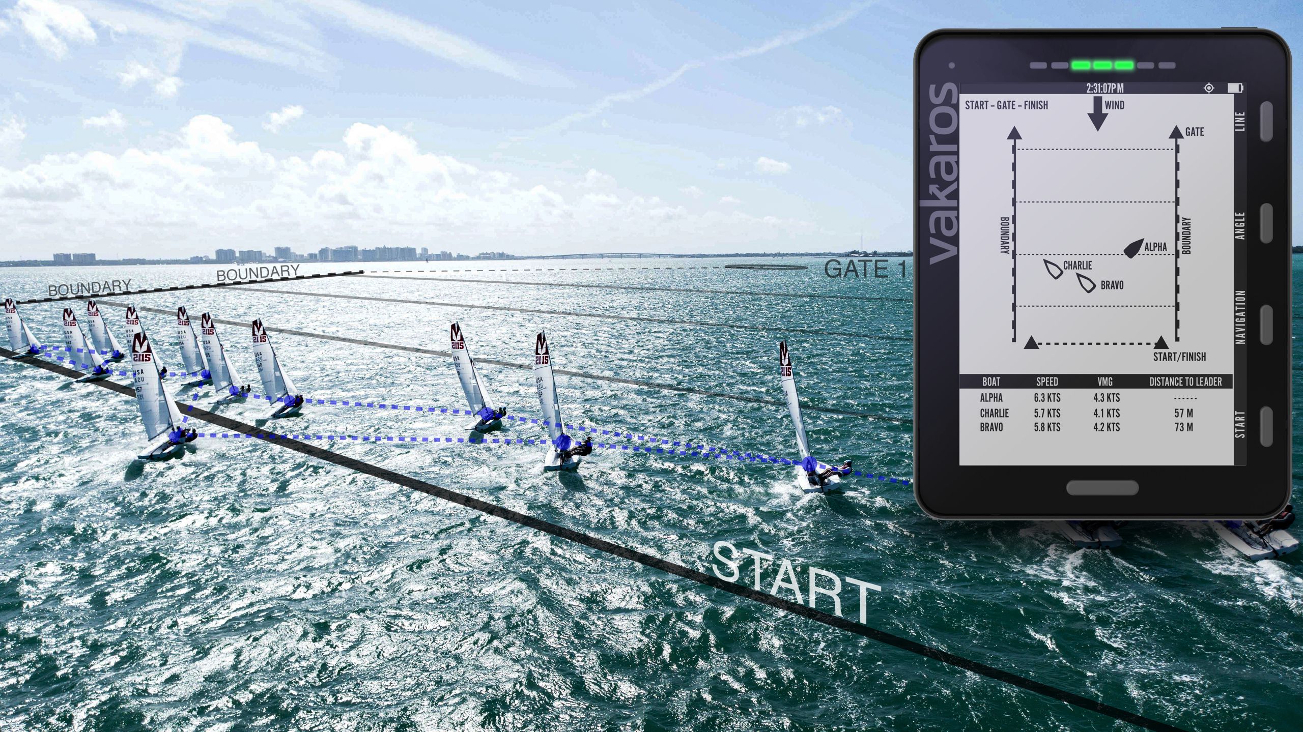
RaceSense is such a novel concept that it’s hard to understand at a glance. While that screen looks like a virtual sail racing app that you play with your fingertips, what’s actually virtual are the folks normally needed to run a real event — plus their boats, the marks, the horn, etc. Instead, Vakaros Atlas 2 tablet-style instruments on each of the real sailboats form a meshed wireless network, and a built-in feature called RaceSense uses distributed artificial intelligence to create the course, call penalties, and name winners. Wow.
If RaceSense works as planned, the feature could be a nifty new way to compete, and conceivably more accurate than human umpires. Moreover, there will also be an alternate RaceSense Fleet mode designed to make conventional race management easier, even with reduced manpower. Plus, if the committee boat can precisely track all the racers at once and even light up a single boat’s Atlas 2 to levy a penalty, sharing that info with enthusiastic but often confused on-the-water spectators like myself should be a fairly simple next step.
But I emphasized that “If” because the Vakaros second-generation Atlas 2 sailing instrument — introduced last July — now won’t ship to retail customers until January due to supply chain issues, and its RaceSense capabilities were only revealed a few weeks ago. In other words, real-world versions of the composite image above have only been prototype test races so far. Then again, Vakaros tells me that the testing is going well and, besides, the $1,000 Atlas 2 looks like an able tool even if a racer never uses the RaceSense features.
Moreover, the key technology behind the Atlas 2 — a dual-band GPS/GNNS receiver able to use the improved navigation capabilities of the L5 frequency — is good to know about afloat or ashore.
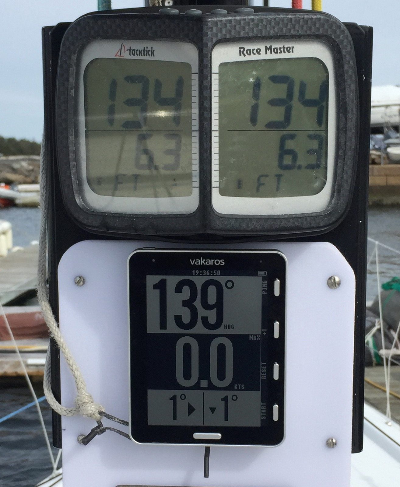
Original Atlas with TackTick Race Master (courtesy Sailing Anarchy) 
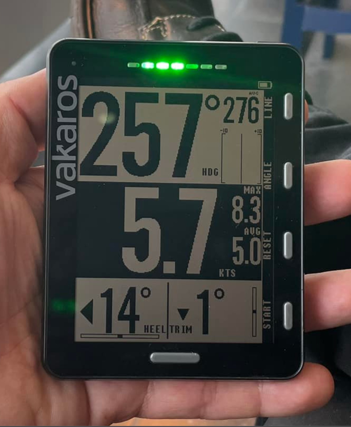
New Atlas 2 model adds multicolor LED strip & more

Stepping back a bit, the original Atlas, introduced in 2018, is a purpose-built, wireless, waterproof instrument focused on the valuable numbers that can be calculated by fusing high-performance GPS/GNSS position info with 9-axis magnetometer, gyroscope, and accelerometer sensing. Its 4.4-inch, 320 x 240 pixel screen looks sharp even in user photos seen on a long Sailing Anarchy Forum thread, where you’ll also find a fair amount of praise for the original device along with some angst about bugs and delayed firmware updates.
But let’s acknowledge that Varakos serves the fairly narrow niche of small to medium size racing sailboats, and of all the many niches that fracture marine electronics, it’s one of the most challenging in terms of environmental conditions, needed precision, and demanding customers. I notice, for instance, that Raymarine hasn’t put much energy into the TackTick MicroNet line it acquired in 2011 and, similarly, Garmin’s sail instrument offerings haven’t progressed far since the integration of their 2012 Nexus purchase.
The big brands, especially B&G, do a lot for sailors with their networked display and sensor systems, but in the modern world of wireless GPS-centric racing instruments, the Atlas competes with devices like the Velocitek ProStart and the Sailmon Max. And it’s noteworthy that the Atlas was first compared to the 2018 Pittman Award winning Racegeek d10 which no longer exists. In short, it’s a tough market and I was impressed with the new features that Varakos added to the Atlas 2 before RaceSense was even mentioned.
Note, for instance, the bright strip of multicolor LEDs at the top of the new design. Along with improved audio speakers, they can alert a racer to various situations like a start line deadline without the need to focus on screen digits. But the really significant Atlas 2 upgrade is its “25 Hz L1+L5 dual-band, multi-constellation GNSS receiver” — a technology leap that deserves discussion however you use the ever-evolving Global Navigation Satellite System.
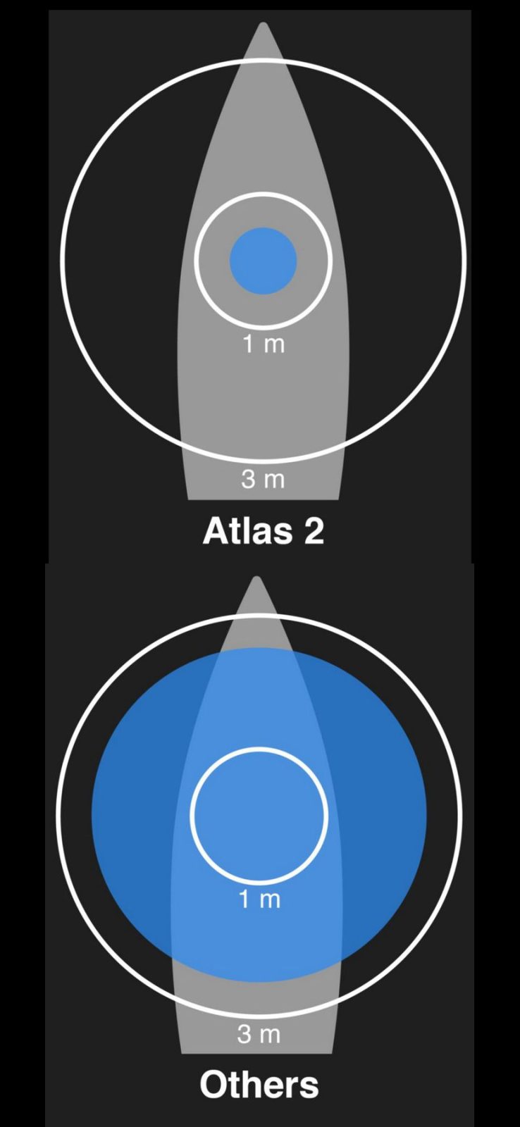
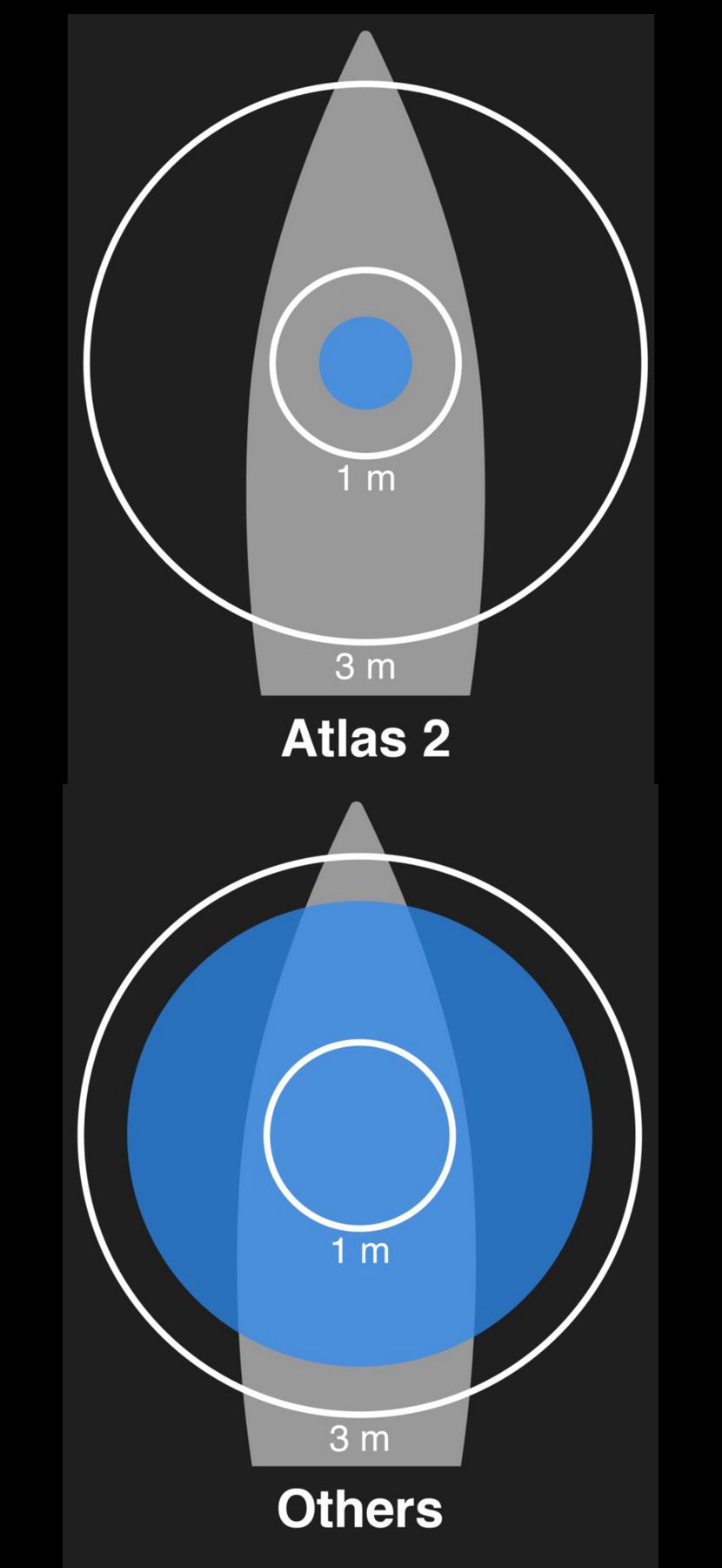
Atlas 2 claimed accuracy versus other sailing instruments 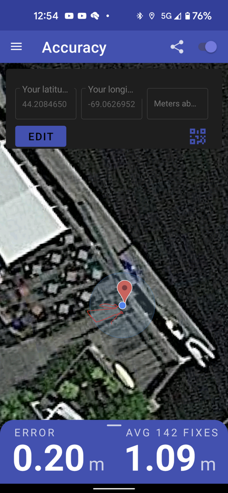
Dual-band multi-constellation GNNS accuracy on my phone 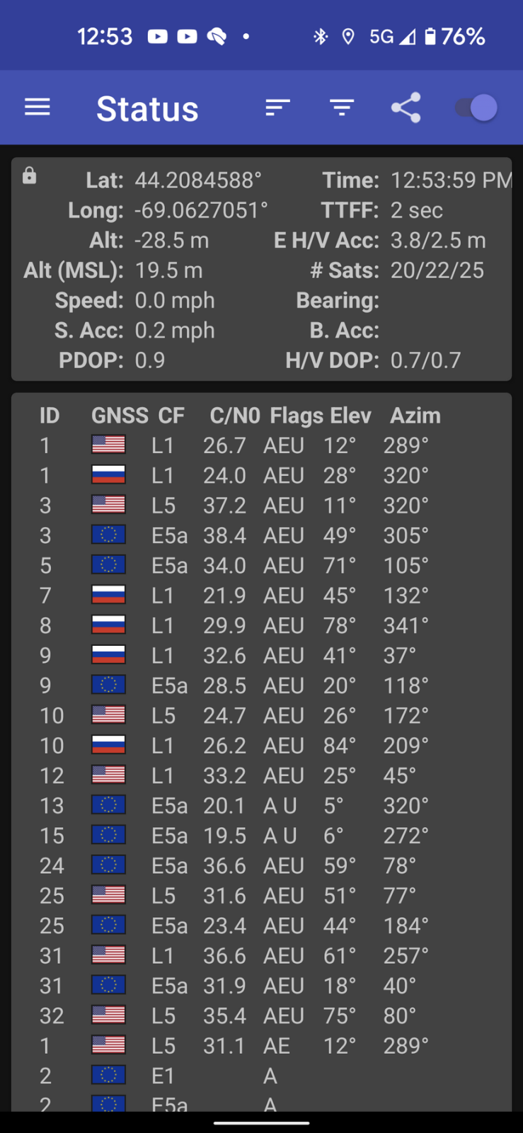
L5/E5a carrier frequencies in use on Pixel 5 shown by GPSTest app

Varakos claims 50-centimeter Atlas 2 positional accuracy — that’s just 20 inches! — and the claim makes sense given GNSS industry enthusiasm about the benefits of adding the relatively new L5 frequency/protocol to conventional L1 signals. The marine world hasn’t done much with L5 yet, but numerous satellites in the GPS, Galileo, and BeiDou constellations are already transmitting on 1176.45 Mhz, and some phones already use a dual-band receiver chip.
In fact, my Google Pixel 5 is on the growing dual-band list — sorry, no iPhone models yet — and thanks to the excellent Android GPSTest app, I’ve now seen evidence of the L5 advantage. As shown in the screenshots, twenty satellites from three different constellations were working to calculate a fix almost exactly where my phone was in the real world, and more than half were on the L5 carrier frequency (called E5a by Galileo).
While dual-band multi-constellation phones purportedly perform substantially better than L1-only models in urban canyons, skeptics might note that marine GNSS receivers usually have wide-open sky views and also that “sidewalk level” precision isn’t necessary anyway (because the charts aren’t that accurate). But let’s look at how critical accuracy becomes when an instrument tries to help a sailor get a good race start, and even more so with RaceSense.

Atlas graphical start line screen 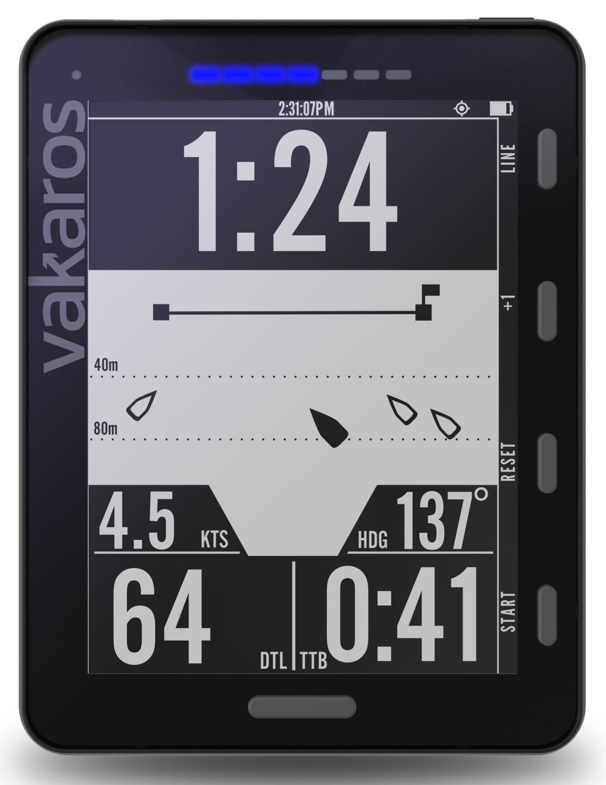
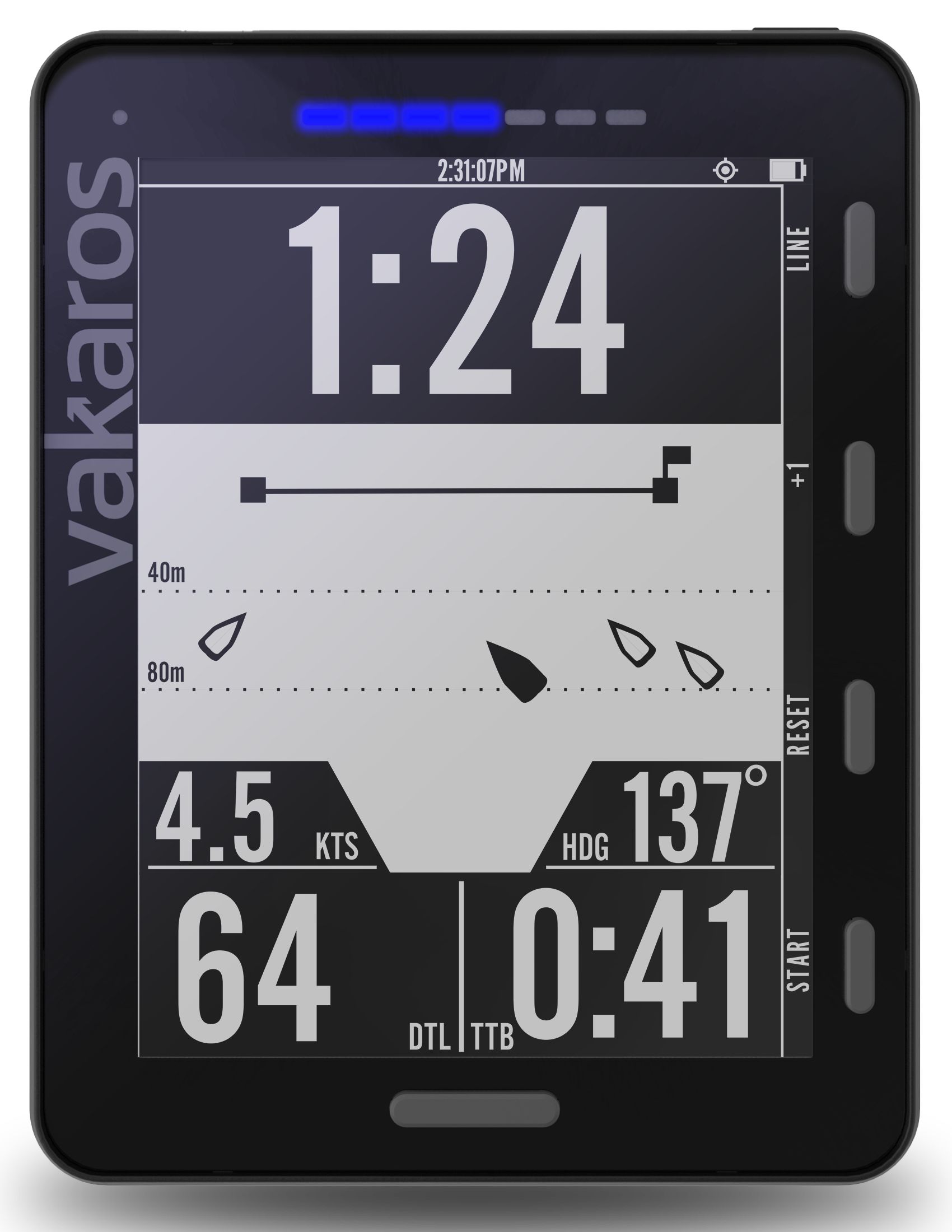
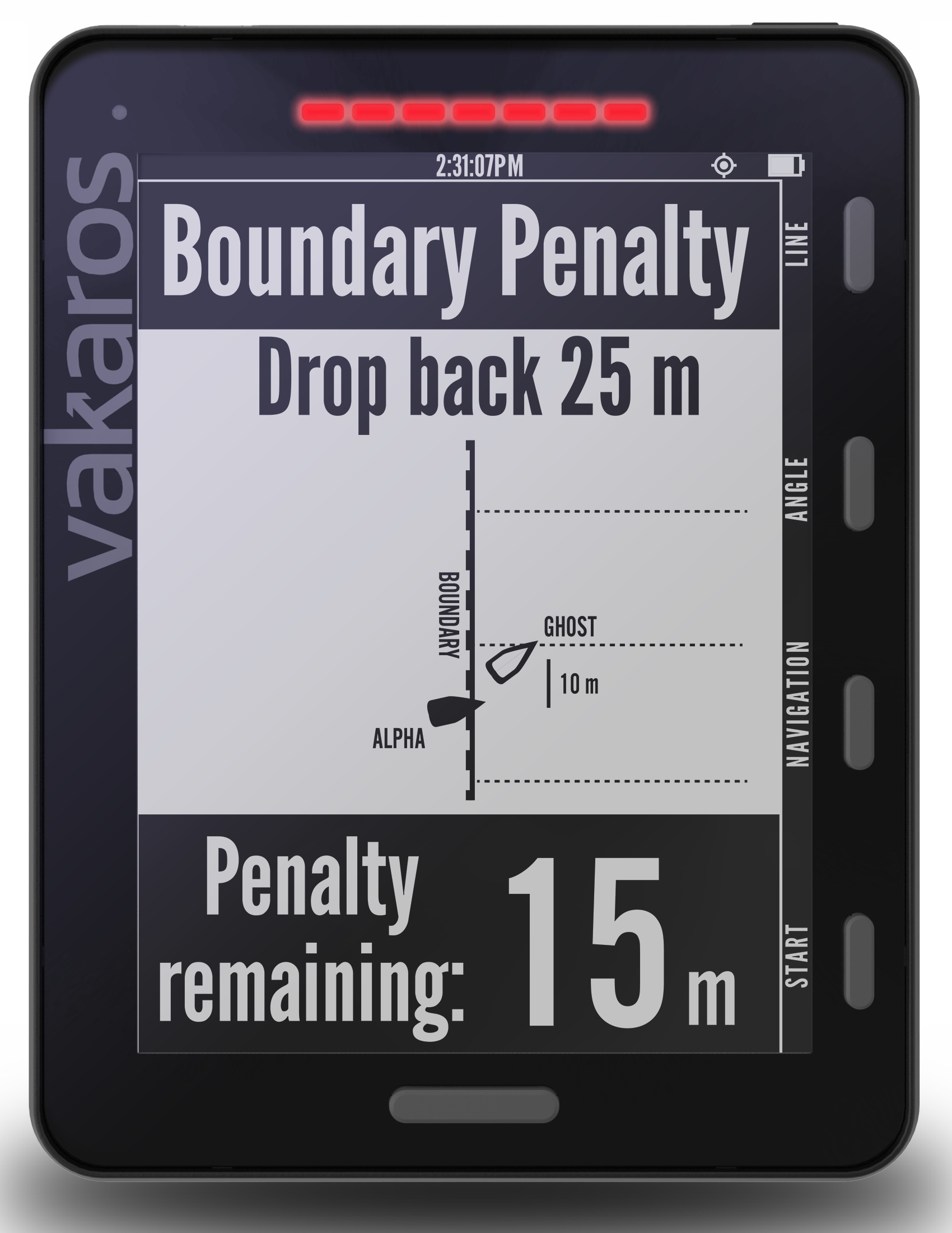
Atlas 2 RaceSense start line screen
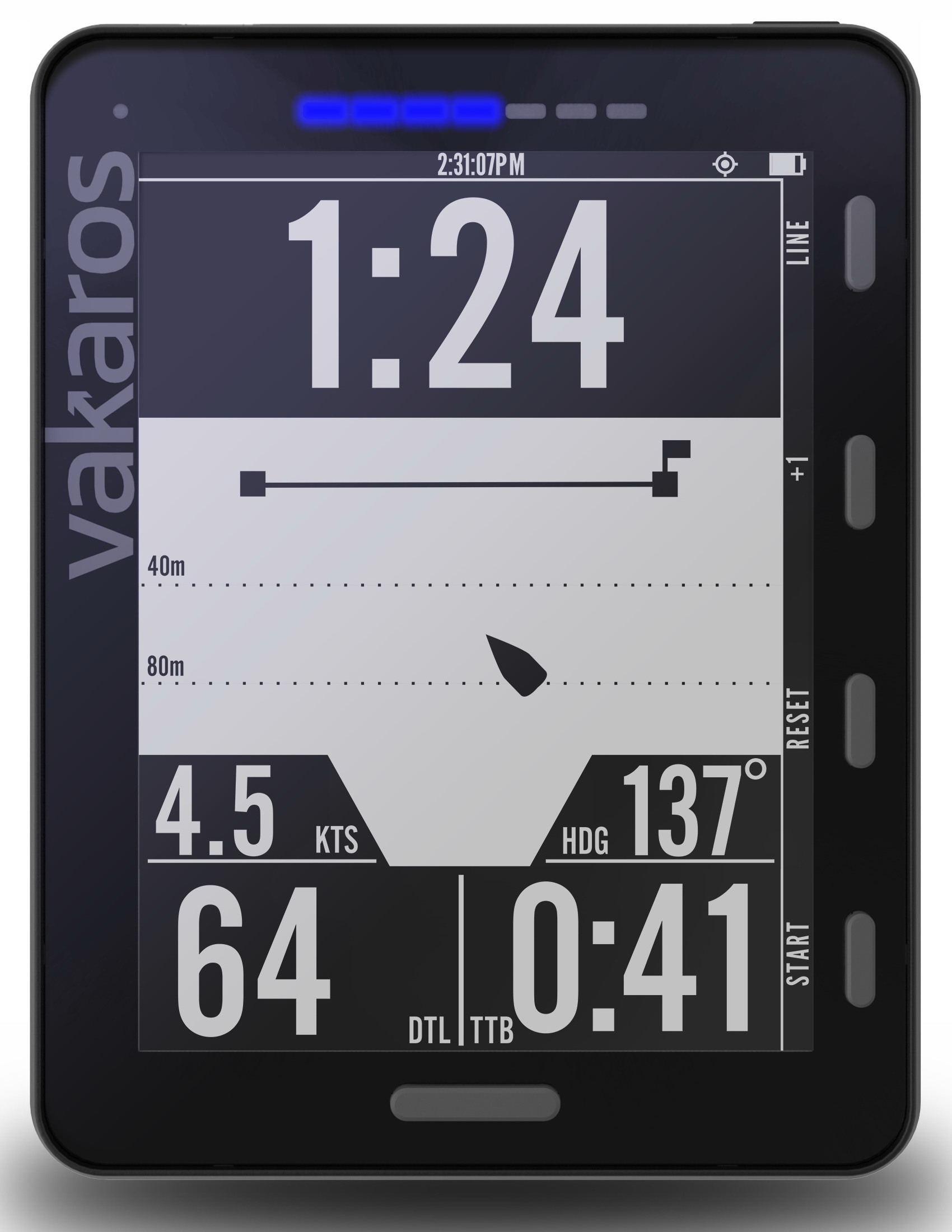
The Atlas 1/2 graphical start line screen at the left is quite like the Garmin Start Guidance already discussed on Panbo, and I once witnessed similar on a B&G H5000. To be clear, the Atlas 2 is reporting 41 seconds Time to Burn at your current Speed over Ground and Heading with 64 meters Distance to Line and more than a minute until the final start horn. So according to the instrument, you’ve got to somehow slow down relative to the line, but the truth of all those numbers — except the 1:24 Time to Line (hopefully well synced) — are contingent on precise position/motion info, and doubly so in the case of TTB and DTL.
Meanwhile, I’m glad that Varakos illustrated RaceSense with nearly the same mockup screen because it may help to understand how differently they’re sourced, though with precision even more critical. Here’s the mode breakdown:
- Graphical start line: This only works on individual boats, and is only as accurate as you are able to ping the mark positions (and sync the start timing sequence). Direct imprecision in position, speed, and heading can also mess up the numbers. (Video demo on original Atlas here.)
- RaceSense standalone mode: One racer goes head to wind and specifies legs/distance and then Atlas 2 sets up the course and networks to all boats. No pinging or syncing required, and the network knows if anyone crosses early, but the race is entirely dependent on Atlas 2 precision and AI.
- RaceSense Fleet mode: Again all boats get the same line and time info, but humans set up and supervise the race with RaceSense assistance. There will be various ways to do this but typically included is a real world starting line with Atlas 2 instruments on the pin and on the committee boat.
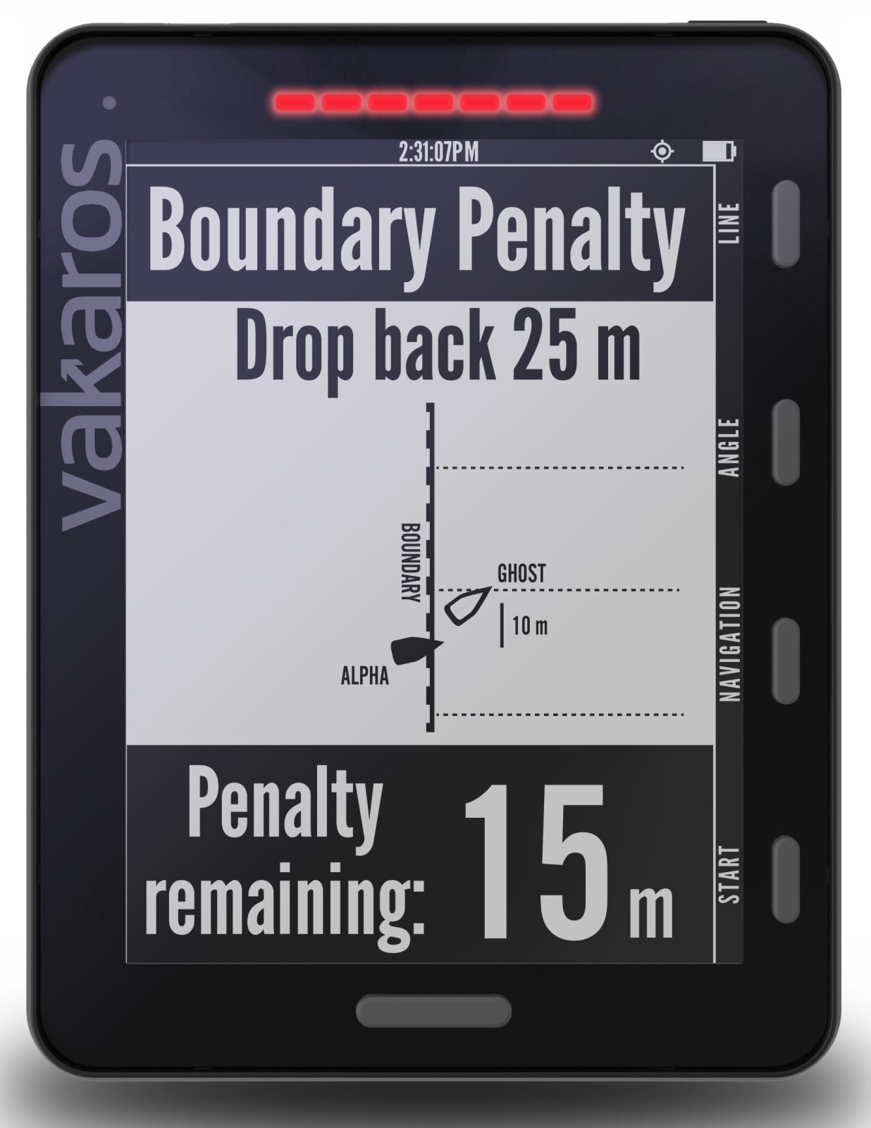
RaceSense virtual umpire in action 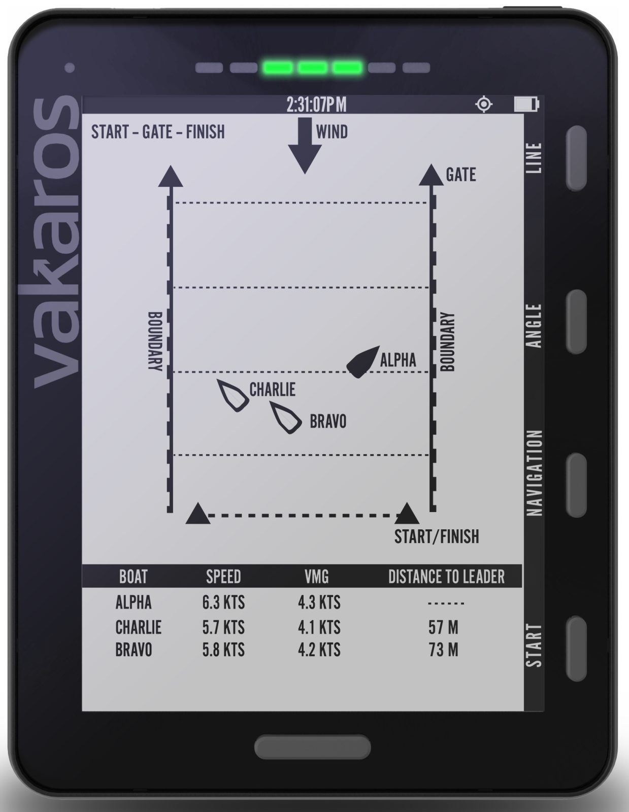
Atlas2 RaceSense tracking screen
These screens show RaceSense continuing to work up the course, and I’ll bet that some readers already realize that the core enabling GNSS precision won’t matter much if the wireless network isn’t fast and reliable. Well, I was surprised to learn the Atlas 2 uses Bluetooth for all its networking — one way it achieves “100+ hours” of battery life — but then I learned that it’s using a special form of BLE 5 with additional signal amplification, and that the Bluetooth SIG confirms the “more than a kilometer” Vakaros range claim.
Moreover, the Bluetooth Mesh specification means that a racer’s Atlas 2 only has to maintain a connection with one other boat to stay on the network, and it can also enable cell phone bridging to the Internet for spectators near and far.
So RaceSense gets me thinking about how precision telemetry has improved America’s Cup racing for competitors, race managers, and spectators alike — a phenomenon I saw up close in San Diego and San Francisco, and then summarized in “Geeks win America’s Cup 34…” Varakos is trying to do similar for more modest boats at much more modest costs. Ambitious!
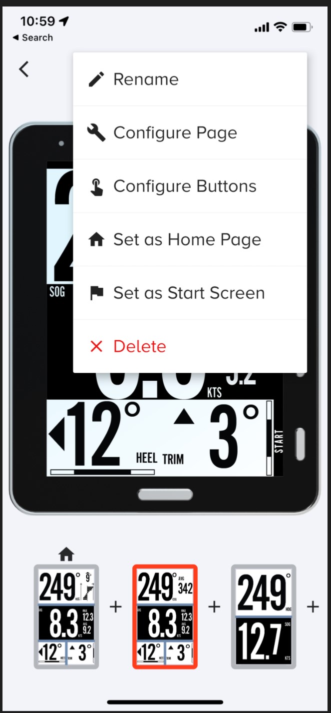
Vakaros Connect app can be used to customize Atlas pages & much more 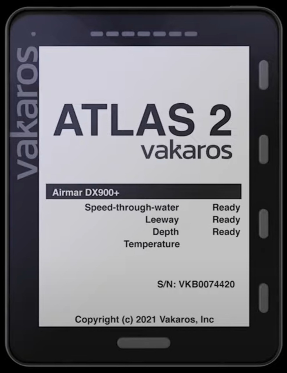
Atlas 2 can integrate with Airmar Bluetooth STW, Depth, Leeway transducers 
Atlas 2 working with Calypso wireless anemometer
Another feature of the Atlas system is the Varakos Connect app — iOS here and Android here –that can be used to configure one or more instruments, download detailed data logs for later review, or customize the user interface. Also, integration with Airmar Bluetooth-enabled transducers like the newish DST810 and the high-end DX900+ have been supported for a while and the Calypso ultrasonic wireless wind sensor — still working fine in my long testing — just joined the club.

But can an Atlas 2 help a single boat manage the complications of, say, a wickedly dense J70 race start? Can RaceSense network and precisely track the whole fleet? Varakos says that many race committees have already expressed interest in giving RaceSense a try and they’re hustling now to make it happen during winter events. I hope to share their testing results as possible and encourage any reader who gets any Atlas 2 experience to chime in.
Meanwhile, dual-band L1/L5 multi-constellation GNNS is already available to the wider boat world in the form of the Garmin GPS 24xd (and one of their engineers nicely explained L5 history and benefit). Mind you, this NMEA 2000 receiver does not have the Atlas 2’s 25-times-per-second GNSS refresh rate nor does it fuse that info with 9-axis motion sensing at 50 Hz. But GPS 24xd users may well be getting better results from demanding features like Garmin Start Guidance.
What else can ultra-precise GNNS do for boaters as L5 transmitting satellites and relatively inexpensive multi-band receiver chips proliferate? Your thoughts, please.


Ben,
Thanks as always for your insightful dives in to complex marine technology! We at Vakaros are very proud of the Atlas 2 and RaceSense, but realize there is a lot to take in. Your post adds not only a solid bit of clarity to that, but also a 3rd party perspective as well. Thanks again.
Hi Ben! Glad to hear you’re staying un-frozen up there! The software looks interesting for racers (not me, but I love to watch!) and dual-channel GPS (it seems to me that “dual band” would imply a wider frequency split than what they’re doing) certainly has potential for very high levels of precision – and error checking. Both things you’d like to have going for you on a dark night and an unfamiliar entrance 🙂
What I have significant doubts about is getting usable range from a Bluetooth device in a race-boat environment. I went over to the calculator you linked to, but even at +20 dBm (100 mw) transmitting power, getting the stated 1 km range requires antenna gains that I think would be unrealizable for an omnidirectional antenna in a boat that heels and pitches. And having the boat that is doing a horizon job on the fleet drop out of the network will cause some hard feelings, I predict! Perhaps they are considering reducing the bandwidth to achieve greater receiver sensitivity, which would help, but introduces some other potential issues as well.
IMHO, this scheme needs a more robust communications layer – something like the digital comms that some manufacturers were looking at with dual-use of marine channels, maybe? It seems to me that high speeds aren’t required, just solid reporting of position and a few other variables. While allowing cellular linking would help out, do most sail-race areas enjoy good cellular coverage? Our experience sailing around suggests otherwise 🙂
Harley,
Thanks for the comment and you are right, the application, comms, and PHY layers all have to be tuned and optimized to make this work. A lot of that we do, some it it we get for free with BLE 5.0. So far, we’ve been happy with our test results.
For what its worth, the space agencies (USAF, ESA, etc) call them bands, so we go with that.
best,
Clay
I did an internet search to see what “multi band GNSS” really meant – and I see that the term “band” is being used in the same sense that the cell companies are using it, rather than the traditional sense. So I stand corrected – within the industry, L1, L2 and L5 are considered separate “bands”, even though they are fairly closely adjacent frequency-wise. In any case, I agree that this is a good thing 🙂
As far as robustness in a race-boat environment, I suggest you seek out a suitable yacht club and equip their fleet of club racers with a test system & see how it works – if they can’t break it, it’s probably good to go!
Hartley
S/V Atsa
While we’ve been working on RaceSense for several years, the timing of the announcement was to allow us to start working more openly with partners. In that regard, we’re putting plans in place with some of the biggest OD fleets, and several of the world’s most prestigious Yacht Clubs to start trails. It’s going to be a fun spring!
Sounds like it! Me, I’m just hoping for a mild winter and for Victron to deliver our new house battery 😉
I did some reading about BLE – I note that the throughput is well below what traditional Bluetooth offers, but significant extra range (presumably because of reduced bandwidth allowing higher receive sensitivity?) – though the stated maximum range is 150M in open areas, I’m sure it can be made higher.
I’m sure those YCs will give you a lot to work with!
Hartley
Hiya Hartley, There seem to be many BLE configurations and the Bluetooth SIG link I put in the entry claims that over 1 km range is possible:
https://www.bluetooth.com/learn-about-bluetooth/key-attributes/range/
More about long-range modes, aka “Coded PHY”:
https://www.novelbits.io/long-range-bluetooth-coded-phy/
Hi Ben! Yes, its clear that the 125 kB mode gains significant performance, presumably by reducing bandwidth and enhancing error-correction. But its still straining at maximum TX power (100mw) to get to 1 km. I also note some odd inconsistencies in these pages – in the novelbits.io page notes that the “LE S=8” mode achieves -82 dBm receive sensitivity, while the calculator assigns -101 dBm to “LE 125K” – quite a difference for what I think is the same mode!. There may well be some underlying differences that are not visible, but I don’t know what they would be.
In a racing sailboat environment, I don’t think its going to be possible to achieve 2 GHz antenna gains greater than perhaps 6 dBi without going to aiming or leveling mechanisms.
My feeling is that they will discover its necessary to place additional MESH-net members across the course to ensure coverage. A more robust transport layer would be ideal – but the constraints of licensing, etc. make this a touchy subject at best, especially for an international product.
Hartley
Hello to everyone!
I am about to buy Vakaros Atlas 2 with Calypso windmeter. Is there more than one version (generation) of Atlas 2 product? I dont want to buy something old without some new features. Another question. Does Calypso windmeter wirks well and provide all features of Atlas 2?
Thanks for answering.
Congratulations to Vakaros for being chosen one of four candidates for the relatively new World Sailing Technology Awards:
https://www.sailing.org/awards/boat-of-the-year/world-sailing-technology-award-finalists/