
Navionics TurboView, a homage to NN3D

When Furuno NavNet 3D was first teased, I didn’t get the “native 3D” part. How could a “true 3D environment” be based on decidedly 2D raster and ENC charts? But I get it now. Whatever you see in NN3D’s conventional top-down 2D view—including routes, AIS targets, radar overlay, etc.—you can also see in 3D. It’s the same data, just tilted and shaded, and easy to fly around in. Which feels different—more “native”, more “true”—than any other 3D navigation I’ve tried before, and much more useful. So I think it’s great that Navionics has apparently developed a way to bring this sort of continuous-zooming, full-detail 3D to a variety of platforms. It’s called Navionics TurboView and I saw the preview above, and bigger here, at FLIBS.
TurboView is not new Navionics data, but rather a new way to look at existing Gold, Platinum, and Platinum + data. I gather that Navionics itself created the Turbo viewing engine, but that means little until manufacturers integrate it into their machines. Apparently the first will be Lowrance’s new HDS series, but others—including PC charting programs like Fugawi Marine ENC—will follow. In fact, the TurboView demo was shown on an in-house Navionics PC viewer, so I don’t know how it will look on real navigation platforms, or what overlays will be supported by whom. But the demo looked and panned/zoomed/flew beautifully.
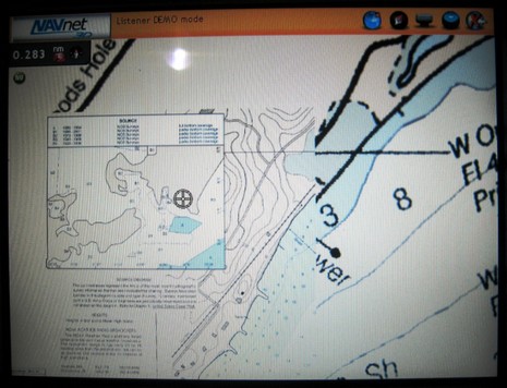
Meanwhile, you may recall that the actual NN3D had issues regarding its charts and how they presented at different zoom levels, especially on the small MFD8. The optional Navionics data isn’t available yet, but Furuno/MaxSea has rebuilt the raster and vector chart portfolio so that more data shows as you zoom out. The update should be available at Furuno soon but I got to check out an updated MFD8 at FLIBS and thought I could see a significant improvement in chart screens I’d seen off Cape Cod last June. For instance, I’m pretty sure that the original NN3D didn’t quilt a 1:10,000 chart to a 1:40,000 at the zoom level you see below.


")


Can someone explain why all this 3D stuff is needed for navigation? I had assumed that it was related to fishing (not a fisherman).
The 3D views are cool, but what is the practical use?
Many centuries ago ocean navigators used only written or spoken pilot notes, and their senses. I’ll bet they were skeptical about the first charts, which I think were drawn on sheep skins.
Now we have centuries of two dimensional chart use in our DNA, and 3D seems a gimmick. But top-down 2D is really just a limitation of print on paper. Once we get it right electronic 3D charting is the more sensible way to go, and I say “sensible” in the fullest meaning of the word.
One attraction for me to the use of 3D view charts is that in waters where the swells are large I can pick a safer path through areas which might be of danger through the generation of breaking waves.
I look forward to the day when real time chart overlays of breaking wave hazards will join the other chart overlays such as wind strength and direction.
I feel very worried about 3D navigation displays. I think it will de-sensitize the user to his actual environment and lead to more accidents.
As a long-time user of 2D paper and electronic charts, I nevertheless recognize the usefulness of having a 3D facility to help with orientation, but that’s all. This is not new. Charts I’ve used that were drawn in the 1800s have sketches in the margins of the landfall view, to assist with familiarization. However, to offer navigators this “gaming” style of charting seems dangerous.
I appreciate the usefulness of new technology – and overlaying weather for example is a magnificent tool. But the 3D thing looks so nice on the screen, it’s almost tempting to avoid looking at the reality outside at all! The grey sky, the waves, the obstacles – far better to stay glued to the screen. The second area of concern is the inevitable tendency to trust the accuracy and perceived infallibility of the tool.
Rule 5 is already treated with contempt in some quarters. GPS and plotters have attracted a new generation of boaters who are just not developing the sort of situational awareness that is needed for safe navigation.
Far from being a Luddite, I love gadgets of all sorts. I approve of the development of 3D technology, but it should NOT be used for normal navigation.
If you got this far – thanks for reading!
I have to agree with the building consensus here. I’ve tried 3D displays at the helm and didn’t think that they really gave me useful information – in fact, I think they confused my situational awareness. I’m sure that could change as we explore ways to present more information along with the 3D views. Right now, it looks like something that is much better at a boat show than on a real boat.
Developers (me included) have a habit of creating things because they can, not because they should. In my opinion, the current 3D displays are an example of that.
Jeff, Have you had a chance to use NavNet3D on the water? I think it might change your mind.
Also, isn’t 3D the preferred map view of both highly trained fighter pilots and completely untrained automobile navigation appliance users?
I haven’t used 3D navigation on the water, but have used it and 2D navigation on the road and I personally prefer the 2D car navigation. Maybe it is just what I am more used to from navigating boats, but I found it provided better situational awareness. That said, it does beg for a different screen aspect ratio (tall portrait for 2D) than a 3D view (wide landscape).
I am open to being convinced, but I agree that sometimes alternatives are developed just because they can be done and not because they are better.
Thought of one other thing. Studies have shown many sailors have superior spacial relations understandings than the general public and are generally better at picturing 3D relationships from 2D images. I know that this is one of my better skills, but my mother and many clients (boat owners) are downright horrible at this. For those users, the 3D views may prove to be VERY helpful and since this represents a significant portion of the users it is good to develop. Just because I find the 2D picture to be a better representation for my mind doesn’t mean it is better for everyone.
I posted first as anon and it seems that the consensus is that 3D is more oif a gimmick than a useful navigation tool. I find 2d auto nav better than the 3D. But I work in 2D all the time as an architect and a bit as a navigator on the sailboat. My interest is in not running aground or hitting charted obstructions under the surface. I don’t think 3D will help with that any more than color rendered undersea contour lines.
As far a rendered land features any navigator who needs 3D to fix his position has no business at the helm of a boat.
This is simply a WOW feature that does nothing to aid the navigator in my opinion.
In a boat, there are two views, the panorama view from the boat and the chart view from above. It can be very hard to see one and imagine the other. Often you don’t need to do this, but sometimes you do. If you are among a group of unfamiliar but undistinguished islands, sorting out which are which on the chart(s) can be difficult. Perhaps this is a case where an intermediate view provided by 3D would help — but only if the point of view was not too high and you could pan around.
The other way this might be useful is to provide both a detailed chart of the near region around your boat and also a less detailed view of the region you are headed for — but I’m not yet convinced that a non-distorted 3D view can do this well enough.
What we’re seeing is the very first generation of 3D plotting. In a few years time when the technology has advanced and we’re all used to the idea, it will make 2D displays look pretty average. I’m sure many will remember the first digital chart plotters. I used Furuno GP1250 satnav (I think that was the model in the late ’80’s) where the charts where drawn with a digital pen (dots) by the vendor. Well look how far we’ve come now with digital charts, weather overlay etc. Maine electronics manufacturers (like all manufacturers) manufacture for the mass markets, not the “die hard” saltys. 3D is sexy, and it is what the mass markets want. If you’re a bit “old school” and prefer the old way of looking at something then keep looking at it that way but the world is not going stop because the minority likes it that way. However, I think what we as consumers need to be aware of is the true definition of 3D……which there isn’t. Some manufacturers are simply jumping on the marketing bandwagon and making their products look like 3D in an effort not to be left behind, but that’s all it does, it only looks like 3D. I have used the Furuno navet 3d system and I was very impressed with 3D radar overlay and true 3D navigation functions. The AIS was especially impressive by scaling the AIS targets to the scale of the chart. I have used a few other 3D products (blue chart G2 and Navionics platinum on a E-series)and they are not true 3D navigation. You can only view the chart in 3D but you cannot navigate in 3D. Unfortunately there is no true standard for 3D and it does not have to meet any industry standadard to be called 3D. My suggestion is make sure that you’re getting 3D and not a look alike!
Ben, I haven’t used NavNet3D in a real situation yet. I’d love to. I have used other systems.
You make good points about fighter pilots and untrained “street pilots”, except…
1. I don’t really know much about fighter pilot navigation except they are obviously in a real 3D environment. While boats do have water depth to consider, the movement of a boat along the water’s surface is 2D. Flying in three dimensions is much different and certainly requires much more information.
2. I do have a lot of experience with street navigation. But that type of navigation is again, much different than boat navigation. When I’m in my car, I’m not watching the screen to make sure that I’m on course. No matter what the display shows, I keep the car in my lane on the street. The navigation system gives me turning directions (and I think the whole 3D-street aspect of it is really just eye candy). When I’m in my boat, I use the navigation system to stay near course because there aren’t any roads out there. The display is a critical piece in giving me that situational awareness to process small-movement steering control. That’s way different than what happens in cars.
Here’s the question I have – with the thousands of ships out there (commercial, military, etc), are any of them navigating with 3D displays?
I’ve been using a pair of MFD12 NN3’s all summer. I use 1 in 2D mode and 1 in 3D mode.
I’ll say that no other 3D implementation has worked at all for me. This one works. I like it because it allows me to see things that are close to me larger, but still see a great distance on the same screen. It helps me keep oriented (which I really need help with when navigating the channels in Georgian Bay).
I still use the 2D display for when I want up close detail. That’s still the display I look at when navigating tight waters.
Jeffery Siegel, you say that there are thousands of commercial ships navigating without 3D. You are correct and that’s why I pointed out in my earlier post that 3D in marine plotters is very new to the marine industry. Just remember that pre ’88 there were thousands if ships navigating without GPS and now an IMO GPS receiver and ECDIS it is mandatory on all IMO vessels. I am not saying that 3D will become mandatory but the technology is there and it will improve.
The classic 3D view was a watercolor by Saul Steinberg which was famous after it was on the cover of the New Yorker. That inspired many others. See:
http://www.saulsteinbergfoundation.org/gallery_24_viewofworld.html
http://www.graphicsoptimization.com/blog/wp-includes/images/go_examples/2007_11/NewYorker1976-03-29cover.png
This is wildly distorted, but it uses that distortion to provide a clear local view and a simplified distant view in the same image. That would be useful to the navigator (but not quite so exaggerated or stylized).
A QUESTION OF COSTS…….
Having been a mariner for 20 years, I am impressed by what I see on this blog. Fantastic stuff whihc makes the bridge of the last ship did(2006 built) look like Noah’s ark.
Can anyone tell me if the foll. make an ECS which fits into the IMO ECDIS criteria? If yes, what kind of costs can I expect, if I wish to use only private vector charts (Yes, yes…. – I know theoretically that makes it an ecs and not an ecdis, but anyway I am not looking for compliance on my ships, as that will be a concern only a few years later)…
1) Garmin
2) Furuno – navnet 3d
3) Raymarine
4) Maptech
Do let me know which port / country the costs relate to.
The technicians and ship chandlers are giving me monumental quotes like 10 – 20,000 dollars! I believe it should be more like 3-5,000 $.