Category: Wireless & Apps
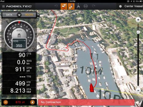
 The test scene is admittedly messy, but having the Wilson AG Pro Quint cell booster out at the helm made it easier to read and photograph. I could also monitor the screen on the Medusa Power Analyzer that the 12v feed is running through (the Quint pulled about 11 watts with two of its amps turned up to about 70db and the other two at about 50 and 55). The best part, though, is how real the testing was. Gizmo is anchored in a wicked cell hole that also happens to be beautiful (mapped here via the test DeLorme InReach SE mounted to the windshield) and only about 11 miles from Camden. Heck, a Verizon call with my wife failed abruptedly about two miles from the anchorage and I couldn’t even get a text out!
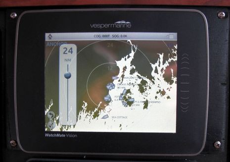 I ended my entry about Vesper Marine’s excellent AIS collision avoidance software with tentative enthusiasm about the company’s next generation WatchMate Vision transponder. Well, a test unit has been installed on Gizmo’s dash since mid-July and, frankly, it’s spectacular. While it certainly offers the AIS target filtering and alerting genius previously discussed, now these talented developers have put maximum AIS utility into a 5.7-inch touchscreen while also creating what could the central WiFi link between a boat’s fixed sensors and a boater’s mobile apps…
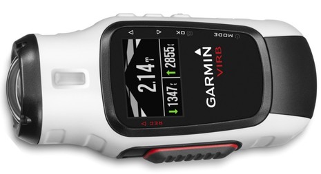 Yesterday Garmin big-footed into a new niche with new VIRB action cameras — VIRB as in verb, as in action (I think). It’s not a boat camera per se, but I expect that one will be useful and fun around a boat, and it’s also another indication of the company’s product ‘ecosystem’ stradegy. Garmin was just getting into dedicated marine electronics when I began covering the subject in depth over a decade ago, but nonetheless the major players almost unanimously cited the big Kansas complex full of engineers (with its own factory in Taiwan) as their biggest competitive fear. I suspect it was capablities like this that caused the concern. VIRB is not an assault on any marine companies but CNet’s sharp analysis is aptly titled “Garmin gets up in GoPro’s grill with VIRB HD cameras“…
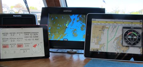 After Raymarine and Furuno introduced multifunction displays with WiFi built-in and apps that could mirror and even control the MFD screen on an iPad or Android tablet — a great idea that caught on quickly — I was frankly a dite dubious when various Navico folks said that they had an even better idea. Eventually, though, we got to discuss the WiFi1, their MFD network hotspot, and then the whole multi-tier GoFree concept. It’s a complicated concept largely because it’s so ambitious — for instance supporting both Navico screen control apps and multiple third party apps like the ones seen above — but it seems to me that GoFree is now doing even more than Navico promised, and there’s virtually no limit to where it’s headed…
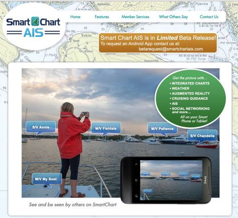 The first Smart Chart AIS app, a result of the very interesting U.S. government-funded Class E AIS project discussed here last August, is looking fo 100 Panbo beta testers. Volunteers need to have an Android smartphone or tablet and should be boating in U.S. waters or at least spending time on the coast. Here’s the Smart Chart web site and here’s the beta sign up site. Beta feedback will happen on the SC forum, not in this entry’s comments, please. I’ve been in the test program for a few weeks and will illustrate some of the app’s features below. I’ll warn you, however, that there’s a major dissappointment which has nothing to do with Smart Chart’s developers…
 Some of Garmin’s many wireless strategies are coming together on Gizmo and there have been some nice surprises. Since there’s now a GPSMap 741 with built-in WiFi mounted at the lower helm and networked via NMEA 2000 with the 7212 on the fly bridge, one of the first things I did when we began our cruise last week was to see what that meant in terms of route planning on an iPad running BlueChart Mobile (BCM). It was a minor thrill to realize that I could spec out the day’s plan on the pad, send it to the 741, and have it pop right up on the 7212 as the active route my sweet mate was using to steer by…
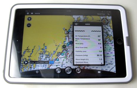
I’ve been testing three waterproof iPad cases that all have “Life” in their name for some reason (anyone?). Frankly, none got me excited until I recently snapped my iPad mini in the Lifeproof frē case above (running Garmin BlueChart Mobile). The design is stellar, I think. The LifeProof is so light and snug that the mini still feels mini, but it now has has a protective rubbery edge and non-slip back and it survived 30 minutes submerged in my sink though all the buttons plus the charge port still work fine. I suspect I’ll always use this case on the boat, and maybe everywhere. But that’s not to say that I know everything about the ever-changing world of pad cases. Let’s review the testing and discuss…
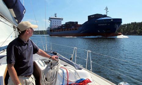
I’m not sure that anyone has made such an effort to show me his marine electronics products as Anders Bergström, and it worked. I left Sweden very impressed with the Seapilot charting/AIS app and the AIS expertise of True Heading. But Sweden itself played a part. The country has built out an AIS-friendly infrastructure that I hope other nations will replicate, and its complex waterways often highlight why we should want them to. It’s not uncommon, for instance, to sail around a high island and find yourself in a tight channel with a large fast-moving ship…
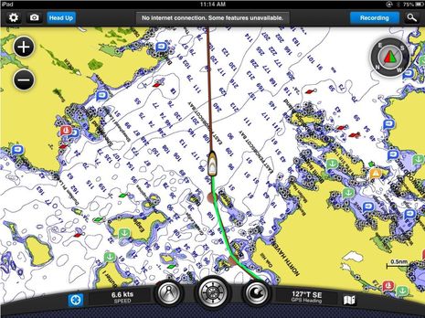
Any boater with an iPad has an amazing selection of apps these days, and the Android selection isn’t bad either. For some time I’ve intended to catch up on interesting new charting entries like SEAiq and SeaNav plus major improvements in category leaders like Navionics Mobile, C-Map Plan2Nav, and Garmin BlueChart Mobile. (And also clever ideas like SARMOB, which can turn multiple smartphones into an active man overboard system, and Boat Battery, which can help us figure out our electrical appetites and share specific device power profiles.) But today I’m going to focus entirely on the spanking new Nobeltec TimeZero iPad app, because I think it’s amazing…
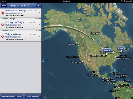
The original idea was to finish this entry during the Chicago stop of the very long journey seen on the nifty FlightTrack app screen above, but travel mistakes were made and O’Hara airport had less connectivity than one might presume in this day and age. Is anyone surprised to hear that the Tokyo and Seoul airports are much friendlier to the traveler trying to stay in touch? So, yes, I’m already in Korea and will soon begin a writer’s tour that is being hosted by Intellian Technologies and that is intended in part to show us the state of recreational boating in this “technology-led” country…


