
What I learned about Furuno’s new TZtouchXL MFD series at MIBS
I just returned from the Discover Boating Miami International Boat Show (DBMIBS or MIBS as most of us know it) and while there spent time with Furuno USA learning all about their new TZtouchXL MFDs. Panbo will bring you more coverage of these new MFDs, but before the ink dries, I wanted to get a few notes out about the new units.
There’s a lot of new functionality and a nicely updated user interface coming with these new MFDs but I think the headline features are: AI-enhanced autorouting, risk visualizer, TZ Maps including high-definition bathymetric data, and a refined UI. In addition to new software, there are changes to the physical sizes Furuno offers. The new series will be available in 10, 13, 16, 22, and 24-inch displays. Similar to what Furuno did with TZT3, the two smallest sizes offer hybrid touch with both touch screens and physical buttons to the side. The larger 16, 22, and 24-inch MFDs are all touch but there are new optional remotes offered in both horizontal and vertical orientations. Much of the nitty-gritty is spelled out in Furuno’s press release announcing the new series.
Before we dive in, if the TZtouchXL name is familiar, that’s likely because Furuno actually introduced the 22 and 24-inch units at Miami last year. At the time, they were slotted in as the larger units in the TZtouch3 family. Now, they are joined by a full line of TZtouchXL MFDs from 10 to 24-inches.
Hardware changes

Interestingly, the smallest TZtouchXL display, the 10-inch unit, offers the highest resolution at 1920×1200 pixels. The rest of the line all offer 1920×1080 resolutions. For the two smaller sizes, that’s a significant upgrade from the TZT3’s 1280×720 resolution for the 9-inch model and 1280×800 for the 12-inch unit. The rest of the TZT3 line utilized 1920×1080 displays.
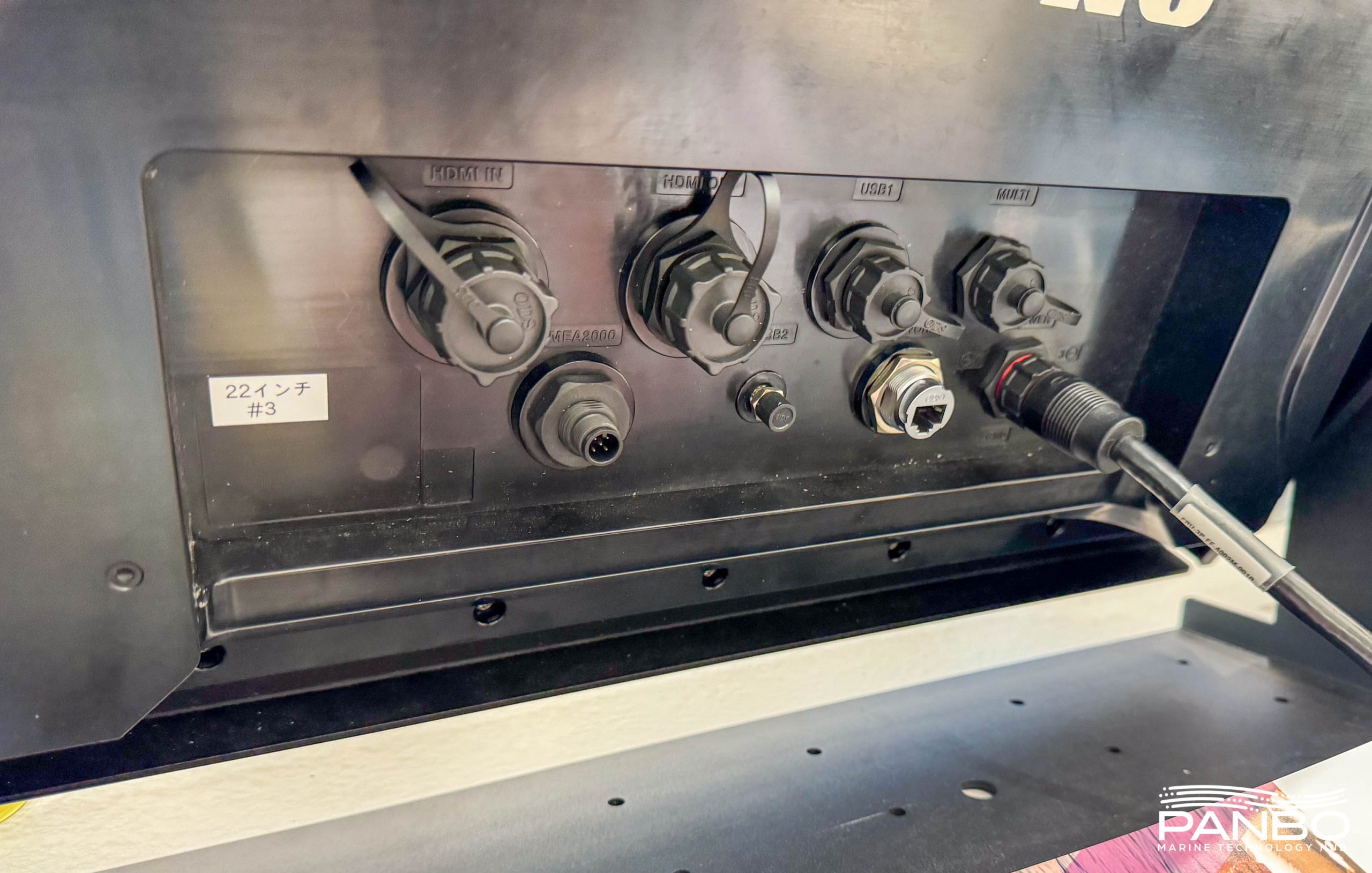
In a departure from recent Furuno MFDs, all connections on the XL series are made via mounted, color-coded ports on the rear of the unit. Gone are the multiple connections hanging off the unit. TZtouchXL has one analog camera input while previous generations had two.
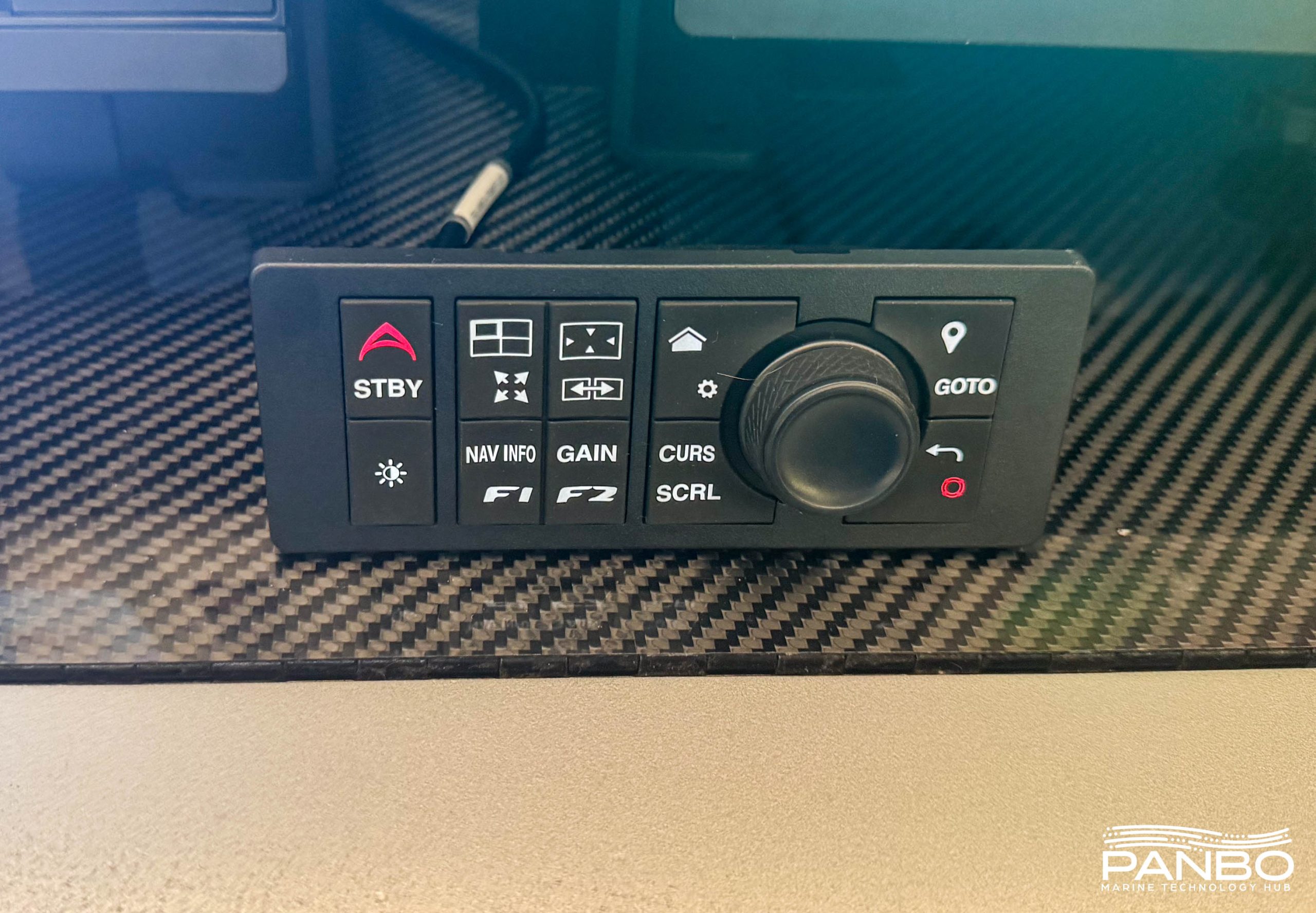
Similar to TZTouch3’s arrangement, the two smallest sizes — the 10-inch TZT10x and 13-inch TZT13x — offer hybrid touch with both touchscreens and a physical button panel to the right of the screen. The larger sizes are all touch with an optional MCU006 or MCU006H control panel. The MCU006H is arranged horizontally while the MCU006 is vertical. In a departure from previous Furuno controls, the MCUs connect via NMEA 2000.
AI Routing
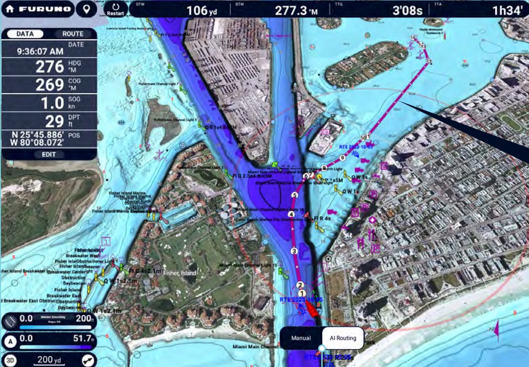
Furuno is the last of the major MFD manufacturers to offer auto-routing because, until now, they haven’t felt they could make it sufficiently reliable and trustworthy. During the press event, they showed a video of an impressive automatically constructed route. They also demoed a live autoroute, which I’d show you except that I managed to lose it in the transfer process.
So you will have to take my word for what happened: The autoroute created live bypassed a marked channel for a slight shortcut that took the boat across shallower waters. I believe those shallower waters were still charted as deeper than the specified safety depth, but the decision to bypass a channel doesn’t strike me as prudent. Furuno says that if a user modifies the route to follow the channel, the routing algorithm will learn from such edits.
Thus it I think the usual caveats about taking care with automatically created routes still apply. It will be interesting to see how AI Routing does in the field and if it can deliver on the learning promise.
Risk Visualizer with AI Avoidance
Furuno’s Risk Visualizer is visually similar to Raymarine’s AIS target intercept graphics. But, with two major differences: Furuno’s Risk Visualizer leverages their excellent ARPA capabilities to include both radar and AIS targets and then plots an AI-assisted avoidance route. Risk Visualizer graphically alerts of any detected targets at risk of collision. Furuno first introduced Risk Visualizer in 2022 with the FR10 and 12 standalone radar displays, but those displays didn’t support AI Avoidance.
Once the system identifies a risky target, it calculates a route to provide a solution to the potential risk. That proposed solution will factor in available depth and other factors. But, after the demo, I’m still unclear as to whether channels and navaids are respected.
TZ Maps
About two years ago Furuno’s access to Navionics’ charting data ended when Garmin decided not to renew the agreement that allowed Map Media to convert Navionics data to MM3D. That also coincided with C-Maps’ new X-Series charts being announced as Navico exclusive. So it looked like Furuno’s charting options might take a hit. Well, fear not! Furuno has responded to this challenge with TZ Maps and it’s an impressive response.
TZ Maps are available on TZtouchXL MFDs, TIMEZERO PC software, and TZ-iBoat for iOS. I understand that a single license of TZ Maps works across TIMEZERO, TZ-iBoat, and TZtouchXL. The new charts are sold by the region for $250 per region. For example, the USA chart includes coastal waters (including Alaska and Hawaii), the Great Lakes, USACE inland rivers, the Mariana Islands, American Samoa, the Palau Islands, and the Marshall Islands. $250 covers the cost of the charts in Raster, Vector, high-resolution Bathymetry, and high-resolution satellite photos. The full catalog can be found at https://mytimezero.com/tz-maps-catalog.
Chart purchases include a one year subscription for updates. Plus, the updates can be downloaded directly via the MFD as long as it has an active internet connection. I sincerely hope this might be trend-setting among other MFD manufacturers.
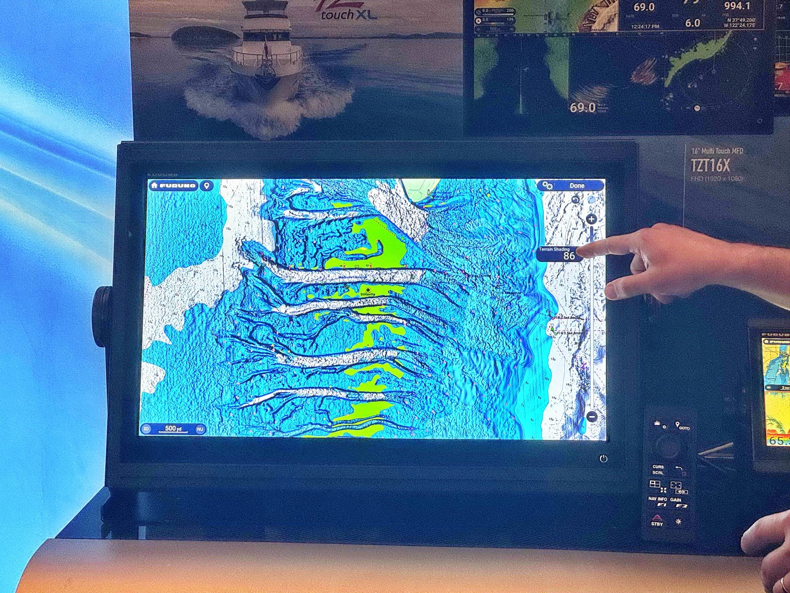
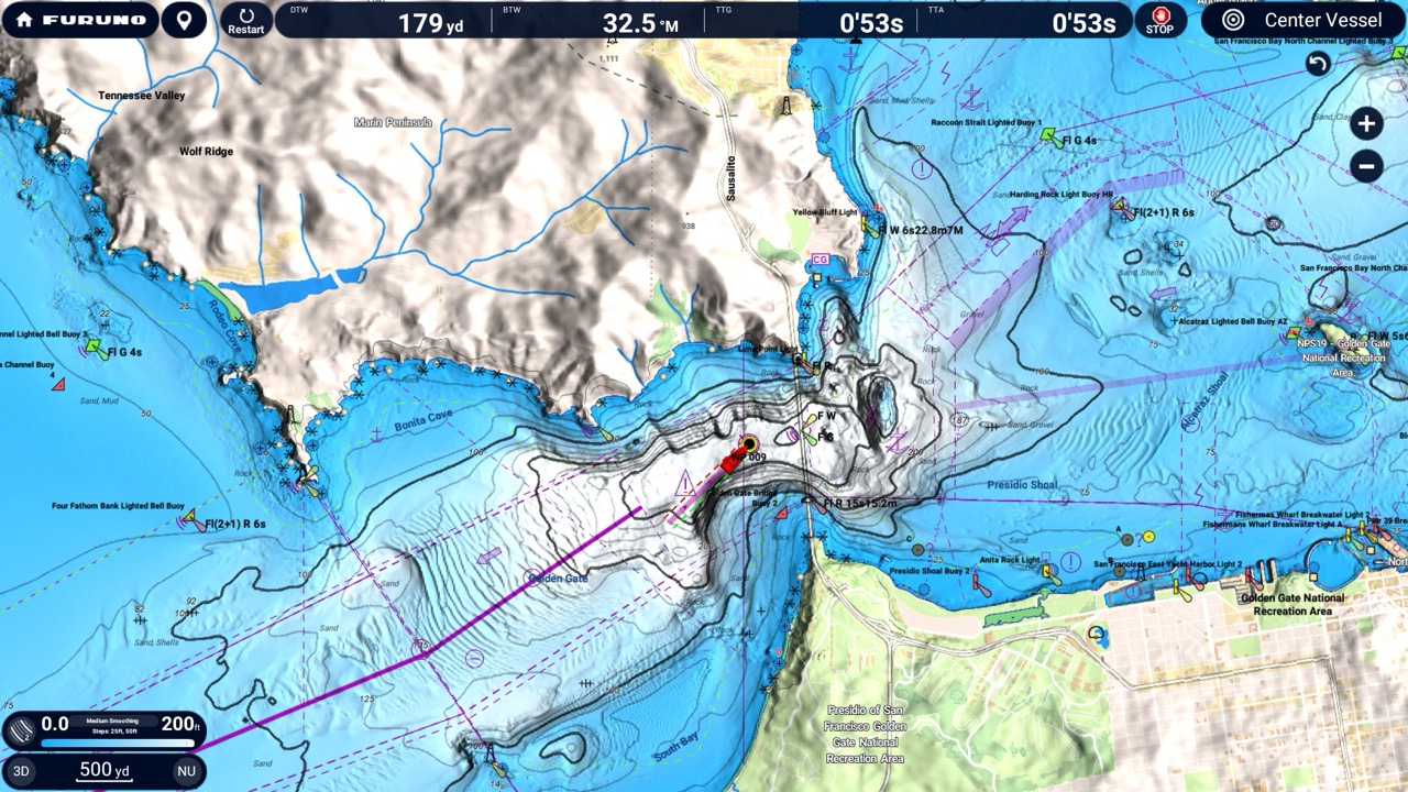
BathyVision
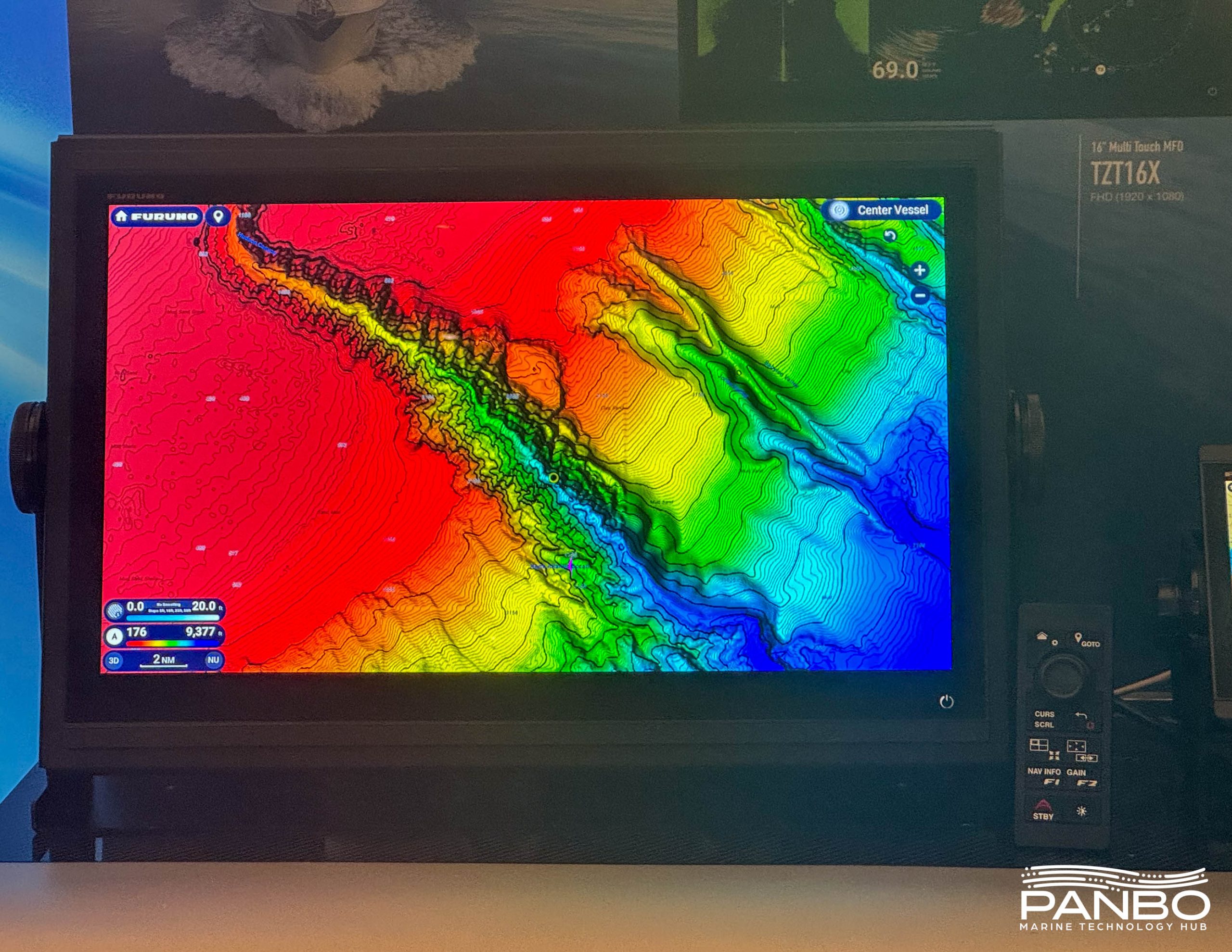
When Furuno calls their BathyVision high-resolution, they aren’t kidding. During the presentation, they explained the charts include full bathy coverage down to 3-inch contours for the entire coverage area. I’m still trying to find out more about the sources of this data and verify they’re supplying that resolution over the entire coverage.
Because BathyVision is part of the vector data, Furuno can fully control the presentation. The video above compares CMOR Mapping on the left with TZ Maps’ BathyVision on the right. As you can see, the depth shading is easily adjusted.
Pricing and availability
The 22-inch TZT22X and 24-inch TZT24X can be ordered now with shipping scheduled to begin in a few weeks. The 22-inch and 24-inch units have minimum retail prices of $10,495 and $11,995 respectively. The 10-inch TZT10X, 13-inch TZT13X, and 16-inch TZT16X will begin shipping later this spring. They carry minimum retail pricing of $2,995, $3,995, and $5,895 respectively. Also, note that the three smaller models have both internal GPS units and three channel sounders.


Does anyone know if the new TZMaps charts will work with the older TZT2 Touch MFD’s?
It’s my understanding that TZ Maps won’t work on anything older than TZtouchXL.
-Ben S.
Yes that is correct per the Furuno forum. I have a TZT2BB and would like the TZ maps on it but for now will need to rely on my laptop Timezero for these charts. While not announced I would expect a TZ TouchXlBB in 2025.
Not surprising, but a little sad for me: The TZT2, BB version excepted, can not even share radar or other ethernet services with XL…
“Only the TZT2BB will be able to mix with XL once the 3.7 software is available. TZTL12F and TZTL15F units can NOT mix with XL on Ethernet. While it is possible to have a TZT2 system as it is and then connect XL by NMEA 2000 only; to share most NMEA data…the access to the radar and sounder features are done via Ethernet so the XL in this example would not have access to those sensors. While it would offer some sharing of data, it wouldn’t be the full integration that is typical nor share routes etc. TZT2 can run with (aka mix) one series down (with TZT1) or one series up (TZT3)… but not two series up (XL) unless it is the 2BB. The 2BB is an exception because it came later and has the same processor and memory as a TZT3 so it was possible to update software to be like a TZT3 and mix with XL. Hopefully that makes sense.”
I’m sure that there will be more about compatibility here soon: https://furunousaforum.com/forums/navnet-tztouchxl.31/
Hi Ben, yeah I was the OP that prompted that response from Furuno via Johnny. What’s sad is that many of us purchased our otherwise excellent TZT2 units as late as 2019, barely 4 years ago. And already there is no support for this major upgrade. Shades of Apple methinks. My prior NavNet gear was supported and upgraded for a decade…I think the too-fast cycle to TZT3 before TZT2 was barely burned in a major cause of this. Furuno is eager to show they are competitive with new features, processors, displays, etc., but they have to remain aware of the investments their customers are making.
Unfortunately they will not.
Thanks Ben.
Was any announcement made for an upgrade to the TimeZero PC software? What about compatibility between an XL MFD with a PC setup? Thanks!
I purchased the TZMaps for TZ Navigator but when I found out TZMaps were not compatible with the Furuno TZT2 MFD, returned them. TimeZero was quite good about this.
To be honest though, while testing the TZ Maps, the bathymetry display was not great for navigation as it was far too busy and obscured the real navigational hazards. It might be great for fisherman but for a boat underway, not great IMO.
Thanks Ben,
I assume the XLs are compatible with all current radars, any word on a new radar model?
I wish Furuno would make a 7″ version of this. Or rather, make a replacement for the 1871F to the same sort of hard- and software specs as the TouchXLs.
I need a small one that is not using much power and is not too tall, which basically means an NSX 3007 or B&G’s Zeus S equivalent. Garmin’s 7″ GPSMAP chartplotters are much taller (percentagewise).