
All U.S. raster charts and a charting program, fifty bucks!
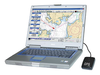
Maptech’s freeboatingcharts.com is now offering a DVD with all current NOAA raster charts, all Corp of Engineers river charts, and a real charting program for $50. The charts are organised on the disc into 23 ChartKit-style regions, and this deal even includes technical support. The software is Offshore Navigator Lite, the same program that now comes free with Maptech’s printed ChartKits and Waterproof Chartbooks. It’s not great, but it’s not bad either. I’ll try to write more about it soon, as well as the Zeus thing I started! Have a great weekend.


I am looking for a portable unit for the mississippi river for piloting ships lower river. I am somewhat fimilar with the RAVEN units