Simrad MOnitors, the other NSO evo2 shoe drops
So, it turns out that when I saw the new NSO evo2 blackbox system at IBEX Simrad was low key about it because they were planning a big splash here at the Fort Lauderdale show....
So, it turns out that when I saw the new NSO evo2 blackbox system at IBEX Simrad was low key about it because they were planning a big splash here at the Fort Lauderdale show....
 It’s quite unusual to illustrate a Panbo entry with an advertisement, but I think this one has editorial content. Isn’t it great to see three separate companies state in print that their electronics will work together to accomplish a complex task? Won’t that make it harder for any one of the three customer service departments to point the blame for operational problems elsewhere? Plus the task in this case — to put the control and output of yacht cameras onto the Internet so owners or crew can access it anywhere — is pretty impressive.
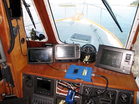 The test scene is admittedly messy, but having the Wilson AG Pro Quint cell booster out at the helm made it easier to read and photograph. I could also monitor the screen on the Medusa Power Analyzer that the 12v feed is running through (the Quint pulled about 11 watts with two of its amps turned up to about 70db and the other two at about 50 and 55). The best part, though, is how real the testing was. Gizmo is anchored in a wicked cell hole that also happens to be beautiful (mapped here via the test DeLorme InReach SE mounted to the windshield) and only about 11 miles from Camden. Heck, a Verizon call with my wife failed abruptedly about two miles from the anchorage and I couldn’t even get a text out!
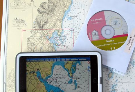 NOAA’s Office of Coast Survey has been making news. We were just discussing changes to the Magenta Line on ICW charts when a reader (thanks, Collin) caught the announcement that OCS will stop printing traditional paper charts next April, which even got on NPR national radio. Charts lithographically printed on heavy paper are a beautiful technology and it hurts a bit to see them go, but I’m not it makes much practical difference. Personally I haven’t purchased one in long time (nor do I ever thrown them away) and I guess the mandatory carriage commercial vessels will do fine with print-on-demand charts and/or slowly proliferating ECDIS systems. At any rate, it seems like a good time to discuss how nicely the NV-Charts paper/digital package has evolved and also new ways that NOAA is distributing its cartography…
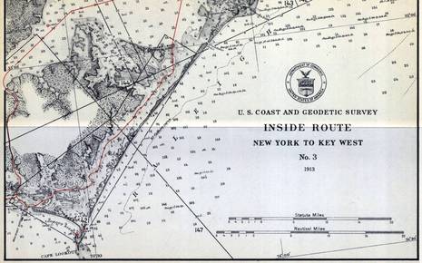 When Peter Swanson called to say he’d just become PassageMaker’s new editor-in-chief (which he’ll be great at, I think), the conversation soon turned to our strong mutual interests in cruising, electronics and charts. That’s how I finally learned that NOAA has started to remove the magenta chart lines that guide many users of the Intracoastal Waterway (ICW) and that they may never be replaced. Peter wrote about the issue in August, and NOAA recently put up a notably well-crafted Federal Register article that seeks more comments from the public. That’s where I learned that the brightly colored “recommended route lines” began on a 1913 chart series called the Inside Route Pilot — fascinating sample above, full size here — and that they haven’t been comprehensively updated since the 1930’s, when taxpayers spent a lot of money expanding the ICW (and creating jobs)…
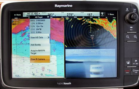 I’ve long thought that the usefulness of a navigation camera would increase significantly with tight integration to a boat’s principal navigation system, and now I’m convinced. When I redid Gizmo’s antenna mast last spring, I got to top it off with a powerful FLIR M-618CS dual camera system that was sometimes very handy as I cruised up the coast. But when I finally got around to integrating it with the Raymarine e-127 above, its safety value took a quantum leap. While it’s obvious from the lower-right camera window that this particular test day was very clear, also obvious to me was the camera system’s potential when I can make it quickly pan and tilt to any spot on the chart screen, on which it will stay locked no matter how Gizmo manuevers and — in the case of MARPA and AIS targets — regardless of how the target moves…
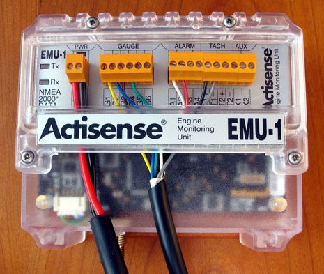 It’s great to test a device that promises to do something new and desirable for the good vessel Gizmo and find out that it installs fairly easily and works quite well. That Actisense EMU-1 is now converting the analog gauge data from the boat’s 14-year-old Volvo Penta diesel into NMEA 2000 messages that can displayed in multiple ways on most any MFD or instrument screen on board, and can also be custom alarmed and logged. I’m going to be better informed about my engine’s health and I’m going to gain some helm panel real estate for better uses than dumb analog guages…
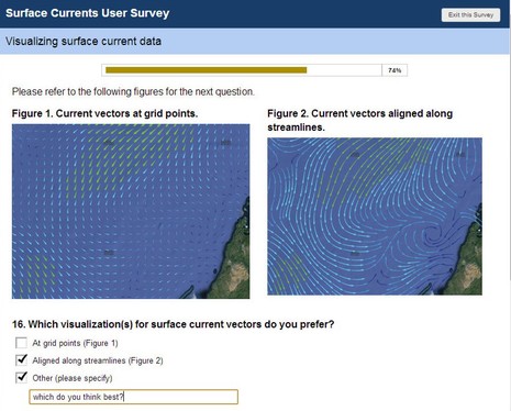 Maybe you too have an opinion about how predicted currents should be overlaid on electronic charts? Well, the International Hydrographic Organization (IHO) is developing an S-100 specification for “the delivery and presentation of navigationally significant surface currents” and right now they’re running a online survey of all interested parties. What waters do you care about (coastal for me)? What prediction frequency would you like? Are you willing to pay? How should the data look? And more…
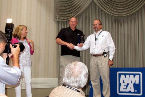 That’s Raymarine’s Larry Rencken accepting the NMEA New Technology Award for the Evolution autopilot system from NMEA Director Bruce Angus (with NMEA Office Manager Cindy Love assisting). This was Evolution’s second honor in two weeks — congratulations! — as it also shared the IBEX Innovation Award for electronics, as discussed on Panbo here. Whereas I was involved in that first contest and a close observer of the various NMEA Awards, I thought I’d explain how they work and also note the other winners. No awards process I know of is perfectly fair, but these are handled quite seriously and are worthy of attention, I think.
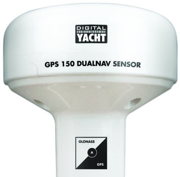 I’ll write soon with NMEA Conference details of the futuristic (and unfinished) NMEA OneNet standard, but I also left San Diego with the strong impression that the good old NMEA 0183 standard is still very much alive. One interesting example is the new Digital Yacht GPS 150 DualNav, which earns its last name for its ability to receive more than one set of positioning satellites at once — already active GPS and GLONASS in particular, more coming — and to then deliver more accurate L/L, COG & SOG than can be gleaned from just one GNSS system.