Yearly Archive: 2013

METS 2013: Glomex WeBBoat, fingers on Garmin and Simrad, and more 5

METS 2013: Glomex WeBBoat, fingers on Garmin and Simrad, and more

mets_2013_glomex_webboat.jpg

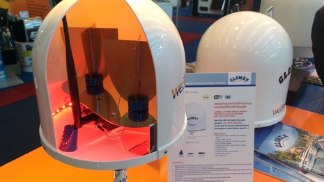
The Marine Equipment Trade Show 2013 held in Amsterdam last week lived up to its reputation again. The trade floors were packed with exhibitors, and I was told that the booths were packed with visitors on the first two show days. Fortunately, it wasn’t as busy during my third day visit and I could move around easily — if not as anonymously as before; at Garmin I was welcomed as “Hey, you’re the guy from Panbo!”  Ben has already reported on Garmin’s down- and side scanning sonar, xHD radomes, etc., plus the new Simrad NSS and B&G Zeus2 Series, but I got to see the new products in action and there was much more to cover, like that neat Glomex WebBoat WiFi/3G access point seen above…

Furuno MUxxxT monitors, Hatteland X Series, and TimeZero Coastal Monitoring 7

Furuno MUxxxT monitors, Hatteland X Series, and TimeZero Coastal Monitoring

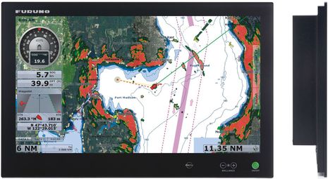
Furuno_MU240T_monitor.jpgFuruno’s new multi-touch MUxxxT monitors are intended to play nicely with NavNet TZtouch MFDs. Using its DVI output, the TZT9 or TZT14 can send a screen mirror to the wopping 24-inch widescreen MU240T above — at 800×480 and 1280×800 pixels, respectfully — and USB takes the touch commands back to the TZT (using a standard Windows driver). Meanwhile the TZT Black Box has enough DVI and USB ports to drive two of these glass-bridge-style monitors (and two keypads, like the one KEP recently introduced or the one Furuno is purportedly working on)…

Simrad NSS evo2, multi-touch 7-inch to 16-inch and beyond 48

Simrad NSS evo2, multi-touch 7-inch to 16-inch and beyond

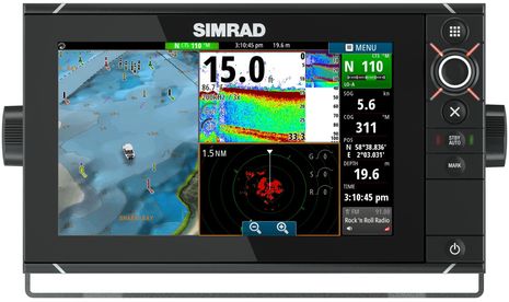
Simrad_NSS9_evo2_new_11-13.jpgAt METS this morning,  Simrad announced an evo2 update to the NSS Series and quite an update it is. The new multi-touch wide screen models will come in 7-, 9-, 12- and 16-inch sizes and since they are close family in every way to the recently discussed NSO evo2, a boater will be able to mix and match bright, glass-bridge-style displays from 7 to 24-inches. And while NSS evo2 can network with Simrad’s radars, sonars, SonicHub audio, WiFi 1 etc., all four sizes come with “embedded CHIRP enabled Broadband sounder and StructureScan” (which can probably network out to the whole family)…

Holy Garmin cow: SideVü/DownVü, GPSMAP 800/1000, GMR 18/24 xHD, Meteor 300, gWind & the Helm app 44

Holy Garmin cow: SideVü/DownVü, GPSMAP 800/1000, GMR 18/24 xHD, Meteor 300, gWind & the Helm app

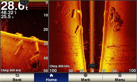
Garmin_SideVü_DownVü_800_kHz.jpgGarmin is purportedly announcing nearly fifty 2014 marine products today!  A lot are related to the company’s new ability to offer the high resolution down and side scanning that’s become so popular with freshwater and near coastal fishermen (and curious gunkholers like myself). Soon the relatively easy-to-understand (and fit-on-a-small-screen) down view will  be availiable in new echo dv fishfinders and echoMAP dv fishfinder/GPS combos that will then better compete against similar products from Lowrance, Humminbird, and Raymarine. Moving up the cost curve you’ll find CHIRP-assisted DownVü and SideVü, which look wicked sharp in the screenshot above (imaging what’s likely the remains of a bridge in a man-made lake)…

Ancor goes NMEA 2000 & the BEP Pro Installer line 6

Ancor goes NMEA 2000 & the BEP Pro Installer line

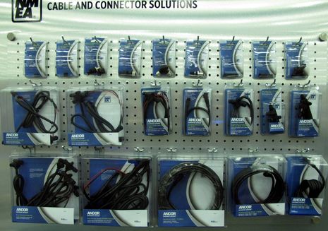
Ancor_NMEA_2000_cables_n_connectors_cPanbo.jpgPerhaps coming soon to a marine electronics store near you (though not yet online) is a fairly complete line of NMEA 2000 cables and connectors under the well-known Ancor brand. I particularly like how the kits and explanatory packaging will encourage consumers to set up their own small networks. The 2- and 5-meter cables, for instance, are sold as Backbone/Drop Cables while the 10-Meter is simply a Backbone Cable (because a spur shouldn’t exceed 5 meters). I saw the preview Ancor line above at IBEX but learned more about it in a special Soundings Trade-Only advertorial publication designed for next week’s METS show…

Iris NightRunner nav camera, too good to be true? 5

Iris NightRunner nav camera, too good to be true?

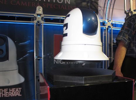
Iris_NightRunner_camera_at_FLIBS13_cPanbo.jpgIris Innovations used some magnet magic to highlight the sveltness of the NightRunner dual payload pan/tilt/zoom navigation camera system it debuted in Fort Lauderdale. The real magic, though, seems to be in the pricing. At about $5,000 including a full-featured joystick control pad, the NightRunner isn’t that much more than a fixed Raymarine T200 with the same 320 x 240 thermal resolution and no daylight camera at all, and the NightRunner installation doesn’t seem much harder. Meanwhile the dual payload PTZ model most similar to the NightRunner appears to be the  FLIR M-324L (or its sibling Ray T400) with a full retail price of about $15,000!  How is this possible?

“Lessons of the BOUNTY” — Andy nails it 9

“Lessons of the BOUNTY” — Andy nails it

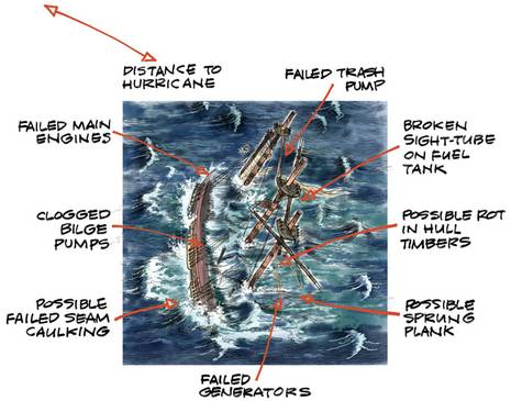
BOUNTY_issues_--_Courtesy_Jan_Adkins_and_WoodenBoat.jpgI’ll probably always associate Hurricane Sandy and the sinking of the HMS Bounty with last fall’s cruise to the Carolinas and a Fort Lauderdale Show that got a little scary just because Sandy’s eye passed by about 160 miles to the east. Soon after flying from Lauderdale to Gizmo’s super safe location in Myrtle Beach (lucky!), I was adding Bounty comments to an entry about how I’d first spotted the storm on a Furuno TZT. What I didn’t mention then was that I’m one of a cohort that had more reason than most to get cold chills over the sinking of a large traditional sailing vessel, a loss that could have been so much worse if it weren’t for an extraordinary USCG rescue operation. But it’s relevant now because an old square rig shipmate has written a very fine analysis of the disaster and what we can learn from it…

Raymarine LightHouse II, the paper chart lives on 21

Raymarine LightHouse II, the paper chart lives on

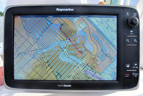
Raymarine_LightHouse_II_w_NOAA_raster_chart_cPanbo.jpgIsn’t it interesting that just after we learned that NOAA will no longer print traditional paper charts, Raymarine announced that all its current plotters will soon be able to use the digitized ‘raster’ equivalent of those same NOAA charts? The “completely redesigned LightHouse II” software that will make this entirely free new feature happen is due out in December, but I got on the water with a beta version last week. I was impressed with how well the raster charts looked and how well they panned and zoomed, even in beta, and there’s much more to like about LightHouse II…

FLIBS 2013, over the top 5

FLIBS 2013, over the top

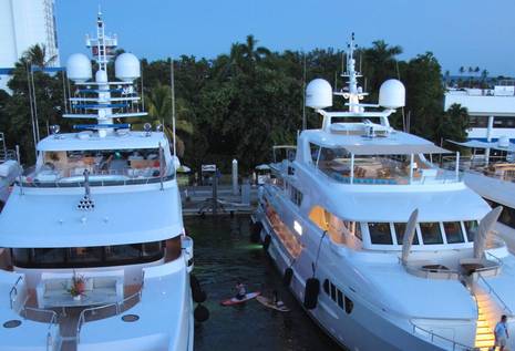
FLIBS_13_yacht_Remember_When_cPanbo.jpgThe Fort Lauderdale International Boat Show was bigger than ever this year and while FLIBS exhibits really do appeal to almost every boating persuasion, who doesn’t enjoy gawking at the very high end? Click, for instance, on the photo above and check out the remarkable farm of Furuno radars, Sea Tel satellite domes, FLIR cameras, and much more at left. The 162-foot Remember When is equipped to the max and I was not surprised to learn that proud owner John Rosatti started working on boats with his dad at age 13. Meanwhile, yours truly was higher than a megayacht on the sky deck of the odd but accessible 3,200-ton vessel doing business as SEAFAIR. Simrad was celebrating the NSO evo2 debut up here, and we all enjoyed watching the young couple on paddle boards (Remember When crew perhaps?) head off with their cooler to locations unknown. There was lots of marine electronics news in Lauderdale, but this entry will be an eclectic tour of other sights that drew my attention…