
“21st Century Waterways” — have your say about the Future of Navigation in the USA
Hurricane Arthur is putting a damper on Fourth of July celebrations even up here in Maine. The fireworks were canceled yesterday, our family lobster dinner is postponed, and the gale watch that went up this morning may mean I’ll be minding Gizmo tonight. But once again knee-jerk criticism of weather forecasting is not standing up to reality, specifically the work of NOAA’s National Hurricane Center. Arthur made a slight left turn last night, hence the gale watch, but remains darn close to the track forecast days ago. What’s more, the NHC not only distributes voluminous detail about the science behind their forecasts, but also a running graphic tally of how their forecast and the underlying computer models compare to the storm’s actual track. No doubt some boaters will still get in Arthur trouble, but I’m also confident that the U.S. Coast Guard is wonderfully able and willing to render assistance. So what a perfect time for those of us in a dry spot with an Internet connection to spend a few minutes helping NOAA, the USCG and also the Army Corp of Engineers (USACE) to maximize their resources in the future.
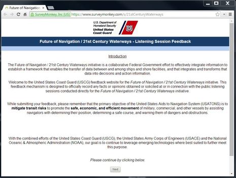 In 2012 we first heard that the USCG was considering a reduction in physical aids to navigation and other initiatives that may make sense in a world where electronic navigation has gained a lot of ground on visual navigation. This apparently led to a recent series of “Listening Sessions” around the country, and now there’s an online Future of Navigation / 21st Century Waterways survey where you can share your thoughts. While the language in the introduction above is a bit stilted, “collaborative Federal Government effort to effectively integrate information to establish a framework that enables the transfer of data between and among ships and shore facilities, and that integrates and transforms that data into decisions and action information,” read a couple of times suggests a big vision, I think. And don’t be put off by suggestions that this survey is just for professionals; I believe that the USCG asked me to “spread the word/opportunity” on Panbo because they know that many readers are knowledgable recreational boaters.
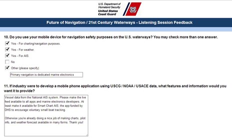 I, too, will be interested to hear how readers respond to the survey and I’ll share a few opinions I came up with. First of all, I used this opportunity to plead once again for distribution of all the AIS data collected by the U.S. Government to the public. As much as I appreciate how much the Coast Guard does for us, I’m not sure they even realize that another division of DHS financed the Smart Chart AIS app system that could be a much better source of small boat tracking information if it (and related apps) could offer us the NAIS level realtime AIS monitoring. (I appreciate Marine Traffic, too, but volunteer coverage remains very spotty).
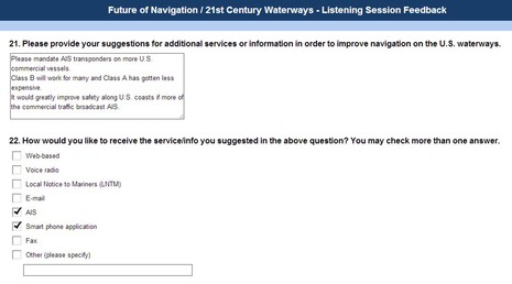 I also found a way to remind the USCG that they still have not extended AIS mandates to many commercial vessels running up and down the coasts. Many such vessels — like the Maine ferries, thank goodness — have voluntarily installed AIS but there are still many ferries, passenger boats, small tugs and fishing boats that can afford and should be regulated to adopt this valuable safety device. Heck, this impatient entry dates back to 2010!
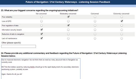
What may get me in trouble with some readers, though, is my sense that some physical aids to navigation can be removed without significant harm to our safe navigation. But I think I came up with a clever trade off, suggesting that “the first dollars saved by reducing AtoNs should go to the rapid deployment of a secondary electronic positioning system, probably eLoran” (which is thankfully back on the table). Please take the 21st Century Waterways survey and please tell us your ideas for the future of navigation aids. Have a great holiday weekend, too, even if Arthur comes around.


Arthur is mostly history here now, very wet history. The NHC’s track, precip, and wind forecasts were pretty much spot on.
Then I realized that the adventurous crew of S/Y Novara, who I met this spring, might be right under tropical storm Arthur as they work their way up to the North West Passage. Glad to see that they’re holed up in Halifax, and also to realize they’re being tracked here along with other NWP attempts:
http://www.enablingwebsites.com/sv_novara_track.html
Lots of interesting stories in all those vessel links.
Those NOAA hurricane charts are pretty accurate in my experience. I spent a while in yacht insurance and we watched hurricanes very closely Almost every storm I watched on the charts was pretty much dead on. They still have work to do on other weather but when it comes to hurricanes I have been truly impressed over the last 7 years or so.
For your amusement, I took the survey. In response to what everyone could do better, I suggested that the CG place more emphasis on the VHF message content as opposed to which CG jurisdiction is transmitting. More than 80% of messages (I should really keep a log) leave me wondering whether the station ID is really more important than the vessel in distress or the hazard to navigation.
Sigh
Don
I also took the survey, and also commented on VHF communications. I just spent a week and a half going from Albany, NY to Atlantic Highlands, NJ on our sailboat. At 8kts over ground, we spent 3 days down and 3 days up the Hudson River and heard broadcasts from numerous sectors.
During this time we heard MANY USCG VHF broadcasts from several different sectors. I would estimate that over 50% of those broadcasts were unintelligible, or gave information too rapidly without repeating it.
Unintelligible broadcasts – Either too much background noise, mumbling into the radio, massive echoing (feedback on the USCG side from radios on in close proximity to the USCG personnel transmitting)
Information Given Rapidly – The majority of the broadcasts started with the sector broadcasting – this information was usually repeated 3 times. The actual content of the broadcast was often spoken very quickly with no repeat. This included location information, latitude/longitude, nature of the broadcast and actual emergency or other information.
It would be great if the personnel manning the radios could be more effectively trained on radio broadcasting (use diction, speak more slowly), if the content could be repeated – especially when locations are included and if less emphasis could be put on the sector than the content.
It would also be great if this information was easily available via the web. Perhaps you could click on a sector map (like the NWS marine forecast by zone) and it would show you all active alerts for that zone – and nothing else. Maybe this exists? But I’ve never seen it – at least not in an easily to find location.
It’s most important for people on the water and currently in transit to have ready access at their fingertips to as much information as possible. When at the helm, I don’t have time to navigate large and complex websites to find what I’m looking for. I want ready access to information that affects me, and I want it easy to find and easy to view.
Just a reminder for anybody that may have missed it, here is the Live Tracker for the Charles W Morgan’s 38 Voyage:
http://www.mysticseaport.org/38thvoyage/chart/
Speaking of NAIS here’s an excellent page describing the the aviation version which uses ADSB and CPDLC to monitor and control aircraft outside of radar coverage, check out the video:
http://nats.aero/blog/2014/06/north-atlantic-skies-gateway-europe/
Thanks Chris (and Don) for bringing up the VHF issues. I can generally understand the USCG broadcasts up here and they’re good about keeping the parts on 16 short. But I have been frustrated when they give repeated lat/long coordinates for an accident in progress when simply saying something like “1.5 miles southeast of Rockland breakwater light” would be much easier for listeners to understand and respond to.
And, Chris, your idea of pushing alerts out on the Web is very much a part of the Smart Chart AIS scheme. Their servers can apparently link directly to government GIS systems so the phone app could easily and quickly show USCG content overlays. But Smart Chart AIS needs a carrot to attract more users…like access to the government’s AIS data.
The survey is still open…