
Dinghy as depth scout with Garmin QuickDraw Contours
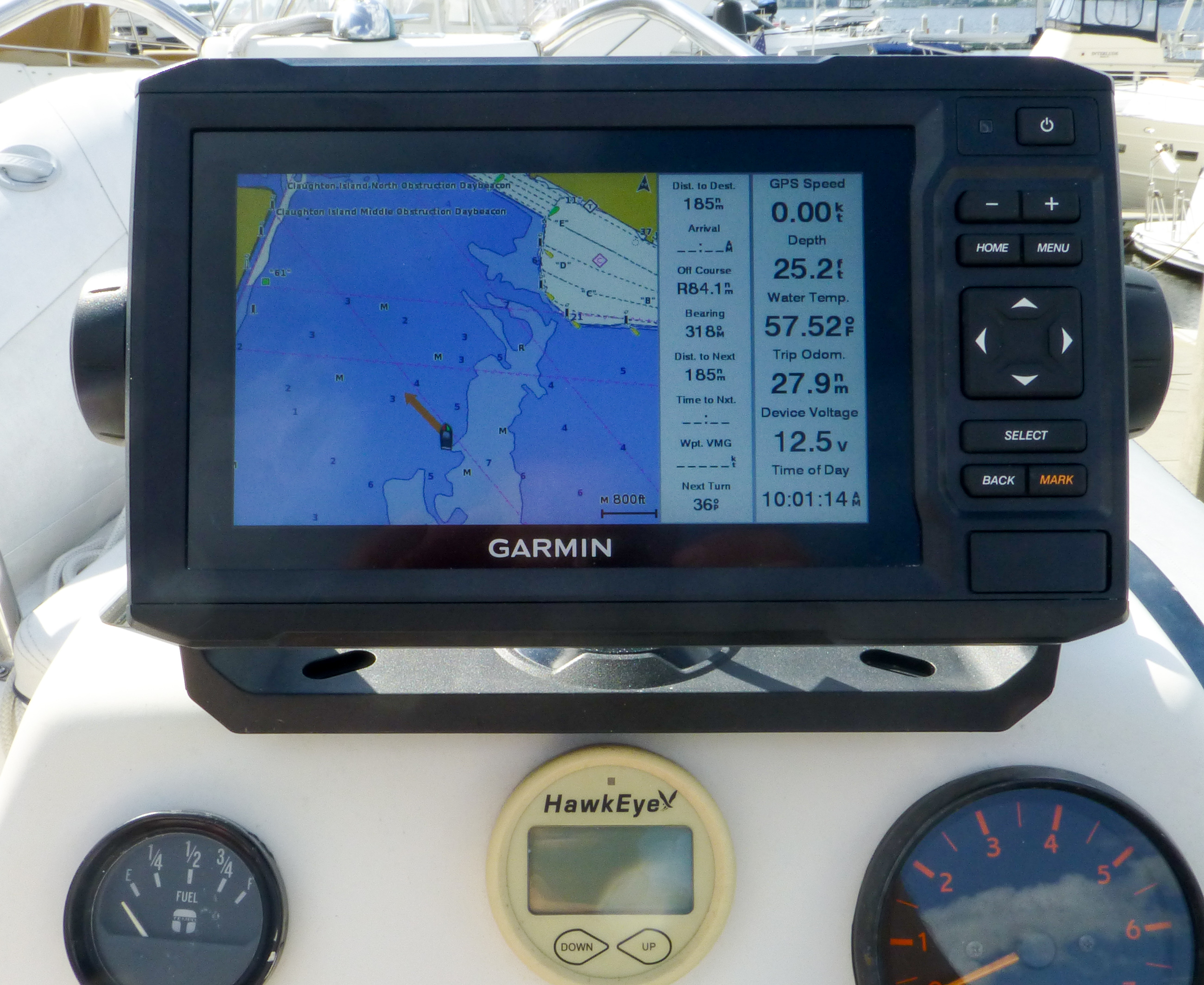
The Garmin Echomap 64cv MFD at the helm of my dinghy
My boating career started in the generally deep waters of the Great Lakes where the prevailing wisdom is: If you can’t see it, you can’t hit it. But cruising the Great Loop taught me the perils of shallow water boating, especially because our props hang lower than any other part of the hull by two feet. So I’ve gotten creative in an effort to make shallow water boating involve fewer clunks of running gear meeting bottom, and the most effective technique I’ve found so far is advanced scouting with our dinghy using the QuickDraw bottom survey feature of its Garmin Echomap 64cv.

The bottom of Have Another Day with the props hanging low
Our Carver Voyager 570 Have Another Day draws 5′ 1″ when fully loaded with fuel, water, Seakeeper, dinghy on the boat deck, and ALL of our stuff. I’m often surprised at how little margin for error I have in maneuvering her and then find myself looking for more information where the deepest water is. I’ve added forward-looking sonar that can be useful seeing of what’s right in front of the boat — and plan a complete review — but the shallower the water, the shorter its range. So I’ve settled on an approach made possible by Garmin’s QuickDraw technology, which Ben E. wrote about when it was announced.
-
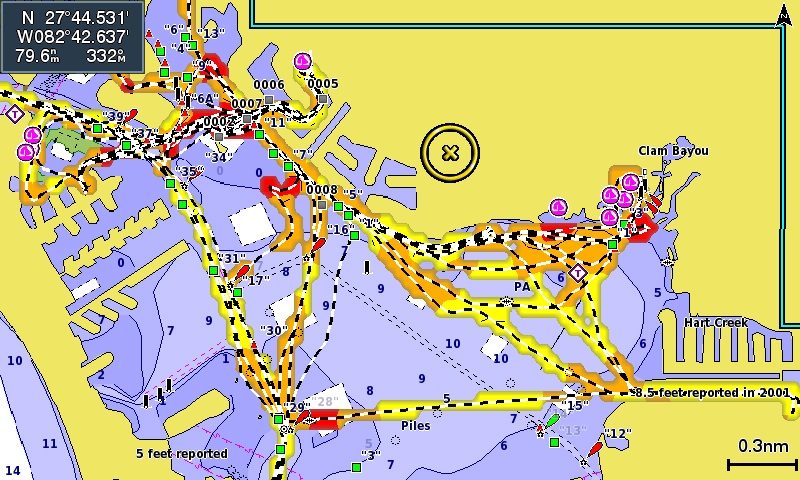
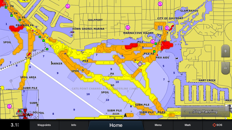
- Boca Ciega Bay as sounded and displayed by the dinghy’s Garmin EchoMap 64cv

-
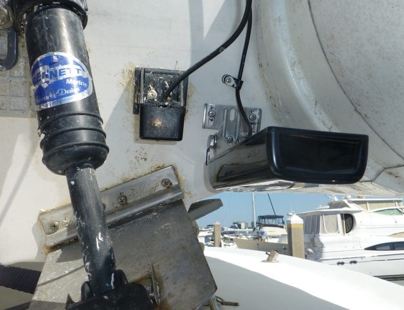
- The GT23-TM transducer on the transom of my dinghy. Note the one just to the left, it was there before the trim tabs and has a hard time finding the bottom now
I’ve equipped our dinghy with a Garmin EchoMap 64cv MFD with a GT23-TM transom mount transducer, and here’s how this works: My wife Laura or I dinghy out looking for deep water while using the EchoMap’s QuickDraw Contours feature to plot and record bathymetric data to the MicroSD card in the MFD. This is a lot easier to do in a dinghy that draws about 18 inches and can be easily pushed off any groundings, as opposed to roughly 30 tons drawing 5+ feet.
-

- Boca Ciega Bay as sounded by the 8612 on Have Another Day
-
- Boca Ciega Bay as sounded by the EchoMap 64cv and displayed on the GPSMap 8612
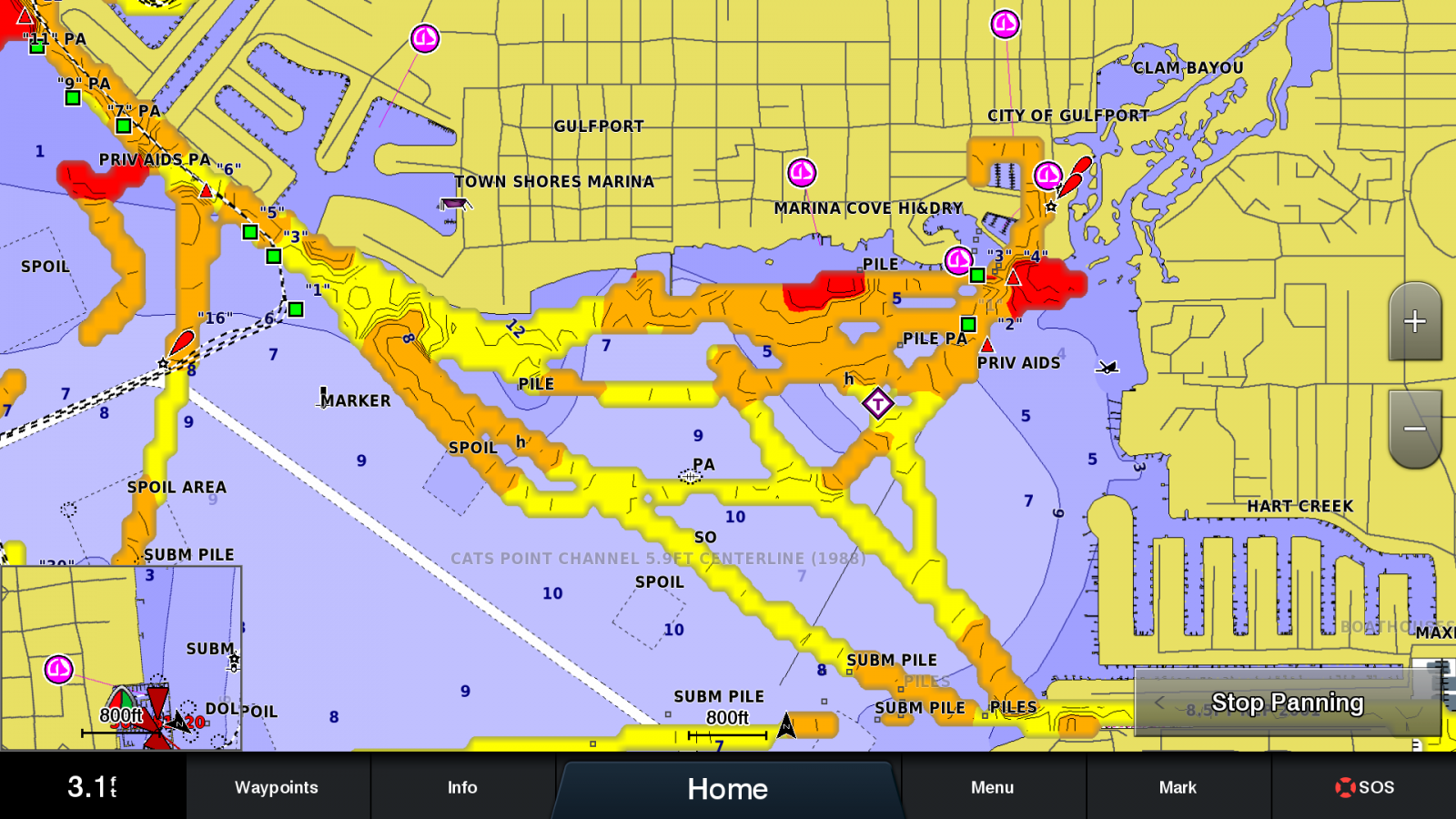
Now that we’ve collected data in the dinghy, the MicroSD card from the EchoMap 64cv gets inserted into the Garmin GPSMap 8612 located at the helm of Have Another Day. MFD manufacturers are increasingly moving the MicroSD card slots to the rear of the MFD which means if you have your plotter mounted in the helm (and not on a trunion) you will likely need an accessory card reader to make this easier.
The image in the gallery above left shows the view from my 8612 with its own soundings displayed. I haven’t explored the anchorage or the route into the City of Gulfport’s municipal marina (top right of the image) on Have Another Day so there are no soundings for this area on this image The right image was taken after I removed the MicroSD card from the dinghy’s 64cv and inserted it into the 8612. Now I have full visibility of what I found when I sounded the area using the dinghy.
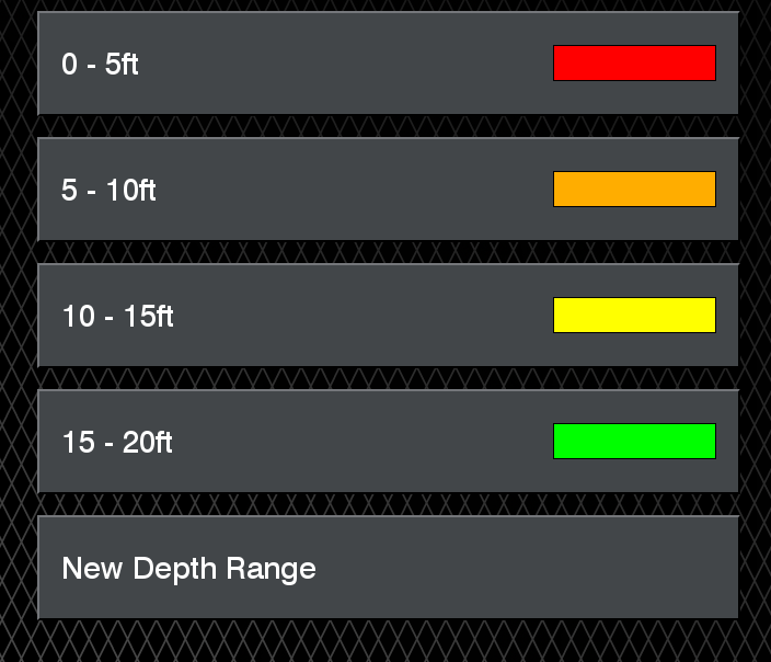
QuickDraw color ranges as set by default. I find these ranges work well for me.
Garmin allows the colors and depth ranges to be changed, but I’ve found their defaults work well for my use. In addition to range settings there are also settings for sounder offset for recording, recorded display (which can be useful for my use since the dinghy and big boat have their sounders at different depths), and community display.
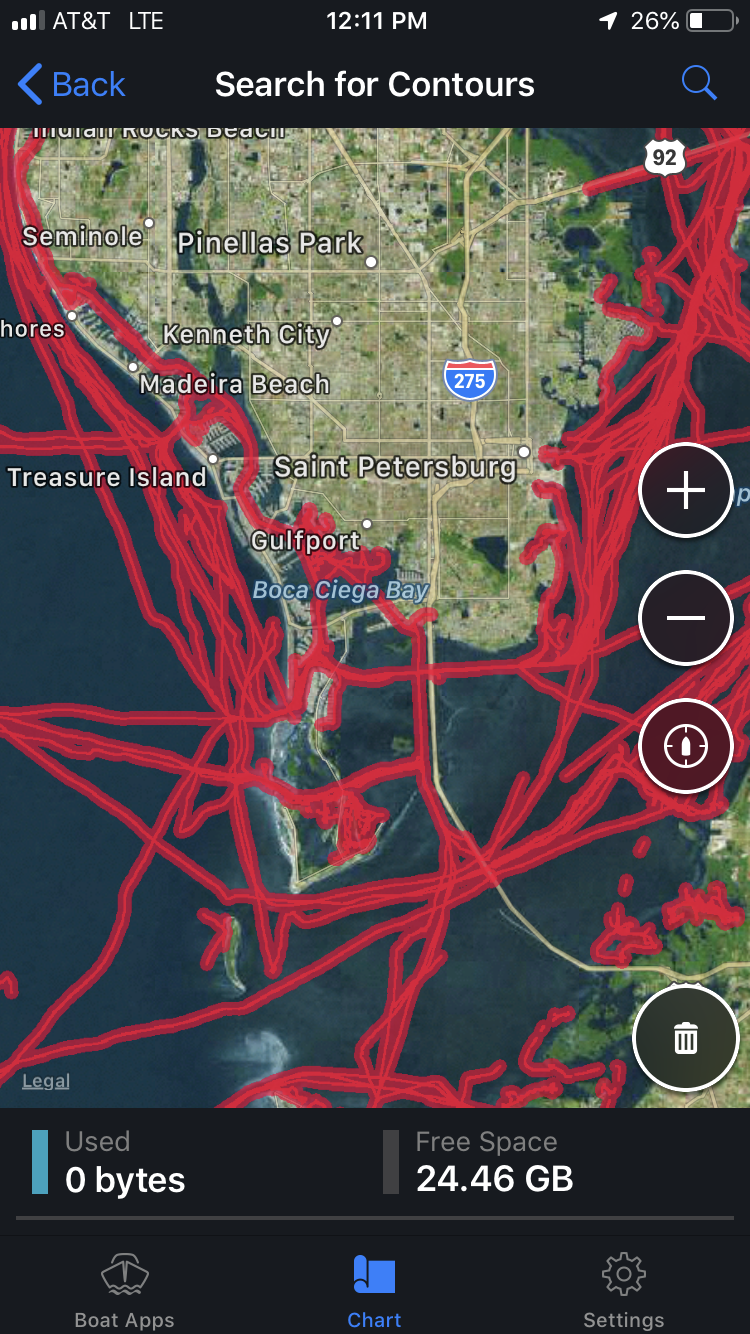
QuickDraw Community Contours available for download via the Active Captain app
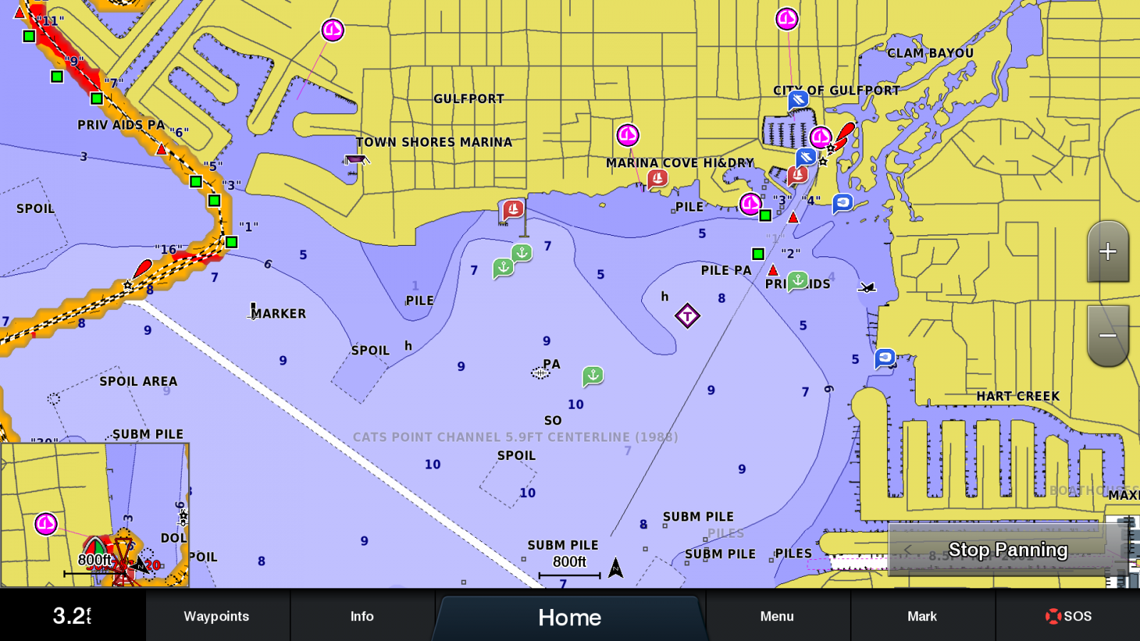
In addition to contours you’ve recorded, you can download community contours via the Active Captain app and then upload them to your MFD. In areas of skinny water, I strongly prefer contours we’ve recorded because I know the offsets of the transducers are accurately entered and I know the tide state when data was recorded. But if I don’t have my own data, I can use a downloaded contour set and then verify the accuracy in deeper waters. But I will always place less confidence in contours I haven’t recorded myself.
B&G, Humminbird, Lowrance, Raymarine, and Simrad all support Navionics’ Sonar Chart Live. Sonar Chart Live allows you to collect live data, display it on your MFD or app and then upload it to Navionics. Once uploaded to Navionics they process it and add it to the database for Sonar Charts.
Seeing the route I scouted on an MFD at the helm affords big peace of mind. Even armed with this additional information it’s important not to rely on it solely. You will want to make sure you account for tide and consider any difference in sounder offset between the two setups. Laura and I have also used our docking headsets with her in the dinghy and me at the helm of Have Another Day and had her call out the depth readings from the dinghy in real time. Both techniques work well, but, if I have the time to do the scouting in the dinghy then transfer the card I prefer that method because it gives the opportunity to have surveyed the entire route and be familiar with it prior to traveling it.

The depth scout stored on the boat deck of Have Another Day


Hi!
Let’s hope Garmin and the rest develop this feature further. A synchronisation function over WiFi would be very useful for example.
Don’t forget Lowrance’s Genesis Live! – https://youtu.be/nmCI1i5TOq0