
Sea Diamond sinks, bad current?

This weekend a Panbo reader emailed me thusly: “How about an in-depth look at the electronics and friggin’ AIS on that cruise ship that grounded then sank???” Well, I wish I could find the details of what electronic aids were available on that now sunken bridge, but I have little doubt about the accident’s cause. Incompetence trumps electronics every time! While I generally sympathize with a skipper who screws up—one result of my own numerous navigation errors—there are indications that this was an accident about to happen. One is that the Captain blamed strong currents for the grounding. As if set and drift shouldn’t have been toward the very top of his worry list, a critical factor to be on aware of, using electronics or older means. Then read down the same article to see how Sea Diamond’s operating company already had two serious accidents in the last year. Incompetence often flows from the top.
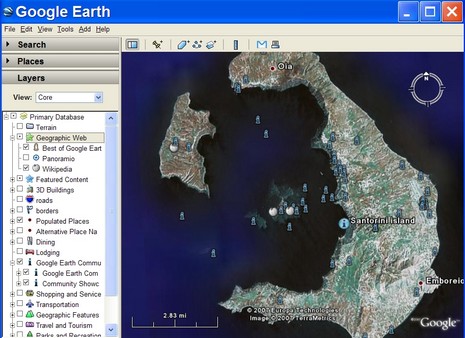
At any rate, the news reports about this tragic sinking will surely get more detailed. For instance, I can’t yet find a map of just where it happened, so I looked up Santorini, Greece, in Google Earth. While there are numerous interesting POI entries about the island, no user has yet geo-located the wreck. But I wouldn’t be surprised to see that soon, GE being the global community map it’s become (more on that later).


I like a good challenge, so when I read Ben could not find the location of the wreck I thougt I could put my Google skills to test.
Following is a Marine Salvage site that has posted a nautical map of where the ship struck land. Apparently it was towed somewhere else to sink. http://uwex.us/
As a side item and unrelated, take a minute to watch on the same web site, the 592 foot cruise ship being thrown around in a storm. Video is taken from a rescue helicopter.
Back on the topic of the wreck, I found this photo album of pics/and one video, taken onboard while the ship was dragging. You WILL BE AMAZED at how close this huge vessel gets to the cliffs. I don’t understand why they did not drop their 4 anchors or use their bow thrusters to navigate. Viewing these pics it is amazing the vessel stayed a float as long as it did.
Pics: http://picasaweb.google.com/juliejames/JohnandSarah
One last interesting find on this boat, is a video showing the sinking of the boat. I thought this video spoke to the discussion of could you be sucked under water as a boat goes down. Watch the life rafts, they are pushed around by the current, but it does not appear any are in danger of being pulled under.
http://www.truecruise.com/sea-diamond.aspx
-Mark Read
Great information and links. Thanks Mark!
i have photos of the sea diamond nav systems as i was on the ship
The current position of the sunken vessel as well as information about the sinking is available on Wikipedia.
http://en.wikipedia.org/wiki/M/S_Sea_Diamond
“Investigations carried out by the defense team of the Master of the Vessel and Louis Cruise Lines have included a new hydrographic survey of the area of the accident in Santorini. […] and discovered significant discrepancies between the actual mapping of the sea area and the official charts used by the Sea Diamond (and all other vessels) at the time of the accident. The detailed survey revealed that the reef, which the Sea Diamond struck, is in fact lying at 131 meters from shore and not at a distance of 57 meters as is incorrectly marked on the nautical chart. The official chart also shows the depth of the water at the area of impact varying from 18-22 meters, whilst the recent survey shows that it is only 5 meters.”
One more reason not to implicitly trust navigation equipment, charts etc. but rather to use one’s best judgement and give a wide berth to suspected hazards.
Sea Diamond: the photo captions are good. The water in the pool is about to pour out and they are told not to panic, everything is under control… and suddenly the crew is wearing life jackets. Subtle.
On being sucked under water when a ship goes down: This ship went pretty slowly, but I would suggest caution if you’re ever in this situation. Never underestimate the force of moving water. Just a week ago a diver got to close to the Saltstraumen in Norway and was dragged down 70 meters in 30 seconds.
Maritime accident reports: It’s always good to know what can go wrong. Here are a couple good sources.
http://maritimeaccident.wordpress.com/
See for example, “The Case of the Cozy Captain” or “The Case of the Seductive SIM”.
http://captrichardrodriguez.blogspot.com/ (“Bitter End”)
Queen of the North: this ferry sank two years ago and it’s been a mystery ever since what the crew were doing. The ECS screen was turned off as were the alarms. They missed a turn and nobody looked at the radar or ECS for 14 minutes, at which point they ran into an island. The accident report was just released, together with an animation/video which shows snippets of what the radar and ECS was showing (from memory cards recovered from the sunken ship).
http://www.tsb.gc.ca/en/media/Major_Investigation/Marine/M06W0052/MI-M06W0052.asp
And on a lighter note:
http://www.youtube.com/watch?v=dn0GjURpYls
The final screen says “Proper Navigational Equipment”, but I don’t think Silva sells AIS 🙂
Everyone associated with and concerned about the Costa Concordia disaster should view this good site and these comments. I think we can guess what was steering Captain “Chicken of the Sea’s” rudder.