
SI-TEX Marine Electronics Releases New Polaris Charts

Starting August 1, New Cartography Platform Comes Bundled With SI-TEX NavPro Series MFDs Provides Rich Bottom Contour Detail, Hi-Res Spot Soundings, Dynamic Tides & Currents and More
August 1, 2022 — SI-TEX Marine Electronics today announced the official release of new POLARIS Charts, a content- and feature-rich vector cartography platform developed by sister company AvMap Srl exclusively for the company’s popular NavPro Series MFDs. POLARIS Charts covering the entire United States now come bundled with SI-TEX’s NavPro 900C/F and NavPro 1200C/F MFDs at no additional cost, providing powerful, yet affordable navigation, fish finding and radar functionalities for a wide range of boats. These units combine powerful chart plotting, built-in CHIRP sonar, and Wi-Fi radar capability in one convenient and easy-to-use package.
SI-TEX’s Hybrid Touch Screen Display allows for operation via touch screen or traditional button controls, so boaters can operate it how they like. The NavPro 900 features a sunlight readable 9-inch touch-screen display, while the NavPro 1200 provides a 12-inch sunlight readable touch-screen display.
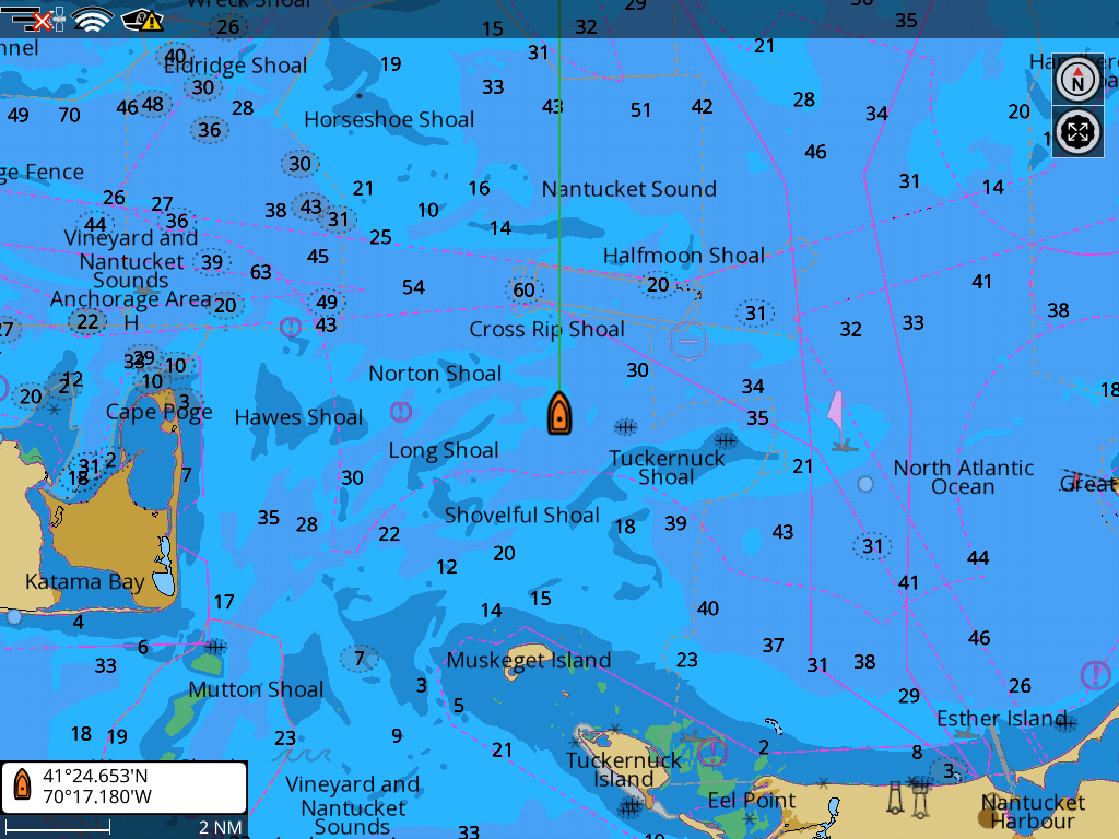
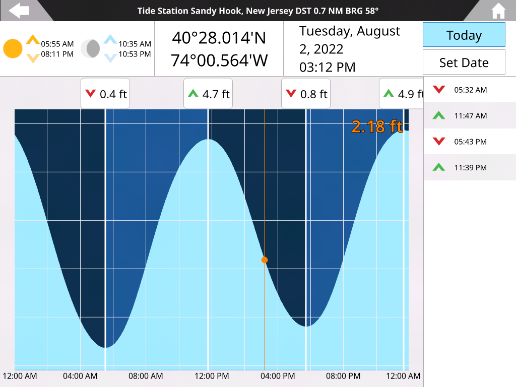
POLARIS Charts provide a wealth of important data for navigators and fishermen, including rich bottom contour data and high-resolution spot soundings, high-resolution bathymetry and port plans. “Whether following a safe route through a tricky channel or pinpointing drop-offs that attract gamefish, Polaris Charts are a powerful addition to these MFDs,” says Ted Bodtmann, CEO of SI-TEX. “Additional features like Dynamic Tides & Currents can help cruisers determine the best time to exit or enter an inlet, and help anglers target the best bite times around rips and shoals. A variety of selectable color palettes lets boaters set up their Polaris Charts to match for personal preference and ambient light conditions. In addition, the ability to choose certain colors to highlight depth ranges on the charts helps make prime fishing areas and/or dangerous shoals and shallows stand out for the navigator.”
“POLARIS Charts are based on the Official NOAA ENC charts. They provide all the essential features for each boating need and they are extremely easy to use: no activation fee, no complex coverage selection and no subscriptions needed”, says Simone Lazzarini, CEO of AvMap.
The NavPro 900 and 1200 MFDs offer optional high-resolution WI-FI radar that makes it easy to install and rig SI-TEX’s 4kW, 24-inch compact radome on just about any vessel. By mounting and wirelessly syncing the SI-TEX MDS-12 Network Radome to a NavPro unit, boaters can turn these popular and affordable MFDs into powerful 36-nm range radars that deliver excellent target resolution and a range of features boaters expect from professional-grade SI-TEX radars. Overlaying radar targets onto the feature-rich Polaris Charts provides navigators with enhanced situational awareness and safety, even in the most challenging conditions.
In addition to the included POLARIS Charts, SI-TEX’s NavPro Series is also compatible with optional Navionics+, Navionics Platinum+, C-MAP MAX and C-MAP 4D charts.
SI-TEX’s NavPro 900 starts at $1,099 MSRP; while the NavPro 1200 carries a starting MSRP of $2,299. This includes POLARIS Charts cartography covering the entire United States. Both are backed by SI-TEX’s 2-Year Warranty and U.S.-based customer service. POLARIS Charts are also compatible with the popular Explorer NavPro Wi-Fi and will be available on micro-SD card for the aftermarket MSRP price of $125.
To learn more, call SI-TEX Marine Electronics at (631) 996-2690 or visit www.si-tex.com or www.avmap.it/polarischarts.
Related Posts:


Panbo publishes select press releases as a service to readers and the marine electronics industry. The release contents do not reflect the opinion of the editors and are not fact checked by the editors


Recent Panbo Comments