
EarthNC Online, woohoo
EarthNC has come a long way since December. For one thing there is now an official Web site. And a few weeks ago the company introduced EarthNC Plus, a $50 CD package that can overlay all available ENCs on Google Earth. I’ve been testing it, and will write more about it soon. But today let’s look at EarthNC Online, the just introduced free viewer. You have to install a plug-in from GoogleEarthAirlines which lets you access G.E. from inside your browser. Sounds a little dicey, but it all worked fine for me (using Firefox 2.0).
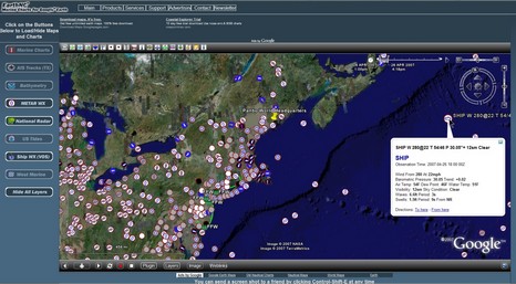
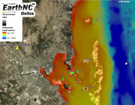
Now’s the time to pop up the large version of the screen above. You’ll see that I’ve turned on the Metar WX overlay (all those clickable weather reports on shore), National Radar (which didn’t show me any radar, a glitch I guess, but did put up flood warning areas around New York City), and finally Ship WX (VOS), which shows some 24 hours of vessel reports (use the timeline upper right). Then I zoomed into World Headquarters, where I activated the Marine Chart, US Tide, and Bathymetry overlays. The latter, like the VOS reports, is data I’ve never been able to access so easily before. Clicking on nav aids brought up their characteristics, by the way, and that little circular tide icon below Curtis Island yielded three days of predictions. All pretty darn nifty, and EarthNC says that user-entered POIs and route building are coming soon.


Recent Panbo Comments