Category: The future

FLIBS 2015: Telemar superyacht helm, Hatteland 55-inch Chart Table, and Triton luxury submarines 6

FLIBS 2015: Telemar superyacht helm, Hatteland 55-inch Chart Table, and Triton luxury submarines
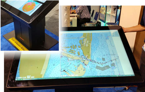
Hatteland_Series_X_55_inch_chart_table_cPanbo.jpgImagine running Coastal Explorer, or your favorite charting program, on a 55-inch multitouch display with 3840 x 2160 pixel resolution — also known as UHD or 4K — secured to a sturdy base with pushbutton up/down and tilt controls. I’ve never so enjoyed tapping out a route, and the Hatteland 4K Chart Table is actually way sexier than that…

iKommunicate from Digital Yacht, Signal K gets kickstarted 53

iKommunicate from Digital Yacht, Signal K gets kickstarted

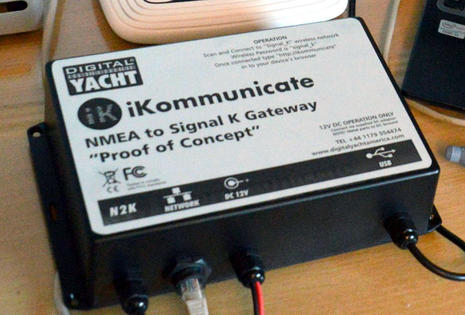
iKommunicate Signal K proof of concept aPanbo.jpgSorry for the fuzzy photo, but it makes sense as the iKommunicate Signal K Gateway isn’t a real product yet, and the real product may look quite different from the “Proof of Concept” prototype above if it actually materializes early next year. Why so vague? What’s happening here is a techy chicken and egg thing. Digital Yacht was understandably hesitant about developing a gateway for Signal K apps and services that hardly exist yet, but the Signal K universal boat data conceptopen source, entirely free, and created by unfunded volunteers — needs a commercial level NMEA gateway so that third party developers can easily show us what the potential apps and services can do. That’s my understanding of why DY launched the iKommunicate Kickstarter campaign and also why I’m hoping that fellow boat geeks and related companies will join me in backing the project and thus helping Signal K become real…

NMEA Conference 2015, back-to-back good times with the Big Four 15

NMEA Conference 2015, back-to-back good times with the Big Four

NMEA Conference Schedule 9-27-15 cPanbo.jpgThose early morning Google Calender notifications above indicate my awesome Wednesday schedule during last week’s 2015 NMEA Conference. It’s tempting to presume that the back-to-back demo trips around Baltimore Harbor with the Big Four manufacturers mark peak intensity for my career as a marine electronics pundit, but actually the whole industry seems to be in good shape with the pace of innovation quickening…

Nobeltec PC Radar & TZ v2 app, blazing trail two ways? 25

Nobeltec PC Radar & TZ v2 app, blazing trail two ways?

FurunoPC_Radar_DualNav.jpg

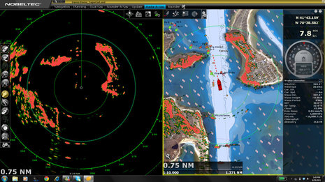
Nobeltec Furuno PC-Radar was announced at the Miami boat show, but I don’t think it’s gotten the recognition it should. Yes, it’s like the Furuno MaxSea PC Radar that came to Europe in 2013, but now the feature/cost proposition seems to fit a wider range of boats, plus it’s actually available over here. It’s also noteworthy that Nobeltec’s TimeZero v2 app is now out with support of Furuno WiFi radar and it’s interesting to see how these two radar solutions compare. It looks to me like Nobeltec and Furuno are blazing two distinct paths to primary limited visibility navigation without multifunction displays…

NMEA okays Signal K, a milestone in marine electronics? 33

NMEA okays Signal K, a milestone in marine electronics?

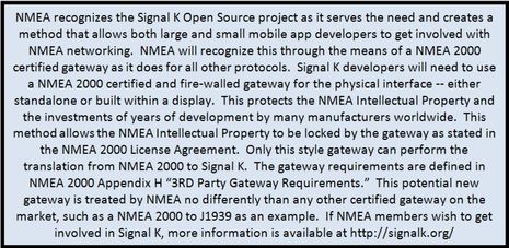
NMEA_recognizes_Signal_K_aPanbo.jpgWow! Today the National Marine Electronics Association — also known as NMEA, or IMEA for its International reincarnation — announced recognition of the Signal K open source marine data project. It’s clearly not an endorsement, but it does provide clear methods to gateway NMEA 2000 boat data to the Internet-friendly universal marine data model that the Signal K is about. And that’s plenty good enough, I think. In fact, as the title above wonders, this may turn out to be a very big deal. I also think it marks a nice evolution for NMEA. Though criticism of this trade and standards organization from outside the small world of hardcore marine electronics has largely been unfair, NMEA could do better fitting into the much bigger and faster-moving data/app universe, and now they’re trying harder…

How Simrad Halo works, 12 radars in one! 11

How Simrad Halo works, 12 radars in one!

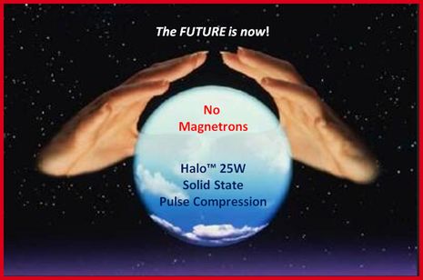
Simrad_Halo_future_is_now_aPanbo.jpgPanbo’s first entry about Simrad’s unique solid-state open-array Halo radar tried to cover the promised features. Now I’ll try to explain how it works, with the huge benefit of slides made available to me by Navico engineer Don Korte, who I first met when Broadband (3G/4G) radar was introduced in 2009. I’m starting with the image above because that’s not just Navico marketing; it would be hard to overstate Don’s enthusiasm for Halo as he led me through the presentation. It was a teleconference but I’m pretty sure he was jumping up and down as I slowly got some of the concepts and he answered my smarter questions with a hearty “YES!”…

Simrad Halo solid-state open-array radar, what you get 14

Simrad Halo solid-state open-array radar, what you get

Simrad_Halo_radar_demo_Hawks_Cay_Jan_2015_cPanbo.jpg

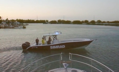
This is big. Today Simrad announced the first recreational solid-state open-array radar and it seems to be a humdinger. In January I got to see Halo in action aboard the same Yellowfin 36 seen above in a screen grab of Simrad’s informative Halo video, and I’ve also met twice with members of the engineering team. In fact, there are so many features with so much complex technology behind them that this entry will only attempt to cover what Halo hopes to do for you; next week we’ll get into how it works. And yes, this radar does include blue LED accent lighting, if you want it, but that’s just the bling…

Shouldn’t our community sourced marine data be open to all developers? 48

Shouldn’t our community sourced marine data be open to all developers?

OpenSeaMap_Depth_Data_call_aPanbo.jpg

I’ve been cogitating a lot about crowdsourced depth data lately, including the realization that “community sourced” is a better term. Whatever it’s called, Navionics in particular has made it wonderfully easy to collect and share sonar files and especially wow with the Vexilar integration. But the business stakes are high and thus we have the frustration of Navionics and Garmin butting heads. Upon further contemplation, a wistful thought from that last entry — “Wouldn’t it be great if we could upload our data to some service that would make it available to any chart developer?” — seems not only important to avoiding further messes and helping this technology proliferate, but also quite possible…

More AIS in the USA, the new USCG requirements 11

More AIS in the USA, the new USCG requirements

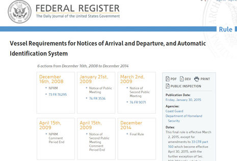
USCG_AIS_Final_Rule_collage_cPanbo.jpgPlease credit the U.S. Coast Guard with a sense of humor. The (NOA and) AIS Final Rule may be a dry read, but not last week’s email announcement, which began with the giddy declaration “4,232 days in the making!” I don’t know why the rulemaking process took so long, and it may have been most frustrating for those who do, but I’ll still be glad to have more of the commercial vessels working along our coasts equipped with AIS. It won’t happen fast, though — vessels newly required to carry Class A or B AIS transponders can take until March 2016 to install them — and the number of such vessels seems uncertain…

Nobeltec TimeZero app 2015, Furuno DRS4W WiFi radar overlay & more! 13

Nobeltec TimeZero app 2015, Furuno DRS4W WiFi radar overlay & more!

Nobeltec TimeZero app 2015 w Furuno WiFi radar cPanbo.jpg

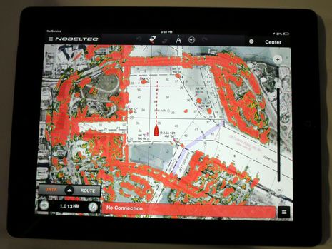
Yes, iPad navigation fans, that is Furuno 1st Watch WiFi Radar overlaid on the Nobeltec TimeZero charting app. I wasn’t even sure that an iPad could overlay radar over a simple vector chart, but here it is over a finely rendered raster chart blended with hi-res satellite photos. This is virtually the same mix of navigation data that I’ve found so useful on a Furuno TZT and the short demo file I saw running in Fort Lauderdale suggested that it may pan and zoom (and even go 3D) almost as smoothly on an iPad. It’s a major advance in tablet navigation, I think, but the TimeZero app update coming next Spring has more to brag about…