Category: Wireless & Apps
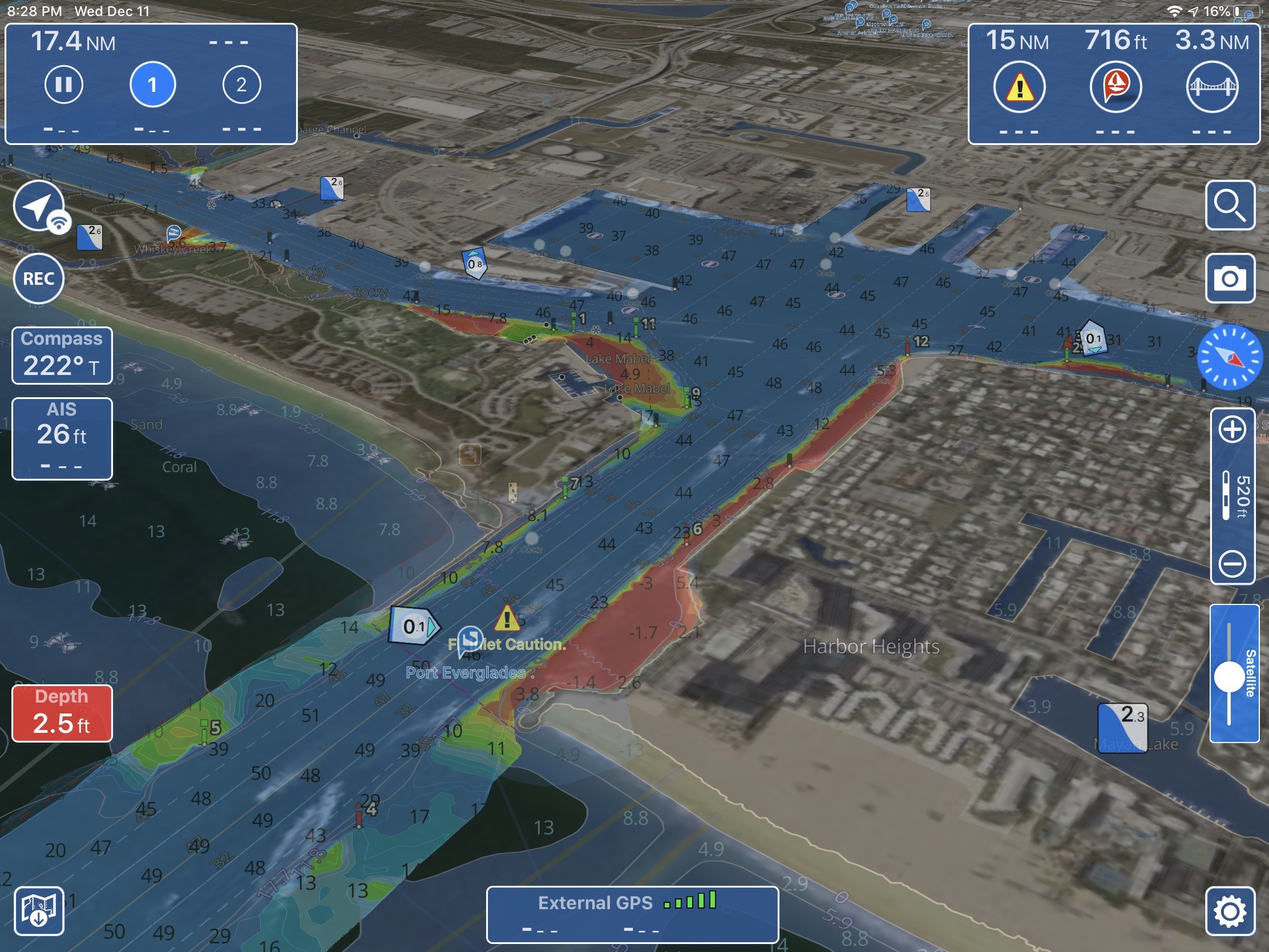
Aqua Map has already established itself as an excellent app for boaters supplying valuable data at your fingertips. But one weakness has been the relatively slow rendering of charts. This made scrolling slower than you would like, but now Aqua Map is out with version 20 and an all new charting engine. The result? Lightning fast scrolling and several nice updates to make one of the leading navigation apps even better.
I’m generally content to operate at trawler speeds these days, on and off the water. But — boy, oh, boy — taking on a new boat has definitely brought out the kid in me. Though it was only a few weeks ago when I finally realized that rebuilding the 14-foot power cat (and original Gizmo) is not in my future, the new plan has already hosted some electronics testing that would have been much more difficult with the 37-foot Gizmo, and it’s a different kind of pleasure on the water. Say hello to Gizmo Junior…
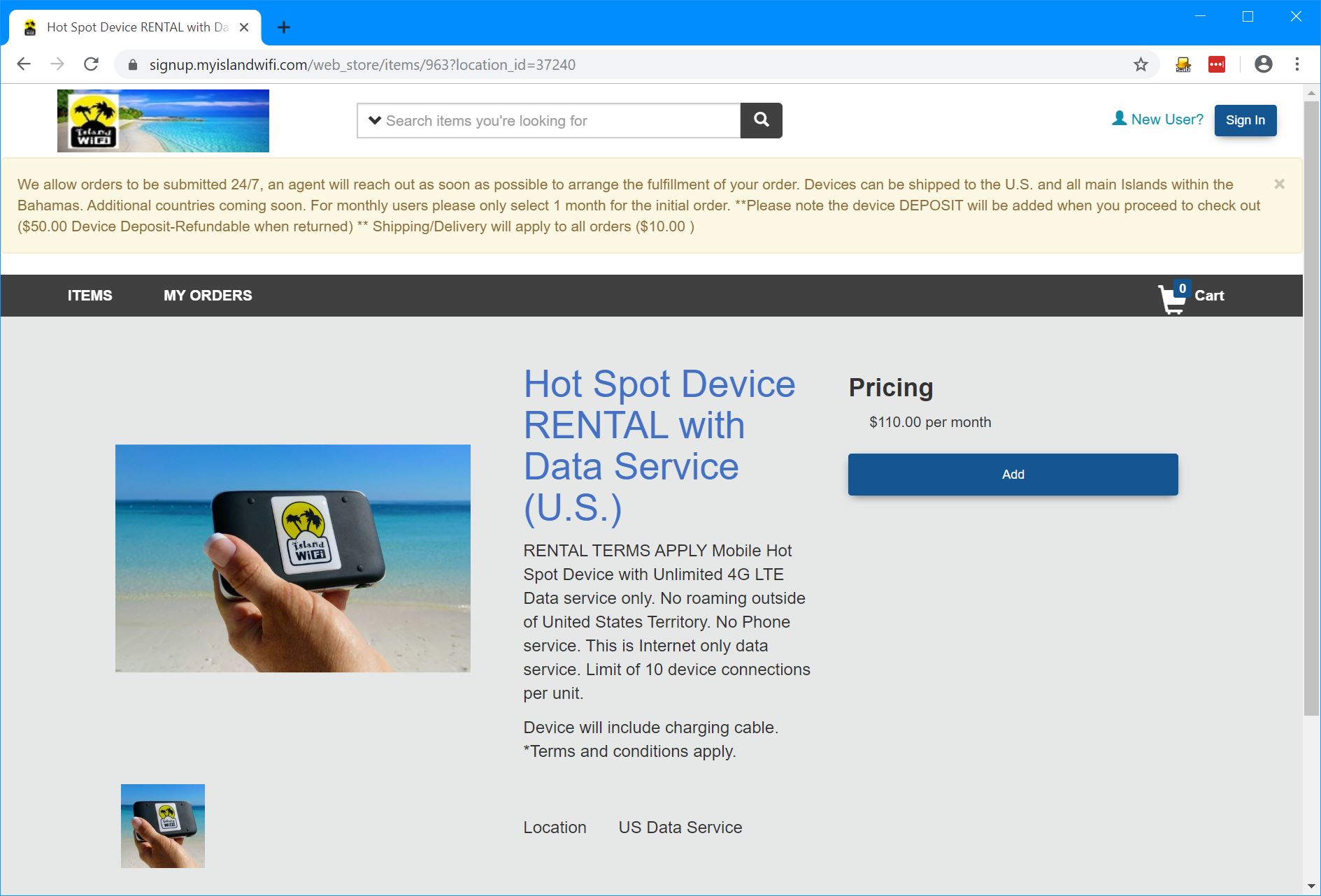
When Have Another Day visited the Bahamas in 2017 internet connectivity was complex and pricey. In 2018 Island WiFi began renting mobile hotspots with unlimited data; the raves of simplicity and cost-effectiveness from those cruising the Bahamas could be heard all the way back in the states. Many commented that the service was so much better than what they could get in U.S. providers that they wished they could use My Island WiFi’s service in the U.S. Well, now they can, Island WiFi has started offering service in the U.S.
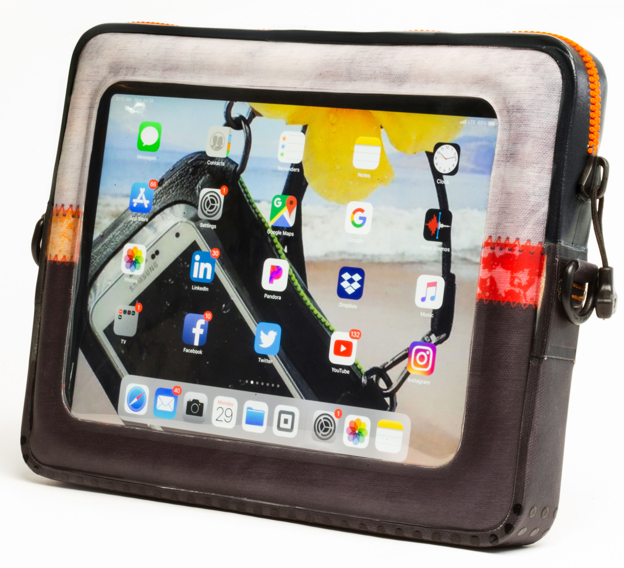
At the 2017 Annapolis Sailboat Show, the two cheerful founders of Ugo gave me their original smartphone case to test. And while I find it awkward to use with the large phones I prefer, it is beautifully built and seriously waterproof. So I suspect that Ugo’s new and similarly designed tablet case will be a winner…
In a recent blog post Navionics announced they’ve added vectors to AIS target displays and the ability to edit rate and review ActiveCaptain Community points of interest (POIs). It looks like Navionics is making good on their promise of rapid improvements to their AIS features.
Digital Yacht have unveiled their TriNav GPS160, a new, high performance positioning sensor using GPS, Glonass and the new Galileo satellite systems for exceptional positioning accuracies and redundancies. Typical accuracy is better than 1m and data can be set to output at up to 18Hz for smoother plotter track displays. TriNav software technology also improves positioning vulnerabilities that could occur through spoofing and local interference.
iNavX, the leading marine navigation app now provides access to CHS Charts from the Canadian Hydrographic Service. These comprehensive digital charts provide exceptional detail when navigating in Canadian waters.
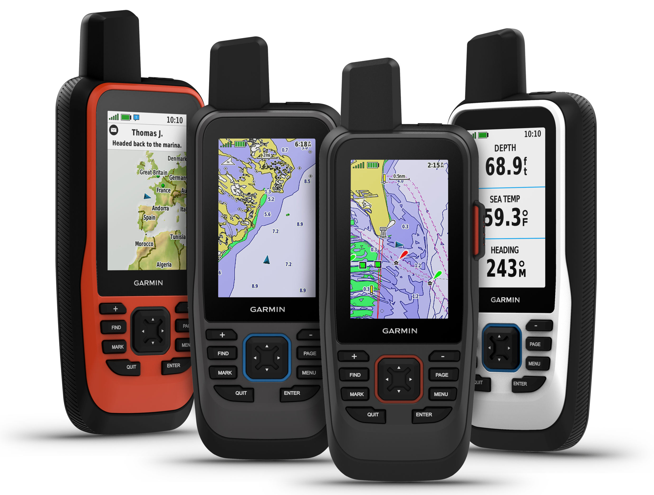
Garmin International, Inc., a unit of Garmin Ltd. (NASDAQ:GRMN), today announced the all-new GPSMAP 86 handheld series, a feature-packed addition to its popular marine handheld collection. Combining Garmin’s premium GPS navigation with inReach satellite communication technology1, the flagship GPSMAP 86sci is the first handheld to come preloaded with Garmin BlueChart g3 coastal cartography with integrated Navionics data. For added awareness and convenience, the GPSMAP 86 series can connect to onboard Garmin chartplotters and instruments to stream…
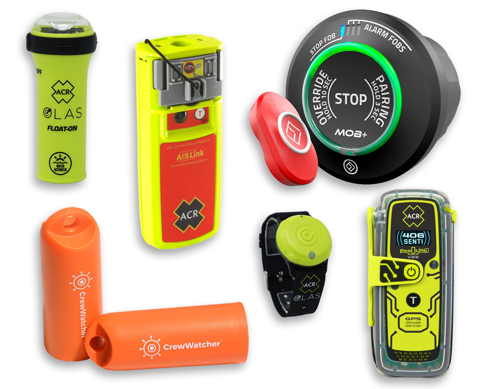
In man overboard (MOB) scenarios, time is frequently the difference between a happy outcome and tragedy. The sooner everyone on the boat is aware there’s a problem and begins responding the greater the odds this will be a scary moment on which to reflect and not a life-changing event.
Sirius Signal just announced a super bright red-orange/cyan electronic Visual Distress Signal Device (eVDSD) that promises to be vastly more effective than the current white light models, especially in coastal areas with shore lights in the background. The new model C-1002 SOS device also includes a Bluetooth app for testing, maintenance, and much more…


Recent Panbo Comments